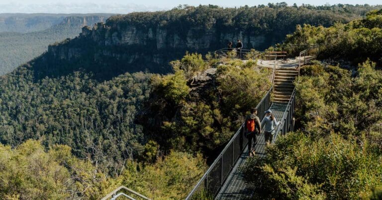
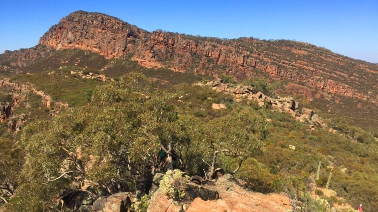
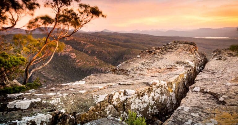
Walking the Larapinta Trail, it would be easy to assume that people have been following this particular route through the West MacDonnell Ranges for generations. The trail seems to belong to the landscape, threading its way through gaps and gorges, following valleys and creek beds, climbing onto long quartzite ridges and eventually reaching Mount Sonder at the western end of the range. The reality is quite different.
What I find particularly interesting about the Larapinta Trail is just how young it is. Unlike Tasmania’s Overland Track, which gradually evolved from mining tracks, trapping routes and early recreational walking, the Larapinta was deliberately conceived as a long-distance walking trail. The idea only emerged in the late 1980s, the first section opened in 1990, and the complete trail was not officially opened until 2002.
There is something almost contradictory about that. You can spend weeks walking through a landscape with an extraordinarily deep human history, yet the recreational trail beneath your boots has existed for little more than three decades. That distinction is important, because the history of the Larapinta Trail really contains two very different stories. One is the ancient and continuing relationship between Aboriginal people and this Country. The other is the much more recent story of how park planners, rangers, Traditional Owners, construction crews and others created a walking route across it.
A trail through a living cultural landscape
The Larapinta Trail crosses Tjoritja / West MacDonnell National Park, west of Alice Springs. For the Traditional Owners, this is not simply a collection of mountains, waterholes and walking destinations. It is a living cultural landscape.
The park’s joint management plan describes Tjoritja as Country shaped through Tnangkara, the Creation Time, with ancestral stories, responsibilities, beliefs and law embedded within the landscape. Traditional Owners belong to sixteen different countries or estates within the national park, and cultural responsibilities continue to determine how important places, stories and knowledge are cared for. Some of that knowledge can be shared with visitors. Some cannot.
I think that is worth understanding before considering the history of the walking trail itself. A modern trail map inevitably reduces the landscape to lines, distances, campsites, water points and named features. Aboriginal relationships with Tjoritja are far more complex than that. Places along and around the trail may hold cultural meanings that are not obvious to a walker passing through them, and not every story associated with those places is intended for public interpretation.
The name Tjoritja / West MacDonnell National Park itself reflects that continuing connection. In 2014, Traditional Owners renamed the park to recognise its original name, Tjoritja. Several years earlier, in July 2012, title to the national park had been granted to the Traditional Owners through the Tyurretye Aboriginal Land Trust. The park was then leased back to the Northern Territory for 99 years and is now jointly managed by Traditional Owners and the Northern Territory Parks and Wildlife Commission.
Even the word Larapinta reaches beyond the walking track. The Northern Territory Place Names Register records it as deriving from Lhere-pirnte, an Arrernte name for the Finke River, translated by the register as “salty river”. The Finke crosses the trail towards its western end and has cultural significance extending far beyond its role as a landmark on a hiking itinerary. So while the Larapinta Trail itself is modern, the Country it traverses certainly is not.
Long before there was a Larapinta Trail
European exploration and settlement added another layer to this landscape during the nineteenth century. The eastern end of today’s trail begins at the Alice Springs Telegraph Station Historical Reserve. Construction of the station commenced in 1872 as part of the Overland Telegraph Line linking Adelaide and Darwin. It became the first substantial European settlement in the Alice Springs area and remained an important communications centre for decades.
That makes the beginning of the Larapinta quite an interesting place to start walking. You leave from one of the clearest surviving reminders of European expansion into Central Australia and then gradually move away from roads and settlement into the ranges.
Pastoralism, mineral exploration, transport routes and tourism subsequently affected parts of the wider region, while destinations such as Simpsons Gap, Standley Chasm, Ellery Creek and Ormiston Gorge became increasingly familiar to visitors. Before the Larapinta existed, however, these places were largely experienced as separate destinations. Visitors would drive to a gorge, perhaps complete a short walk, then return to the road and move on to the next attraction.
That fragmented way of experiencing the ranges would eventually give someone an idea. What if these places could be connected on foot?
The idea begins to take shape
The name most closely associated with the creation of the Larapinta Trail is Alan Ginns, a senior park planner with the Northern Territory Conservation Commission. During the 1980s, protected areas along the West MacDonnell Ranges consisted of a series of smaller, disconnected reserves. Ginns was involved in preparing a proposal for a much larger national park that would bring those areas together.
As part of that thinking, he and his colleagues began looking at recreation differently. The initial concept was not necessarily to create one enormous end-to-end trek. The idea included shorter half-day and day walks around established destinations such as Ormiston Gorge, Ellery Creek and Serpentine Gorge. But when the planners began examining maps, the possibility of linking these places became obvious. The destinations were already strung along the ranges. Instead of treating each one as a separate place to visit, a walking trail could connect them.
ABC Alice Springs interviewed Ginns about the origins of the trail in 2021. He recalled poring over hundreds of maps with his team while trying to work out how such a route might function. Reconnaissance walks and helicopter flights helped narrow possible routes into corridors roughly 50 to 100 metres wide. Sacred site clearances had to be obtained before particular alignments could proceed, and some potential routes were walked repeatedly before a final line was chosen.
I like this part of the Larapinta story because there was nothing inevitable about the route we walk today. Looking at a map now, it is easy to see a continuous line and imagine that it simply follows the obvious way through the mountains. In reality, people had to work out where that line should go, sometimes metre by metre. According to Ginns, potential alignments could be walked half a dozen times before they were considered suitable. Once a route was settled, it had to be marked for the crews who would follow with hand tools and begin turning an idea on a map into a physical trail.
The official 2004 Larapinta Trail Management Strategy traces the trail’s genesis to a 1989 strategy for the development of a large national park in the West MacDonnell Ranges. Ginns remembers the concept taking shape during 1988. Both accounts fit comfortably together: the idea was being developed in the late 1980s and became part of the formal park planning that followed.
The purpose was ambitious from the beginning. The management strategy describes the proposed long-distance track as a way of giving the new park a unifying theme while creating an extended bushwalking opportunity through the desert mountains. It was not simply a track-building project. The trail was part of the idea of the national park itself.
Building a trail through the desert
The first section of the Larapinta Trail opened in July 1990, running west from the Telegraph Station towards Simpsons Gap. Building what eventually became a trail of more than 200 kilometres was another matter entirely. Much of it had to be constructed through rugged country without convenient road access. There was no established Australian blueprint for building a long-distance arid-zone walking trail on this scale, and Ginns later described the process as something of a learn-as-you-go operation. The planners undertook route reconnaissance, worked out the alignment and then determined how each section could actually be constructed.
The finished trail reflects that variety. Some sections use existing management tracks or access routes, but much of the Larapinta was purpose-built specifically for walking. In steeper areas, crews constructed steps, stone pitching, drainage and benched track. Elsewhere a deliberately lighter touch was used, with vegetation cleared only sufficiently to define a route and markers helping walkers through ridges, valleys and gorges.
One of the more unusual parts of the trail’s construction history was the involvement of prisoners from the Alice Springs Correctional Facility. A group of 12 low-security prisoners worked on early sections of the trail and helped construct much of Sections 1 and 2. Their involvement was substantial enough that parts of the work area around Simpsons Gap had to be temporarily administered so the prisoners could camp near the construction site under supervision.
It is probably not the history most people imagine while walking out of Alice Springs towards Simpsons Gap, but it is quite literally built into the trail. Over the years other work crews and organisations contributed to construction and maintenance as the route continued westward. The official management history records that the trail was built by different groups, using different techniques and standards, across a period of 12 years. That long construction period also explains why the Larapinta was not initially the single continuous walk we think of today. Sections became available progressively while other parts of the route remained unfinished.
An even more ambitious destination
The trail we now know finishes at Mount Sonder, or Rutjupma, after passing Redbank Gorge. That was not always the ambition. Alan Ginns has recalled that the original planners considered taking the route farther west to Mount Zeil, the highest mountain in the Northern Territory. It would have extended the concept significantly beyond Mount Sonder. It never happened.
I find that interesting because Mount Sonder now feels like such a natural ending to the Larapinta. For many walkers, climbing towards its south summit in the early morning has become the emotional conclusion to the entire journey. Yet even that seemingly inevitable finish is the result of the trail’s development rather than something that was fixed from the beginning. The Larapinta we inherited is not quite the Larapinta first imagined.
Twelve years to join the trail together
Construction continued through the 1990s and into the beginning of the new century. By this stage, something else had begun happening. People were walking the completed sections and the Larapinta was developing a reputation before it was actually finished. Commercial walking operators also began introducing visitors to parts of the route, helping establish the trail as a serious multi-day walking destination.
On 15 April 2002, the completed Larapinta Trail was officially opened. The management strategy prepared two years later recorded the main route at 223 kilometres from the Alice Springs Telegraph Station to the south summit of Mount Sonder, with additional access links bringing the broader trail network to around 236 kilometres. Current Northern Territory information describes the Larapinta as running for more than 230 kilometres, reflecting subsequent mapping, alignments and the way the trail is now measured.
The exact number matters less than what had been achieved. In a little over a decade, a collection of visitor destinations spread across the West MacDonnell Ranges had become one continuous walking journey. That is a very different history from many older Australian tracks. The Larapinta was not a stock route converted into a walking trail, nor a collection of miners’ and trappers’ tracks gradually adopted by bushwalkers. Much of it was created specifically because someone believed people should be able to experience this landscape on foot.
The trail was designed to make people slow down
There is another aspect of Ginns’ recollections that I think says a lot about what the Larapinta was intended to be. He has said that the planners hoped people would take their time. The competitive running events and fastest-known-time attempts that later developed around the trail were not part of the original thinking. The intention was much simpler: people would spend time in the landscape, appreciate its Aboriginal cultural heritage and experience what it was like to be there. That seems almost obvious, but it matters.
The Larapinta was conceived during a period when Australian national parks were increasingly being understood not simply as collections of scenic destinations but as landscapes people could experience over longer periods. Walking created a different relationship with distance. Instead of seeing Ormiston Gorge, Ellery Creek or Simpsons Gap as individual stops along a road journey, the Larapinta made the country between those places part of the experience. It changed the scale at which visitors could understand the West MacDonnell Ranges.
There are stretches of the Larapinta where that original idea still makes perfect sense to me. The important part is not necessarily arriving at the next named attraction. It is spending hours following a ridge, moving through a dry creek bed or watching the light change across ranges that seem to continue forever. The trail connected destinations, but in doing so it made the spaces between them matter.
Managing the success they created
By 2004, only two years after the complete trail opened, the Northern Territory Government was already reviewing how the Larapinta should be managed into the future. Its growing reputation had created exactly the challenge faced by many successful walking trails. More walkers meant greater pressure on tracks, campsites, water supplies and facilities, but too much infrastructure risked changing the nature of the experience people had come for.
The 2004 management strategy makes interesting reading now because many of the questions it asks remain familiar across long-distance trails today. How much should a trail be hardened? How many signs are enough? When does a campsite need a toilet? How should group sizes be managed? Should there eventually be a booking system? How much infrastructure can be added before the character of a remote walk begins to change?
Water was an especially difficult problem. The Larapinta crosses arid country where natural surface water cannot be treated as a dependable supply for walkers. Artificial water points therefore became an essential part of making an end-to-end trail practical. Maintaining them in remote locations created an ongoing logistical burden for park managers, particularly as walker numbers increased.
Rather than developing a chain of public walking huts comparable with Tasmania’s Overland Track, the Larapinta evolved around campsites, shelters, water tanks and toilets at selected locations. Some camps remain deliberately simple, while others provide more substantial infrastructure. Today there are shelters with water tanks and toilets at a number of major points along the route, and designated campsites help concentrate visitor impacts. The infrastructure is more visible than it once was, but it also protects the landscape from what would otherwise be thousands of individual decisions about where to camp, collect water or create a path. There is always a compromise involved.
Traditional Owners regain ownership of Tjoritja
While the recreational trail was becoming more established, the ownership and management of the surrounding national park were also changing. An Indigenous Land Use Agreement reached in 2005 helped establish the legal framework that eventually led to the transfer of the park to its Traditional Owners. In July 2012, title to Tjoritja / West MacDonnell National Park was granted to the Tyurretye Aboriginal Land Trust and the park was leased back to the Northern Territory Government for 99 years. The park is now jointly managed.
That is an important part of the Larapinta’s history because the trail does not exist separately from the Country it crosses. Decisions about visitor access, cultural interpretation, sacred sites, conservation and future development increasingly sit within a management framework in which Traditional Owners have a formal role. In 2014, the park’s name was officially changed to Tjoritja / West MacDonnell National Park, publicly restoring the Aboriginal name of the Country alongside the familiar European name. There is a certain symmetry in that.
The Larapinta was originally conceived as something that would unite a collection of protected areas into one experience. Decades later, the trail sits within a national park whose management more clearly recognises that this was never simply recreational land waiting to be discovered by walkers. It was, and remains, Country.
From new trail to Australian walking icon
The speed with which the Larapinta has become established in Australian hiking culture is remarkable. It is easy to forget that people walking the complete trail in the early 2000s were experiencing something genuinely new. Some of the campsites and water infrastructure we now take for granted were still being developed. Information was less comprehensive, trail use was lower and the route had not yet accumulated the reputation it carries today. Further investment followed. Shelters, toilets and water storage were progressively upgraded, including substantial works during the 2010s. Commercial guided walking expanded, while independent hikers increasingly travelled to Central Australia specifically to complete the trail.
By 2021, demand had grown to the point where Parks and Wildlife was reporting record interest, commercial operators were heavily booked and larger quantities of water were being transported to supply points. A multi-day walking fee was introduced that year, adding another step in the transition from a newly built long-distance trail to a major managed recreational asset.
Today the Larapinta is divided into 12 sections, allowing people to walk anything from part of a day to the complete journey. It crosses some of the best-known landscapes of the West MacDonnell Ranges, including Simpsons Gap, Standley Chasm, Ellery Creek Big Hole, Serpentine Gorge, Ormiston Gorge, the Finke River and Redbank Gorge before climbing Mount Sonder. But knowing something about its history changes the way I see that line on the map. The trail is not ancient. It does not need to be.
Its significance comes partly from the fact that a relatively small group of people looked at a chain of mountains and waterholes in the late 1980s and imagined a different way for visitors to experience them. They then spent more than a decade finding a route through rugged country, negotiating cultural and land access, marking alignments and physically constructing a trail that did not previously exist.
At the same time, the history reminds us that creating a modern walking trail through an old cultural landscape does not make the trail the most important story there. The Larapinta crosses Country that had names, stories, law and meaning long before the first route marker was placed. Traditional Owners remain responsible for that Country today, and joint management is gradually changing the way its cultural and natural values are represented and protected.
Perhaps that is the part I find most interesting about the Larapinta Trail. It feels timeless when you are walking it, but it isn’t. The mountains, gorges and watercourses carry histories measured on a scale far beyond the trail itself. The walking route is a very recent addition, created between the late 1980s and 2002 and continually adjusted, maintained and reconsidered ever since. In only a few decades, it has become one of Australia’s great long-distance walks. Yet the Larapinta is still, in historical terms, only the newest line across a much older Country.
Sources
- Northern Territory Parks and Wildlife, Larapinta Trail Management Strategy, December 2004. The principal government source for the origins of the trail, the 1989 park strategy, opening dates, construction period, original measured length, track-building methods and early management approach.
- Parks and Wildlife Commission of the Northern Territory, Tjoritja / West MacDonnell National Park Joint Management Plan, February 2018. Used for Traditional Owner connections to Tjoritja, the sixteen countries or estates within the park, transfer of title, joint management arrangements and the 2014 park renaming.
- ABC Alice Springs, “The long walk in the desert“, Emma Haskin, 27 May 2021. Includes extensive interviews with Larapinta Trail planner Alan Ginns about the original concept, map work, reconnaissance, route selection, prisoner construction crews, the proposed extension towards Mount Zeil and the intentions behind the trail.
- Northern Territory Place Names Register, Larapinta. Used for the recorded derivation of Larapinta from the Arrernte name Lhere-pirnte for the Finke River and its recorded meaning.
- Northern Territory Government, Alice Springs Telegraph Station Historical Reserve. Used for the history of the Telegraph Station and its establishment as an early European settlement in the Alice Springs area.
- Northern Territory Government, Larapinta Trail. Current government information on the trail and its management within Tjoritja / West MacDonnell National Park.
- Northern Territory Government, Plan Your Larapinta Trail Walk and Sections of the Larapinta Trail. Used for the current description of the trail as more than 230 kilometres long, its 12-section structure and major locations along the route.
- Northern Territory Government, Walking Groups on the Larapinta Trail. Current information on public shelters, water tanks and toilets along the trail.
- Northern Territory Government Newsroom, Enhancing Visitor Experience: Larapinta Trail Upgrades, 2019. Used for later infrastructure investment including new shelters, water tanks, toilets and interpretation at major trail locations.