Water planning in dry parts of Australia usually starts with real confidence. You measure the distances, estimate a pace, work out how much water that should mean, and the map shows a creek or a tank along the way that gets folded into the plan as somewhere to refill. At the trailhead, none of that feels shaky. The pack has what looks like enough to reach the next source, and the day feels balanced.
The problem is that water availability in dry country is genuinely uncertain, and the plan usually doesn’t account for how uncertain. A creek on the map might be seasonal. A waterhole might have dried out weeks ago. A tank might be empty, damaged, or not worth drinking from even if it’s not empty. Guidebook notes and trip reports reflect someone else’s conditions from however long ago they walked it, not necessarily yours today. None of that feels like it’s being ignored when you’re planning the trip. It’s just that a marked water source tends to get treated as reliable unless there’s a specific reason to doubt it, and carrying extra water gets weighed as unnecessary weight rather than as the thing that actually covers you if the source isn’t there.
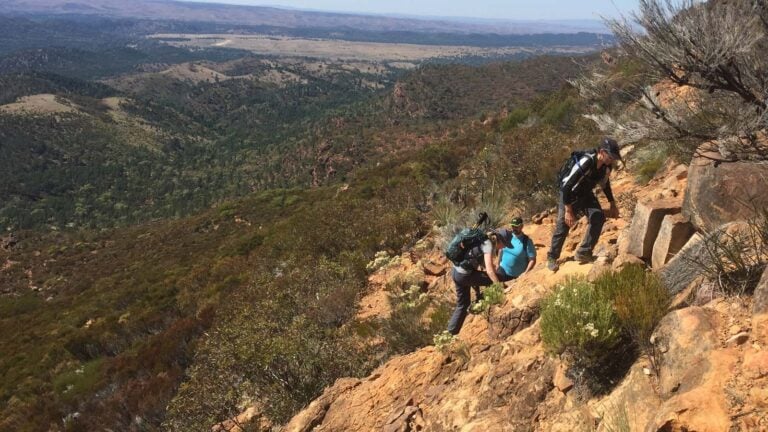
I learned how quickly that gap opens up on a multi-day hike through remote Victorian bushland, on a section I’d planned as steady ridgeline travel. Dense regrowth slowed us to less than half the pace I’d planned for, and by the time we’d been walking for a few hours, we’d already used more water than the original plan accounted for, without anything actually having gone wrong. Nobody made a mistake. The terrain was simply harder than expected, and every extra hour of effort in the heat meant more water gone before we’d covered the distance that water was meant to last for.
That’s the part that’s easy to miss in advance: heat and effort increase water demand well beyond what the initial estimate assumed, and slower progress from terrain, vegetation or fatigue means more time spent consuming water to cover the same ground. The gap between planned and actual consumption doesn’t open all at once. It widens gradually, and it’s often not obvious until you check how much is left and it’s less than you expected at this point in the day.
If the next water source then turns out not to be there, the situation changes immediately. Now the remaining distance has to be covered with whatever’s left in the pack, or you need to find an alternative, and what was a straightforward day becomes a question with no confirmed answer.
That’s the point where decision-making gets genuinely harder, and it’s worth being honest about why. Some people slow down to conserve water, which extends time exposed to heat. Others push the pace to reach the next possible source sooner, burning more water doing it. Some start rationing, drinking less than the body actually needs. None of these responses are unreasonable on their own. The difficulty is that they’re usually being chosen while mild dehydration is already starting to affect judgement, narrowing focus down to the next shaded spot or the next possible source rather than the bigger picture. That’s exactly the point where stepping back and reassessing matters most, and exactly the point where it becomes least likely to happen.
This is why water planning failures rarely trace back to one bad decision. They come from uncertain information, real environmental conditions and human judgement under genuine strain all interacting, none of them dramatic individually.
Water matters more than most other planning inputs because so much else depends on it. Hydration affects physical performance and cognitive function directly, and it shapes pacing, heat tolerance, and the ability to actually navigate and judge risk properly. As water gets tighter, everything downstream of it gets harder: fatigue builds faster, decisions get worse, and there’s less room left for anything else to go wrong at the same time.
The failure point is rarely visible when the first assumption turns out wrong. It shows up later, once reserves are lower than expected and the next source is genuinely uncertain, by which point the options for adjusting have already narrowed.
Water planning gets treated as a calculation, distance, pace, litres per hour. In practice it behaves more like a bet on how much uncertainty you can absorb if the inputs turn out to be wrong. Maps, trip reports and past experience are useful, but none of them guarantee anything’s actually there when you arrive. What actually protects you isn’t getting the calculation more precise. It’s carrying enough that being wrong about a source doesn’t turn into the thing that decides the rest of the day.
This essay is part of the Human Factors in Hiking series, exploring behaviour, awareness and decision-making on the trail. Water planning sits within the Hydration and Fuel system of the Hiking Safety Systems Framework, one of eight interconnected systems that influence safety in the field. Explore the series → | Learn about the Framework →