The Mount Zeil Summit walk is challenging grade 5 hike located in the West MacDonnell National Park, Northern Territory. The hike, depending on your route, should take around 9 hours to complete.
Warning
This is a remote area trail. Help takes time to organise and arrive. Carry an PLB or satellite phone. Carry enough water and protect yourself from the sun. Even during winter thirst and dehydration can be debilitating, so be prepared.
Hike overview
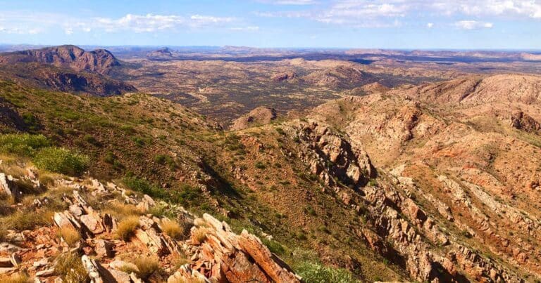
Soaring 1,531 meters above sea level, Mt Zeil is located in the West MacDonnell National Park and stands as the undisputed king of the Northern Territory and the tallest sentinel west of the Great Dividing Range. Its imposing presence draws adventurous souls seeking a challenging climb and breathtaking panoramas.
While the summit may call your name, reaching it requires a lot of planning. You can drive to a Day Parking Area which is situated about 1.5km walk to the north side of the mountain. Remember, this is just the starting point, as Mt Zeil boasts no clearly marked trails and I have not provided a GPS route.
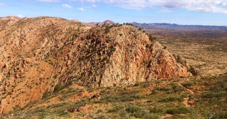
Mt Zeil's beauty lies in its untamed nature. Navigate the rugged terrain, characterised by sharp inclines and the invitingly spiky spinifex. This off-the-beaten-path adventure is for experienced hikers who relish the thrill of the unknown.
The arduous climb rewards you with a sense of accomplishment and unparalleled views. From the exposed summit, the vastness of the outback unfolds beneath your feet, a tapestry of ochre earth and verdant pockets painted by the seasons. Savor the moment, for you stand atop the crown jewel of the Northern Territory.
Note: The length of 20km is approximate only. There are no market routes to the summit and no official starting point. The final length and duration will need to be determined by you during your planning.
Route and GPX file
Due to the remote nature of this hike and the preparation required, I have not provided my GPX file. If you are looking for more information, contact NT National Parks on: (08) 8951 8272.
Tips
- Respect the National Park: Mt Zeil resides within the West MacDonnell National Park. Familiarise yourself with park regulations and obtain any necessary permits before embarking on your climb.
- Safety First: This challenging climb is not for the faint of heart. Ensure you're physically fit and well-prepared for the rigors of the terrain. Sturdy footwear, ample water, and sun protection are essential.
- Leave No Trace: Pack out all your waste and respect the delicate ecosystem of the mountain.
Trail location
Sorry, no records were found. Please adjust your search criteria and try again.
Sorry, unable to load the Maps API.
Getting there
Start your journey on the Tanami Track, roughly 20 kilometers north of Alice Springs where it diverges from the Stuart Highway. Proceed about 30 kilometers along the Tanami Track until you reach a secondary path branching off to the left. This will lead you to several water bores near Mount Zeil.
Gallery
Mount Zeil (Image: Northern Territory Parks and Wildlife)
If you have any photos from this hike and are happy to share them, please upload your .jpg files here.
Please note: Uploading photos does not transfer ownership of copyright away from you. If requested, you will be credited for any photos you provide and can ask they be deleted at any time.
About the region
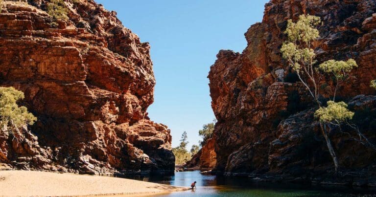
Tjoritja West MacDonnell National Park stretches for 161 kilometres west of Alice Springs. Explore and appreciate the scenic beauty and history of the area on foot, swim in a waterhole, or pitch a tent for a longer stay. Take a dip in the cold waters of one the park's permanent water holes. The larger water holes include Ellery Creek Big Hole, Ormiston Gorge, Redbank Gorge and Glen Helen Gorge.
There are numerous marked walking tracks ranging from leisurely to adventurous. The 223 kilometre Larapinta Trail stretches through the park and offers extended and overnight bushwalks for fit, experienced and well prepared walkers. The park encompasses an ancient landscape sculpted over time by climatic elements. It is also a refuge for rare and threatened plants as well as wildlife, including the uncommon bird species such as the Peregrine Falcon.
Features of the landscape are significant to the Arrernte people, including the Ochre Pits that have long been a quarry for important ochre pigments. There are plenty of places to camp in the park, with varied access and facilities. Camping fees apply and overnight visitors should bring their own water supplies. Commercial facilities are available at Glen Helen Resort.
Similar trails nearby
Explore Safe
While planning your hike, it’s important to check official government sources for updated information, temporary closures and trail access requirements. Before hitting the trail, check local weather and bushfire advice for planned burns and bushfire warnings and let someone know before you go. Plan ahead and hike safely.
Let someone know
Adventure with peace of mind: Fill out your trip intentions form. Before you hit the trail, fill out an online form to privately send important details about your hike to your family or friends. If you don’t return on time, they can easily alert emergency services, preventing worry and ensuring a swift response. Hike with peace of mind and enjoy your outdoor adventure to the fullest. Be smart, be safe: Register your plans here.
Gear to consider

My free planning, food and packing checklists provide an introduction to things your could consider (as well as the Ten Essentials) on your day, overnight and multi-day adventures. Customise your kit according to your personal needs, always considering safety first.
Suggest an edit
Does this hikes information need updating? Sometimes the route, trail features or access conditions change.
Acknowledgement of Country
Trail Hiking Australia acknowledges the Traditional Owners of the lands on which we hike and pay respects to their Elders, past and present, and we acknowledge the First Nations people of other communities who may be here today.


