Preparing for Heat, Fire, Storms and Cold
Extreme weather in Australia does not look the same as it does in North America or Europe, because our biggest risks are not snowstorms and blizzards, they are heat, UV exposure, bushfire, dry lightning, flash flooding and severe storms. Surviving these conditions comes down to preparation, decisions, and having systems that still work once conditions deteriorate. This guide works through three stages: before departure, during exposure, and after you can no longer move safely.
Phase One: Before Departure
Extreme weather survival begins at home, because once you are exposed your options narrow quickly. The goal is to anticipate the conditions that can trap you, then build enough margin that a bad turn in the weather does not become an emergency.
Forecast + Terrain Interaction
A blue sky in the morning is no guarantee of a stable day. In the Great Dividing Range, storms can build rapidly behind the ridges you are climbing, and in desert and inland regions, heat intensifies faster than forecast once wind drops and radiant load increases. That is why checking the Bureau of Meteorology forecast is not enough on its own, you also need to understand how the terrain you are walking into will amplify those conditions.
Before you leave, work through this:
- Check the UV Index, not just temperature.
- Review wind speeds at elevation.
- Examine radar movement at your last reception point.
- Assess upstream rainfall if river crossings are involved.
- Identify exposed ridgelines, drainage lines and narrow valleys on your route.
Your planning needs to consider how weather and terrain will affect each other, not just what the forecast says in isolation.
The Thermal Loading System (Heat & UV)
In Australia, heat kills more people than any other natural hazard, and thermal stress is not just about air temperature. It comes down to radiant exposure, humidity, wind absence and metabolic load together, which is why you can suffer heat exhaustion at 22°C if the UV Index is 11+ and you are climbing an exposed ridgeline with limited airflow.
Before you head out in hot conditions:
- Check the Bureau of Meteorology forecast, including any heatwave warnings, not just the maximum temperature.
- Reconsider strenuous or exposed routes when severe or extreme heat is forecast, particularly where shade, reliable water or easy exit options are limited.
- Consider temperature, humidity, radiant heat, exertion and the conditions of your particular route together rather than relying on a single temperature threshold.
- Plan early starts and early finishes during hot weather.
- Carry enough water for the conditions and increase your safety margin when high fluid losses are expected.
- Consider electrolytes during prolonged activity or when substantial sweating is expected.
- Prioritise shaded routes during hot weather where practical.
If the forecast is beyond what you are comfortable managing, the right decision is often simply not to go.
The Bushfire & Egress System
You cannot out-layer a bushfire. On Total Fire Ban days, hiking in heavily forested terrain or on one-way-in trails leaves you with very limited options if conditions change, which is exactly why the planning has to happen before you are already committed to the route.
Before you head out on a fire-risk day:
- Check the Fire Danger Rating for your specific region, not just whether a Total Fire Ban has been declared.
- Monitor state fire apps such as Fires Near Me.
- Avoid narrow gullies with limited exit options during high-risk periods.
- Identify cleared areas, road access points or large water bodies along your route.
- Plan conservative egress timing in fire season.
If smoke is visible and you cannot confirm its source, reassess immediately, because extreme fire behaviour can move faster than walking pace.
Understanding the Fire Danger Rating System
Australia’s current Fire Danger Rating System uses four levels. A Total Fire Ban is a separate declaration, so check both the fire danger rating and any restrictions or warnings that apply to your route.
| Rating | What it means for hikers |
|---|---|
| Moderate | Review your plan. Know your exits. No changes required but stay aware. |
| High | Reassess your route, campsites and any open cooking. Shorten or modify if you are in fire-prone terrain. |
| Extreme | Leave the area the night before or early in the morning. Avoid remote or one-way-in terrain. If departure is not possible, take immediate action to protect yourself. |
| Catastrophic | Do not hike in bushfire-prone terrain. No exceptions. This is a no-go day. |
Fire Danger Ratings are published by state fire authorities and the Bureau of Meteorology, and they may not be released until 5pm the afternoon before, so build that into your planning routine for any overnight or early-start hike.
Understanding Radiant Heat
In a bushfire, radiant heat is often the greatest danger, because it travels ahead of the fire front and can reach dangerous levels before the flames themselves arrive. Unlike smoke or ember attack, radiant heat cannot be outrun at close range.
Solid objects block it though. A rocky outcrop, a large log, an embankment or a depression in the ground can all provide meaningful protection, but the safest option is still to create distance early, which is why leaving before conditions become dangerous matters so much.
If caught with fire approaching:
- Get behind a solid barrier, rock face, embankment, depression in the ground.
- Cover all exposed skin immediately. Natural fibres offer more protection than synthetics.
- Lie face down and minimise surface area exposed to the direction of the fire.
- Do not attempt to outrun the fire front.
Insulation & Cold Exposure
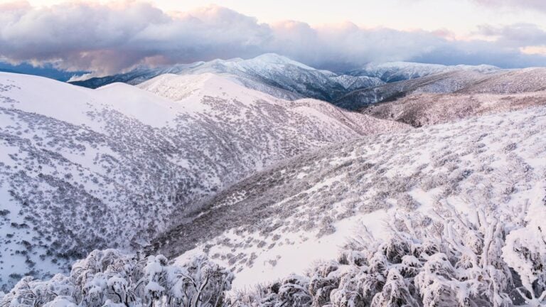
Alpine and shoulder-season conditions still demand respect. Wind exposure above 1500 metres can produce severe wind chill even on an otherwise mild day, and cold rain combined with wind is one of the most dangerous combinations in Australian hiking.
To put that in concrete terms, air at 4°C with a 24 km/h wind already feels closer to −1°C, and at 48 km/h that same air feels closer to −3°C, using the standard wind chill index. The Bureau of Meteorology doesn’t publish a wind chill figure itself. Its “feels like” number is Apparent Temperature, which factors in humidity and radiation rather than wind alone, so treat wind chill as a useful way to picture what wind does to exposed skin, not as the same number you’ll see on a BOM forecast.
Before you leave for cold or alpine conditions:
- Carry layered insulation, not a single heavy item.
- Protect dry layers from moisture.
- Include wind protection.
- Plan for inactivity, not just movement.
Losing your ability to stay warm is one of the quickest ways a manageable situation turns into a serious one.
Hydration & Energy Planning
Dehydration reduces cognition before it reduces strength, and cold suppresses thirst while heat accelerates fluid loss, with wind increasing evaporation in both cases.
Before you leave, plan your intake:
- Carry redundant water capacity.
- Know reliable refill points.
- Pack easily accessible calories.
- Plan regular intake intervals.
Energy depletion narrows your judgement exactly when you need it most, under stress.
Communication & Turnaround Triggers
A simple trip intention can prevent prolonged exposure if things go wrong.
Before you leave, set this up:
- Leave your route and return time with a trusted contact.
- Set a clear late-back trigger.
- Provide explicit instructions to call police if you fail to check in.
- Consider satellite communication in remote areas.
Set your trigger points before you leave, not while you are already standing in deteriorating conditions, because it is much harder to make good decisions once you are tired, cold or under pressure.
- Strong winds that make balance, movement or route-finding difficult, significantly increase wind chill, or create unacceptable treefall or exposure risk.
- Whiteout or severe visibility reduction.
- Heat conditions that exceed what your group can safely manage.
- River levels rising beyond safe crossing height.
- Smoke or fire movement within proximity.
Decisions made calmly at home are stronger than those made under pressure later.
Identify Your Safer Places Before You Leave
For each major hazard on your route, identify at least one location where conditions would be materially better than your current exposure.
- Bushfire: Open clearings, rocky areas with minimal fuel load, large water bodies.
- Lightning: Below treeline, away from ridges and high points, in a low depression or gully.
- Extreme heat: Shaded gullies, watercourses with canopy, sheltered rest points away from direct radiant exposure.
- Storm and wind: Leeward slopes, terrain features that block exposure, away from isolated trees and cliff edges.
The question to ask while planning is simple: if conditions deteriorate at this point on the route, where is the nearest place that reduces exposure? Know the answer before you leave, not while you are standing there working it out.
Phase Two: During Exposure
When weather deteriorates, staying safe becomes more important than continuing the route.
Protect Insulation
In bad weather, insulation is your margin, because it buys you time to think, stabilise, and choose the safest next step. In cold conditions, wet clothing accelerates heat loss and makes simple tasks harder. In hot conditions, poor ventilation traps heat and increases thermal stress. Keep dry layers dry, minimise exposure when changing clothing, and insulate yourself from cold or wet ground whenever you stop.
Control Wind & Radiant Exposure
Wind increases heat loss, and sun increases heat load, so when conditions turn severe, look for natural shelter that reduces your exposure to either. That might be a leeward slope, a position behind a terrain feature, or a shaded gully in hot weather, and reducing exposure like this can often help more than adding another piece of equipment would.
Conserve Energy
Extreme conditions multiply the cost of every effort, so slow your pace, avoid unnecessary detours, cut down on repetitive pack removal, and resist the urge to rush. Conserving energy now is what gives you more options later.
Maintain Hydration & Electrolytes
Drink before thirst signals even appear, and eat small amounts regularly. In extreme heat, supplement electrolytes to reduce hyponatraemia risk, and keep monitoring for headache, nausea or confusion, because cognitive decline is subtle at first and easy to miss in yourself.
Lightning & Hail
Convective storms in Australia can produce severe lightning and destructive hail. Under the current Australian Standard (AS 1768:2021), the trigger is simpler than most hikers expect: stop outdoor activity and seek the safest available shelter as soon as thunder is heard. You do not need to count seconds, and distance is not the measure, because if you can hear thunder, you are already in the risk zone. Do not shelter under isolated trees, and avoid ridge crests and exposed high points.
If caught in the open:
- Crouch on an insulating surface such as a foam mat.
- Keep feet together.
- Minimise ground contact.
- Separate group members by several metres, do not huddle.
- Seek a dry ditch, gully or depression and crouch low.
Wait a minimum of 30 minutes after the last thunder before resuming movement, because storms often pass quickly and your goal here is temporary survival, not forward progress. Large hail can cause concussion, so use your pack to protect your head if necessary.
Avoid Movement Unless Risk Decreases
Movement increases exposure, uses more energy, and can make navigation harder when conditions are already difficult, which is why staying put is often the safer option in poor conditions. If visibility is low, you are insulated, and the terrain around you is uncertain, moving can create more problems than it solves.
Move only when staying where you are creates the greater risk, such as floodwater threatening your position, fire movement forcing you out of the area, or being unable to find any suitable shelter at all. Before moving, ask honestly whether the change will actually leave you safer than where you are now.
Phase Three: After Entrapment
If conditions mean you can no longer move safely, the priority is to make yourself as comfortable and protected as possible while you wait.
Stabilise Temperature
In cold conditions, add insulation as soon as possible, get out of the wind, and insulate yourself from the ground to reduce heat loss. In hot conditions, move into shade where you can and create airflow, and if you have enough water available, wetting your clothing can help with evaporative cooling.
Signal Early
Do not wait for the situation to become critical before signalling. If you have a device, use it early while you still have battery, clarity and coordination. Once you have made contact, shift to conserving power and preparing simple visual signals so rescuers can locate you quickly.
Avoid Risk Stacking
Avoid stacking hazards, because poor visibility, fatigue, cold, heat stress and time pressure can combine to create a cascade of small errors. In that state, do not descend unstable slopes, cross swollen creeks on impulse, or split up the group, unless there is a clear, risk-reducing reason to do so.
Protect Morale & Cognition
Panic accelerates poor decisions.
Try to maintain a simple routine:
- Drink.
- Eat.
- Adjust clothing.
- Monitor each other.
Keeping yourself and the people around you calm helps you make better decisions.
At-a-Glance: Australian Environmental Extremes
Environmental conditions rarely create a single universal numeric red line for hiking. Temperature, wind and rainfall interact with terrain, exposure, group capability and available exit options. Use the following as reasons to reassess your plan or turn back rather than as fixed national thresholds.
| Hazard | System Under Strain | Reasons to Reassess or Turn Back |
|---|---|---|
| Extreme Heat | Thermoregulation, hydration, decision-making | Severe or extreme heatwave conditions, or heat and exposure that exceed the group’s ability to stay cool and hydrated, particularly where shade, reliable water or easy exit options are limited. |
| Bushfire Risk | Communication, situational awareness, egress | Fire Danger Rating of Extreme or Catastrophic, a Total Fire Ban affecting remote fire-prone terrain, a visible smoke plume in the direction of travel, or loss of a clear exit route. |
| Alpine Cold | Insulation, energy availability, navigation | Strong winds, precipitation or whiteout conditions that compromise balance, navigation or the ability to stay warm, or any inability to maintain warmth while stationary. |
| Flash Flooding | Terrain positioning, escape timing | Heavy or intense rainfall forecast for the catchment, a Flood Watch or Warning affecting the area, rising water levels, or a route involving narrow gorges, drainage lines or river crossings without a safe elevated escape option. |
| Lightning | Exposure management, ground current risk | Thunder is heard or lightning is seen. Stop exposed outdoor activity and seek the safest available shelter immediately. Resume only after at least 30 minutes have passed since the last thunder. |
The Reality of Extreme Weather Survival in Australia
Extreme weather survival is usually about making conservative decisions early. Most successful outcomes are quiet and uneventful. That is the objective.
Explore related guides
Weather & Environmental Awareness
- Weather Guide for Hiking in Australia
- How to Predict Weather from the Clouds
- Hiking in different seasons
- Hiking in Winter
- Hiking in summer
Heat & Fire Risk
Survival & Stabilisation