Federation Peak: A Mountain That Has Never Made It Easy
At 1,225 metres, Federation Peak is not particularly high by Australian standards. Its elevation is lower than dozens of mountains on the mainland and in Tasmania. Look only at the number beside its name on a map and there is little to suggest why this isolated quartzite spire in Tasmania’s south-west has acquired such a formidable reputation.
Height, though, is one of the least useful ways to understand Federation Peak.
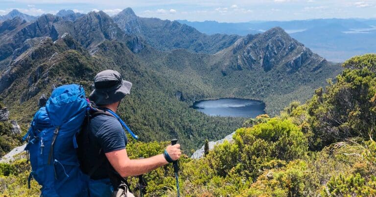
Its southern side rises around 670 metres above Lake Geeves over a horizontal distance of only 450 metres. The final few hundred metres of the summit ascent are almost vertical in places. Around it lies the Eastern Arthur Range, a landscape of jagged quartzite ridges, cliffs, glacial lakes, dense vegetation and rapidly changing alpine weather, deep within Southwest National Park and the Tasmanian Wilderness World Heritage Area.
Federation Peak’s history helps explain why the mountain deserves to be understood as something more consequential than another difficult bushwalk with a summit at the end.
For much of that history, simply reaching the mountain was an expedition.
A history older than climbing
The history of Tasmania’s south-west did not begin when European explorers started drawing lines across maps.
The Tasmanian Wilderness World Heritage Area is an Aboriginal cultural landscape. Archaeological evidence shows Aboriginal people have lived in, used and managed parts of this vast landscape for at least 35,000 years, including river valleys, buttongrass plains and alpine environments. Cultural connections to the World Heritage Area continue today.
There does not appear to be sufficient publicly available evidence to make specific claims about an Aboriginal name for Federation Peak, or about Aboriginal ascents of the mountain itself. It would be wrong to invent that history. But it is equally important not to describe nineteenth-century Europeans as discovering an untouched or previously unknown landscape.
Within the documented European record, surveyor James Sprent was the first westerner known to have noticed the distinctive mountain during his extraordinary trigonometrical survey of Tasmania. He described it as “the Obelisk”, and it later became known as Sprent’s Obelisk.
Its present name arrived in 1901. While cutting a route through the south-west from Hastings towards Port Davey via the Old River, explorer and prospector Thomas Bather Moore named it Federation Peak in honour of the newly federated Australian colonies.
Naming it was one thing.
Climbing it was another.
The problem was getting there
Today it is possible to look at satellite imagery, topographic maps and detailed track information before setting foot in the Eastern Arthurs. Early parties had nothing comparable.
The Hobart Walking Club, formed in 1929, became central to the systematic exploration of Tasmania’s remote mountain country. By the 1940s, Federation Peak had become one of the great unresolved objectives of Tasmanian bushwalking and climbing.
The difficulty was not confined to the summit.
The country surrounding Federation Peak presented its own problem of access. Dense rainforest and horizontal scrub could make progress painfully slow. Steep ridges, rivers and poor weather compounded the difficulty. A route that looked possible from a distance could simply disappear into vegetation once a party entered it.
Contemporary records from the Hobart Walking Club show how close some of these attempts came. In December 1947, Nancy Shaw, Bill Jackson and Leo Luckman made another attempt on Federation Peak and were described by the Club as “almost successful”, before bad weather forced them back during the final stages. A second party including Shaw returned only days later and was also turned back.
Something else happened in 1947 that changed the problem considerably.
An aerial survey of south-west Tasmania allowed walkers to see the landscape from a perspective unavailable on the ground. John Béchervaise later wrote that it was only after this survey that practicable approaches to Federation Peak began to be established. Aerial photographs revealed more open buttongrass corridors between areas of extremely dense vegetation and helped successive expeditions refine their approach.
Even then, Federation Peak remained an undertaking on a scale difficult to reconcile with the way we think about Australian bushwalking today.
In 1948, what the Tasmanian Museum and Art Gallery describes as the first large wilderness food air-drop in Tasmania was made to support another attempt on Federation Peak. Around 90 kilograms of food was dropped from an aircraft. The walkers recovered almost all of it.
A 1,225-metre mountain required aerial reconnaissance and an airborne resupply operation simply to improve the prospects of getting a party into position to climb it.
That tells us something elevation never could.
January 1949
The breakthrough finally came in January 1949.
A Geelong College Exploration Society expedition led by educator and explorer John Béchervaise entered the south-west for what became an 18-day journey. With him was a substantial support and forward party, not merely four climbers arriving beneath a mountain for a day’s ascent.
Béchervaise’s contemporary account, published in Pegasus in June that year, is one of the most valuable records of Federation Peak’s early history because it describes the expedition before decades of mythology accumulated around it.
Floodwaters held the party up for 48 hours. They encountered blizzard conditions. Vegetation remained so dense that even with the knowledge gained from previous expeditions and aerial survey, the party spent days working its way through the country towards the mountain.
Eventually they reached the small plateau beneath Federation Peak’s cliffs.
From there the nature of the undertaking changed again.
The first part of the ascent involved hundreds of feet of steep scrambling. Higher up, Béchervaise, Fred Elliott, Bill Elliott and Alan Rogers encountered the rock face and used what Béchervaise described as orthodox rock-climbing techniques to negotiate a chimney on the south-east face. They eventually reached the summit and built a cairn. The climb, time on the summit and descent took nine hours.
One aspect of Béchervaise’s account is particularly important.
He did not portray the ascent simply as the triumph of his own party. He explicitly acknowledged the Hobart walkers who had repeatedly attempted Federation Peak before them, describing success as “climbing on the shoulders” of previous expeditions.
That is a better way of understanding the first ascent.
Federation Peak was not suddenly navigated by four people in 1949. Its ascent was the culmination of years of exploration, failed attempts, accumulated knowledge, route finding and, eventually, aerial reconnaissance. The Geelong party completed the final part of a much longer process.
Even the precise date illustrates why historical sources deserve care. Federation Peak’s first ascent is frequently given as 27 January 1949, while Geelong College’s own archival biography of Béchervaise records it as 29 January. His contemporary published account does not state the day. “January 1949” is therefore the more defensible wording unless further primary material resolves the discrepancy.
From problem to proving ground
Once Federation Peak had been climbed, people’s relationship with it began to change.
Only three years later, in 1952, Lithuanian-born Tasmanian wilderness photographer and conservationist Olegas Truchanas reached the summit alone and unsupported. His solo ascent is recorded by the Australian Dictionary of Biography among the remarkable journeys he made into Tasmania’s south-west.
As knowledge and climbing skill developed, climbers began seeking not simply a way onto Federation Peak, but increasingly difficult ways of climbing it.
One of the most significant came in February 1968, when Peter Heddles, Rod Harris, David Neilson and Jack Woods made the first ascent of Blade Ridge, the great knife-edged ridge rising towards the mountain’s north-west face. Neilson later recalled that the party had travelled into the south-west specifically hoping to make the first ascent. After a week of bad weather, they descended towards the Northern Lakes, located the foot of the ridge and began climbing.
Nearly half a century later, Blade Ridge would itself become the objective of a winter expedition, demonstrating how Federation Peak had evolved from an almost inaccessible geographical problem into one of Australia’s most significant climbing objectives.
There is a famous description frequently attached to this reputation. Sir Edmund Hillary is often said to have called Federation Peak “Australia’s only real mountain”.
It is a wonderful line.
It may even be true.
But an original interview, book, speech or other primary source establishing that Hillary actually said it has proven difficult to locate. Even the ABC has described the attribution as mountaineering legend. For a mountain already rich enough in documented history, it hardly needs an uncertain quotation to make it more impressive.
Why 1,225 metres can be so serious
Modern walkers have advantages the early Federation Peak parties could scarcely have imagined.
We have detailed mapping, weather forecasts, satellite imagery, GPS navigation, lightweight equipment, Personal Locator Beacons and rescue helicopters.
The mountain has not changed with them.
Federation Peak is hard quartzite, set within a landscape that World Heritage documentation specifically recognises for its rugged, tarn-studded quartzite ranges and glacial landforms. Its summit is exceptionally abrupt. The 2026 coronial findings describe the southern side climbing 670 metres from Lake Geeves in only 450 metres horizontally.
But the summit cannot be considered in isolation from the journey required to reach it.
Tasmania Parks and Wildlife Service currently grades the Eastern Arthur Range Traverse as Grade 5. The approximately 72-kilometre journey generally takes six to nine days and is intended for very experienced bushwalkers with specialised skills. Parks warns of difficult navigation, exposed rock, sheer cliffs, unstable surfaces, steep scrambling, heavy packs and extreme weather.
Federation Peak adds another level.
Parks now makes clear that reaching its summit involves significant exposure and requires technical climbing skills. Its warning could scarcely be less ambiguous: “a fall in this area is likely to be fatal.”
That distinction matters.
Federation Peak may appear on maps and photographs as the grand conclusion to a walk through the Eastern Arthurs, but the summit is not simply the final kilometre of a Grade 5 bushwalk. It is an optional climbing objective reached from within an already difficult wilderness journey.
Parks explicitly says the Eastern Arthur Range Traverse can be completed without climbing Federation Peak, and that many walkers choose to bypass it.
That may be one of the most important facts anyone contemplating the mountain can understand.
The cost of getting it wrong
Federation Peak’s history also contains deaths. They deserve acknowledgement, but not sensationalism.
In findings issued in July 2026, Tasmanian Coroner Madeleine Wilson recorded that coronial records showed five reportable deaths at Federation Peak since 2007, three of them since 2024.
In 2007, a walker died after reaching the summit and falling while descending. In 2016, another walker died in a fall during a summit attempt; a subsequent coronial finding described the death as a tragic accident. In July 2024, a walker died after falling from height in the vicinity of Federation Peak while undertaking the Eastern Arthur Range Traverse.
In December 2024, a 30-year-old Victorian walker died after falling an estimated 80 to 100 metres. The subsequent coronial investigation is particularly sobering because the party had already decided the terrain ahead was unsafe and was attempting to retreat when he fell. Cloud prevented the rescue helicopter from searching the fall location that afternoon.
In November 2025, the body of a 39-year-old New South Wales walker was found near Federation Peak after he failed to return as planned. Tasmania Police referred the death to the Coroner. At the time of writing, the publicly available police statement does not establish a cause of death, so it would be wrong to describe it as another fatal fall unless further findings do so.
These incidents are not evidence that everyone who climbs Federation Peak is reckless, nor that experienced people should never attempt it. Several of those who have died in the area were experienced and well equipped.
What they demonstrate is consequence.
On some sections of mountain terrain, a mistake might mean a bruised knee, a difficult retreat or an embarrassing story afterwards. On Federation Peak there are places where the same loss of balance can have no recoverable outcome.
Remoteness then compounds everything. Poor visibility and severe weather have delayed helicopter access during fatal incidents in both 2016 and 2024. Even locating and recovering someone can become a major wilderness operation.
A clearer warning
Something significant changed in May 2026.
Tasmania Parks and Wildlife Service revised the information it provides for difficult multi-day walks, increasing warnings and giving more detailed descriptions of Grade 4 and Grade 5 routes. According to the Coroner’s findings, imagery was also reviewed so official information would better reflect the conditions and challenges walkers might actually encounter, rather than the more appealing images often shared on social media.
The current Federation Peak information is consequently unusually direct.
The Eastern Arthurs should not be underestimated. The walk is not suitable for beginners or lightly experienced walkers. Federation Peak requires technical climbing skills. A fall on the summit route is likely to be fatal. The traverse itself does not require the summit.
None of that diminishes Federation Peak.
If anything, it places the mountain back into the historical context from which modern familiarity can sometimes remove it.
The first climbers did not regard Federation Peak as another summit waiting to be ticked off. For years, highly capable people struggled merely to work out how to reach it. Parties turned back. Knowledge accumulated slowly. An aircraft survey changed what could be seen. Food was dropped from the sky. An 18-day expedition finally placed four climbers on the summit.
Seventy-seven years later, we can download the route to a phone.
What we cannot download is the judgement required to know whether we belong on it.
Not every journey needs the summit
There is a tendency in outdoor culture to treat a summit as the natural conclusion to a mountain journey. Reach the top and the trip is complete. Turn around beforehand and something has been left unfinished.
Federation Peak is a good mountain on which to question that idea.
There are people with the experience, climbing ability, judgement and comfort with exposure to attempt it in appropriate conditions. Its climbing history deserves respect, from the walkers who spent years finding ways through the south-west to Béchervaise’s party, Truchanas and the generations of climbers who followed.
But respecting that history does not require repeating it.
The Eastern Arthurs exist independently of Federation Peak’s summit. The lakes, ridgelines, weather, vegetation and vastness of Tasmania’s south-west do not become less extraordinary because someone chooses to walk past the junction rather than climb above it.
Perhaps this is ultimately what Federation Peak’s history has to offer a modern walker.
We have become much better at reaching the mountain. We have better maps, better equipment, better forecasts and far better ways of calling for help.
We have not made the mountain less consequential.
And sometimes the most informed decision a formidable mountain gives us is not how to climb it, but whether we need to climb it at all.
For some people, Federation Peak may be one summit that is better left alone.
Sources and further reading
- Magistrates Court of Tasmania – Coronial findings relating to a Federation Peak fatality, July 2026
- Tasmania Parks and Wildlife Service – Eastern Arthur Range Traverse
- Tasmania Parks and Wildlife Service – Eastern Arthur Range Traverse walk notes
- Department of Natural Resources and Environment Tasmania – Aboriginal heritage of the Tasmanian Wilderness World Heritage Area
- Department of Natural Resources and Environment Tasmania – James Sprent and the Trigonometrical Survey of Tasmania
- Australian Government – Tasmanian Wilderness World Heritage Area
- The Geelong College – Federation Peak Ascent 1949, John Béchervaise
- The Geelong College – John Mayston Béchervaise (1910–1998)
- Hobart Walking Club – Club history
- Tasmanian Museum and Art Gallery – Federation Peak wilderness food air-drop
- Australian Dictionary of Biography – Olegas Truchanas
- Forty South – David Neilson: Lake Pedder Changed My Life
- ABC News – Federation Peak winter ascent via Blade Ridge
- ABC News – Federation Peak fatality, April 2007
- ABC News – Coronial finding into 2016 Federation Peak fatality
- Tasmania Police – Bushwalker death at Federation Peak, March 2016
- Tasmania Police – Bushwalker death in the Eastern Arthur Range, July 2024
- Tasmania Police – Body located near Federation Peak, November 2025