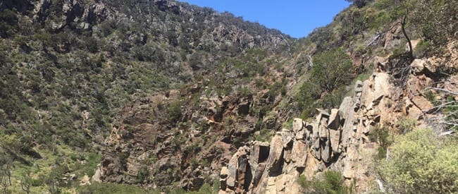
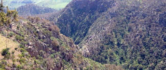
Werribee Gorge and Falcons Rim is a 13.7km, grade 4 hike located in Werribee Gorge State Park, Victoria. The hike should take around 4 hours to complete.
Warning
Parts of this hiking trail traverse through private land. You will need to seek an alternate route or seek permission of the land owner to access their land.
Hike overview
This Werribee Gorge and Falcons Rim Circuit hike explores the length of the Werribee Gorge circuit as well as combining the Falcons Lookout track and Western Bluff Track. Starting at Meikles Point Picnic area follow the Werribee River to the north west. The first part of the walk follows a disused water channel built between 1926 and 1929 to supply irrigation to the local area.
The trail is quite awkward from this point until Needles Beach as it hugs the base of a few small cliffs. Needles beach is a good place for a rest stop. Continued along the trail for about 150m before finding a suitable crossing point back to the opposite side of the river. Listen out for running water as that is where you will often find the best crossing points. Turn left once you cross the river and walk back to the entrance to Ironbark Gorge.
Ascend the steep ridge immediately to the right of the gorge. This is called Falcons Spur and is a well defined but rocky trail. Alternatively you can follow Ironbark Gorge along its length to rejoin the Falcons lookout trail. The trail is not as well defined though. After about 200m the ridge levels out to expose some amazing views through the Werribee Gorge.
Continue along this trail to the base of Falcons lookout and a popular rock climbing site. There is a set of timber stairs taking you to the base if the site. From Falcons lookout the trail follows the crest of a wooded ridge before dropping into a narrow and shady valley.
This trail them enters the upper section of Ironbark Gorge before climbing out of the valley and on to IronBark car park.
Turn left and walk 400m along the gravel road to the train line crossing. Immediately to your left you will see the start of the Western Bluff track. Gradually descend the ridge to the rocky outcrop of Western Bluff. From the bluff the trail descended steeply via Needles spur into the depths of the Werribee Gorge.
Once I reached the Werribee River cross the river then turn left to follow the Werribee River gorge trail to Needles Beach. You are now retracing a short section from the early part of the circuit.
Follow the trail along the eastern side of the river as far as Blackwood pool. The trail then leaves the river to ascend a rocky ridge to western viewpoint. A great spot to take in the twisting river below.
Continue to walk east from Western viewpoint past picture point, which overlooks Needles Beach, and on to Eastern Viewpoint where you can take in a view of the Island. From Eastern Viewpoint you now have the option of following the short circuit trail back to Meikles Point or continuing east past the Hanson Farm ruins back to the quarry car park.
The trail from the car park now follows Myers road for a few hundred metres. Leave the road and follow the trail across a few shallow gullies before descending Pattersons spur via a vehicle management track and back to Meikles Point.
Route and GPX file
Max elevation: 399 m
Min elevation: 147 m
Total climbing: 782 m
Total descent: -784 m
Tips
- Trail can be taken in any direction.
- The river is prone to flooding so avoid after heavy rains.
- Walking poles will be beneficial.
- Be mindful of snakes and hit weather during the summer months
Trail location
Sorry, no records were found. Please adjust your search criteria and try again.
Sorry, unable to load the Maps API.
Getting there
Follow the Western Highway past Bacchus Marsh to the Pentland Hills exit (5km beyond Bacchus Marsh). At the end of the exit ramp turn right to pass under the freeway. Turn left onto Pentland Hills Road. After passing under the freeway again turn left onto Myers Road and follow it down to the Werribee Gorge State Park.
Access conditions
- 2WD Access
- Winding Road
- Large Car Park
- Accessible Toilet
- Public Toilets
- Untreated Water
- Picnic Table
- BBQ Facilities
- Campfire Pit
Gallery
If you have any photos from this hike and are happy to share them, please upload your .jpg files here.
Please note: Uploading photos does not transfer ownership of copyright away from you. If requested, you will be credited for any photos you provide and can ask they be deleted at any time.
About the region
Werribee Gorge State Park is part of an Aboriginal cultural landscape that includes the traditional Country of the Wadawurrung and Wurundjeri Peoples. Werribee Gorge is a wild, rugged natural beauty shaped by 500 million years of geological history. A range of challenging walks amid the steep, river-washed gorge and surrounding rocky ridges offer spectacular views and access to a rock-climbing site within the park. Self-sufficient visitors can picnic and hike to explore this unique park and its distinctive settings.
Similar trails nearby
Explore Safe
While planning your hike, it’s important to check official government sources for updated information, temporary closures and trail access requirements. Before hitting the trail, check local weather and bushfire advice for planned burns and bushfire warnings and let someone know before you go. Plan ahead and hike safely.
Let someone know
Adventure with peace of mind: Fill out your trip intentions form. Before you hit the trail, fill out an online form to privately send important details about your hike to your family or friends. If you don’t return on time, they can easily alert emergency services, preventing worry and ensuring a swift response. Hike with peace of mind and enjoy your outdoor adventure to the fullest. Be smart, be safe: Register your plans here.
Gear to consider

My free planning, food and packing checklists provide an introduction to things your could consider (as well as the Ten Essentials) on your day, overnight and multi-day adventures. Customise your kit according to your personal needs, always considering safety first.
Suggest an edit
Does this hikes information need updating? Sometimes the route, trail features or access conditions change.
Acknowledgement of Country
Trail Hiking Australia acknowledges the Traditional Owners of the lands on which we hike and pay respects to their Elders, past and present, and we acknowledge the First Nations people of other communities who may be here today.


3 Reviews on “Werribee Gorge: Falcons Rim Hike (13.7km)”
Really amazing hike, with some fun technical bits, some good workout climbs, and magnificent scenery.
Rudi Elfrida de Beer sien jy kans vir di ene
Trail Hiking Australia many of the hikers I have come across are not equipped for this kind of walk, do not have any water or food. They just drive in from the city to go for a walk without a map and have no idea of the track.
Werribee gorge is a great one take the kids on. We took a bunch of them and they loved it!!!
yes please!!!
A very busy area!
I completely agree. Used to be such a quiet place a few years back.
Although we only did the circuit walk which was about 8km x
Anita Mitchell already done it! Did it a few weeks ago when our friend visited from the UK. It’s beautiful x
Esra Karatay
Gary Singh when we have holidays ?
I call bullshit on this picture. There’s no way this is a Werribee Gorge shot!
I call the same. I just saw it and sent myself an email to update that. A glitch somewhere in my system.
I have been wanting to do this for a while.
Is the picture taken there?
It is a shame really, I started hiking there about 8 years ago and I could go on a weekend and be the only person there. It was the reason I went almost every weekend. Visited again recently and was shocked by the volume of people. Ironic that I escape into nature to get away from the world but seems everyone is doing the same so it is getting harder and harder to escape..
Louise Higgins Sharon Gallagher Jo Edwards
When can we do this walk?
Muriel Pepper sadly that represents the vast majority or people out there. Preparation is key to enjoying any hike and returning safely. I think a lot of people enjoy urban walks and when they transition into hiking in wild areas they don’t realise the preparation required. Hoping that will change over time.
Nice one – Fir your future adventure tires, this is a great site for loads of walk options!!
Nope. Sorry about that. Must be a glitch from my site. Sent myself an email to fix that
One day next week Simone Amos ??? Maybe skip the gym and we go straight after school drop off???
Penny Mason Peetoom – weren’t u planning a Werribee George walk?