Hike at a Glance
Max elevation: 384m
Min elevation: 147m
Total Ascent: 658m
Hike overview
Embark on the Centenary Walk and The Island hike, commencing at Meikles Point Picnic Area or the Quarry. This anti-clockwise loop follows the Gorge Circuit Track, ascending Patterson's Spur before traversing picturesque gullies and arriving at the Quarry Picnic Area.
Proceed north along the circuit track, passing the toilet block and temporarily exiting the park. Continue past Hanson's Farm and reach the intersection of the Circuit Track and Centenary Walk. Take a right turn, diverging through open woodland towards the bridge across Myrniong Creek at Junction Pool.
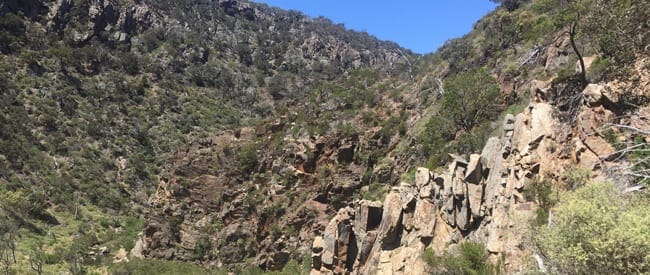
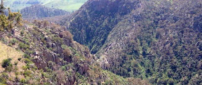
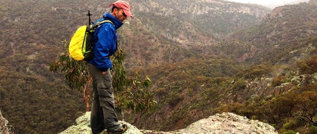
After crossing the creek, a challenging ascent awaits, leading to the top of the James Whyte Island Reserve, where panoramic views over Werribee Gorge and beyond will mesmerise you.
Retrace your steps back to the junction of the Circuit Track and Centenary Walk, but this time, take a right turn instead of continuing straight. Follow the old vehicle track until you reach Eastern Viewpoint, where breathtaking panoramic views over the James Whyte Island Reserve unfold before your eyes.
Backtrack approximately 100 meters and embark on the Short Circuit walk, located on your right. Follow this track until you encounter a disused water channel at the circuit walk junction. Turn right here and continue along the trail for a short distance before descending a set of stairs, leading you back to Meikles Point Picnic Area, where your adventure concludes.
Tips
- Highlights: Open woodlands, creek crossings, steep climb to James Whyte Island Reserve, expansive views.
- Trail can be taken in any direction.
- The river is prone to flooding so avoid after heavy rains.
- Walking poles will be beneficial.
- Alternate is to follow the Gorge Circuit Track from Eastern Viewpoint and return to Meikles Point via Werribee Gorge, following the Werribee River.
Content use
Please don’t copy GPX files or content from this site to AllTrails or other platforms. Each trail has been personally mapped, documented, and refined to support Australia’s bushwalking and hiking community. While some details come from land managers, every listing reflects significant personal effort. This is a free, community-driven initiative—your respect helps keep it that way.
Walk map and GPX file
Max elevation: 384 m
Min elevation: 147 m
Total climbing: 658 m
Total descent: -658 m
Getting there
Getting to the trailhead: Werribee Gorge State Park.
Follow the Western Highway past Bacchus Marsh to the Pentland Hills exit (5km beyond Bacchus Marsh). At the end of the exit ramp turn right to pass under the freeway. Turn left onto Pentland Hills Road. After passing under the freeway again turn left onto Myers Road and follow it down to the Werribee Gorge State Park.
Closest towns to this walk: Bacchus Marsh, Ballan, Blackwood, Geelong, Gellibrand Hill, Gisborne, Gordon, Greendale, Hoppers Crossing, Little River, Melton, Myrniong, Point Cook, Toolern Vale, Werribee
Access conditions
- 2WD Access
- Gravel Road
- Winding Road
- Large Car Park
- Public Toilets
- Untreated Water
- Picnic Shelter
- Picnic Table
- Campfire Pit
About the region
Werribee Gorge State Park is part of an Aboriginal cultural landscape that includes the traditional Country of the Wadawurrung and Wurundjeri Peoples. Werribee Gorge is a wild, rugged natural beauty shaped by 500 million years of geological history. A range of challenging walks amid the steep, river-washed gorge and surrounding rocky ridges offer spectacular views and access to a rock-climbing site within the park. Self-sufficient visitors can picnic and hike to explore this unique park and its distinctive settings.
Similar walks nearby
Looking for more walks in or near Werribee Gorge State Park? Try these trails with a similar difficulty grade.
Track grade
Grade 4 (Hard) - Challenging Walks for Experienced Walkers: Grade 4 on the AWTGS signifies challenging walking tracks. Bushwalking experience is recommended for these tracks, which may be long, rough, and very steep. Directional signage may be limited, requiring a good sense of navigation. These walks are suited for experienced walkers who are comfortable with steeper inclines, rougher terrain, and potentially longer distances.
Explore safe
Plan ahead and hike safely! Carry enough water, pack layers for changing conditions, and bring safety gear like a torch, PLB, and reliable communication device. Check official sources for trail updates, closures, and access requirements, and review local weather and bushfire advice. Most importantly, share your plans with someone before you go. Being prepared makes for a safer and more enjoyable hike! Stay Safe, Explore More, and Always #ExploreSafe.
Packing checklists
What you carry in your pack depends on factors like weather, terrain, and your adventure type. Not sure what to bring? My free planning, food, and packing checklists are a great starting point, covering day hikes, overnight trips, and multi-day adventures. Use them to customise your kit and always prioritise safety.
Let someone know
Before heading out, take a moment to fill out your trip intentions form. It’s a quick way to share your hike details with family or friends. If something goes wrong, they can notify emergency services, ensuring a faster response and peace of mind. Stay safe and enjoy your adventure
Suggest an edit
Spotted a change on this trail? Maybe there are new features, the route has shifted, or the trail is permanently closed. Whatever the update, I’d love your input. Your feedback helps fellow hikers stay informed and ensures that our trail info stays fresh and reliable.
Acknowledgement of Country
Trail Hiking Australia acknowledges the Traditional Owners of the lands on which we hike and pay respects to their Elders, past and present, and we acknowledge the First Nations people of other communities who may be here today.
/Centenary-Walk-&-the-Island-Hike_6.jpg)
/Centenary-Walk-&-the-Island-Hike_3.jpg)
/Centenary-Walk-&-the-Island-Hike_5.jpg)
/Centenary-Walk-&-the-Island-Hike_9.jpg)
/Centenary-Walk-&-the-Island-Hike_11.jpg)
/Centenary-Walk-&-the-Island-Hike_4.jpg)
/Centenary-Walk-&-the-Island-Hike_1.jpg)
/Centenary-Walk-&-the-Island-Hike_7.jpg)
/Centenary-Walk-&-the-Island-Hike_10.jpg)
/Centenary-Walk-&-the-Island-Hike_8.jpg)
/Centenary-Walk-&-the-Island-Hike_12.jpg)
/Centenary-Walk-&-the-Island-Hike_2.jpg)


1 Review on “Centenary Walk & the Island Hike (12.5km)”
I’ve done this hike quite a few times. First time there were no trees at all on top of the Island. Explored there again recently and they have grown a lot. Its not as exciting as other walks in the park but the views to the south, up through the gorge, are pretty spectacular. Its a good vantage point to see the entire park.