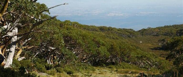
Mount Baw Baw Summit is a 3.5km, grade 3 hike located in Baw Baw National Park, Victoria. The hike should take around 1.5 hours to complete.
Hike overview
Commencing in the heart of Baw Baw's Alpine Village the Mount Baw Baw Summit Circuit traverses some of the most scenic alpine terrain as you hike among the snow gums and enjoy magnificent valley views which stretch out endlessly over Gippsland. The circuit follows established trails such as the Village Trail, Summit Trail, Maltese Trail, and Muellers Trail as it makes its way to the summit of Mount Baw Baw (elevation 1564m) and back. It is a moderately easy circuit up and over the summit of Mount Baw Baw, with a pinch of a climb to get there early on, and then downhill all the way back to the village.
Route and GPX file
Max elevation: 1573 m
Min elevation: 1455 m
Total climbing: 141 m
Total descent: -136 m
Tips
It is recommended to hike this circuit during non-winter months only as some of the trails traverse ski runs.
Trail location
Sorry, no records were found. Please adjust your search criteria and try again.
Sorry, unable to load the Maps API.
Getting there
The turn off from the Princes Hwy (M1) is at the Drouin / Mount Baw Baw exit. Continue along via Noojee along the Main Neerim Rd (C426), Follow this road through Noojee where it will then follow into the Mount Baw Baw Tourist Road (C426). Travel through Icy Creek and Tanjil Bren before reaching the resort gates then continue to Car Park No 1. Last major fuel stops is at Longwarry (before you exit the Hwy). Walk to the Village Restaurant.
Gallery
If you have any photos from this hike and are happy to share them, please upload your .jpg files here.
Please note: Uploading photos does not transfer ownership of copyright away from you. If requested, you will be credited for any photos you provide and can ask they be deleted at any time.
About the region
The Baw Baw National Park is a national park located on the boundaries between the Central Highlands and Gippsland regions of Victoria, Australia. The 13,530-hectare national park is situated approximately 120 kilometres east of Melbourne and 50 kilometres north of the Latrobe Valley.
Similar trails nearby
Explore Safe
While planning your hike, it’s important to check official government sources for updated information, temporary closures and trail access requirements. Before hitting the trail, check local weather and bushfire advice for planned burns and bushfire warnings and let someone know before you go. Plan ahead and hike safely.
Let someone know
Adventure with peace of mind: Fill out your trip intentions form. Before you hit the trail, fill out an online form to privately send important details about your hike to your family or friends. If you don’t return on time, they can easily alert emergency services, preventing worry and ensuring a swift response. Hike with peace of mind and enjoy your outdoor adventure to the fullest. Be smart, be safe: Register your plans here.
Gear to consider

My free planning, food and packing checklists provide an introduction to things your could consider (as well as the Ten Essentials) on your day, overnight and multi-day adventures. Customise your kit according to your personal needs, always considering safety first.
Suggest an edit
Does this hikes information need updating? Sometimes the route, trail features or access conditions change.
Acknowledgement of Country
Trail Hiking Australia acknowledges the Traditional Owners of the lands on which we hike and pay respects to their Elders, past and present, and we acknowledge the First Nations people of other communities who may be here today.


