The Bibbulmun Track feels so established today that it is easy to imagine its yellow Waugal markers leading walkers through Western Australia’s south-west forests for generations. It runs for around 1,000 kilometres between Kalamunda in the Perth Hills and Albany on the south coast, with campsites spaced along much of the route, purpose-built shelters, water tanks, maps, guidebooks and a large volunteer community helping to keep it open.
What I find particularly interesting is that the Bibbulmun Track people walk today is not really the same trail that Western Australia first opened in 1979. The original route certainly deserves to be regarded as the beginning of the Bibbulmun, but by the early 1990s it had become clear that too much of it followed forestry roads and other vehicle tracks, facilities were limited, water could not be relied upon and competing land uses regularly interrupted the walking experience.
Rather than simply patching the old trail, Western Australia did something far more ambitious. Much of the route was reconsidered, almost all of it was eventually realigned, the trail was extended all the way to Albany and a chain of campsites and shelters was created to support walkers travelling for weeks at a time. In that sense, the history of the Bibbulmun is really the story of two tracks. The first proved that Western Australians wanted a long-distance walk through the south-west, while the second took that idea and turned it into the trail we recognise today.
A modern walking trail across Noongar Country
Before getting into the history of the walking track itself, I think it is worth being clear about the much older history of the Country it crosses. The entire Bibbulmun Track lies within Noongar Country, and Noongar people maintain deep and continuing connections with the lands, waters and skies of south-west Western Australia.
Noongar Country covers a vast area of the south-west and includes a number of different cultural and language groups rather than one single community. The Bibbulmun, whose name was later given to the track, were one of those groups, with their Country generally identified around the Pemberton and Broke Inlet region, although traditional boundaries cannot always be represented neatly by lines on a modern map.
The modern walking track should not therefore be understood as an ancient route followed by the Bibbulmun people from Kalamunda to Albany. The Bibbulmun Track Foundation’s own historical account acknowledges that although Aboriginal people travelled long distances through the forests for cultural and ceremonial purposes, the precise routes of those journeys were not known when the recreational trail was named.
I think that is an important point to keep clear because the name can easily give a different impression. The trail was named in recognition of Aboriginal people of the south-west, but the 1,000 kilometre recreational route is a creation of the twentieth century, laid across Country with a human history vastly older than the trail itself.
The familiar trail marker also reflects that connection. Walkers follow yellow triangular markers bearing a stylised Waugal, the name used on the track for the great serpent associated with Noongar creation traditions and the shaping of the land and waterways. The Waugal marker did not appear with the earliest version of the trail, but once introduced it became one of the most recognisable walking symbols in Australia.
Geoff Schafer wanted Western Australians to go bush
The modern story begins with a bushwalker named Geoff Schafer, who had experienced long-distance walking elsewhere in Australia and could see that Western Australia was missing something. Bushwalking clubs already existed in the state, with the Western Walking Club established in 1937 and the Perth Bushwalking Club formed in 1969, but there was nothing in Western Australia comparable with the long alpine journeys available in the eastern states. Schafer had walked around 650 kilometres through the Victorian Alps and returned home frustrated that his own state did not offer a comparable continuous route.
In July 1972, he approached Western Australia’s Minister for Forests, H.D. Evans, with an idea for a long walking trail that would encourage people living in Perth to get out into the bush. Evans was receptive and referred Schafer and his proposal to the Forests Department, where several officers, including Peter Hewett, Wayne Schmidt and Ross Gobby, began exploring how such an idea might actually work.
The first concept was ambitious. By September 1972, the planning team had drawn up a possible route running from Lancelin, north of Perth, all the way to Albany, with the trail swinging through the Leeuwin-Naturaliste area along the way. It did not survive long once the practical work began because the distances and country involved made it unrealistic with the money and resources available. The planners reduced their ambition to a trail between Kalamunda and Northcliffe, which was still an impressive undertaking for a department with limited experience in long-distance recreational trails.
What appeals to me about Schafer’s original idea is how uncomplicated the purpose was. He wanted people to go bush, and although end-to-end walkers would later become an important part of the trail’s culture, the aim was never solely to create an enormous challenge for experienced walkers. The trail was meant to encourage ordinary people to spend time in the forests, perhaps for a day or a weekend, with the hope that a route continuing far beyond where they stopped might encourage them to return.
Geoff Schafer passed away in August 2026, more than half a century after first taking that idea to the Forests Minister. His name remains on the Track at Schafer Campsite between Pemberton and Northcliffe, beside a swimming hole among the karri forest. I find that a particularly fitting memorial because walkers stopping there are doing exactly what he hoped people would do when he first proposed the trail in 1972: leaving the city behind and spending time in the Western Australian bush.
Finding a name for a trail that barely existed
While the first route was being planned, the project also needed a name, and Kirup forester Len Talbot suggested “Bibbulmun”. The intention was to acknowledge Aboriginal people of the south-west and associate the trail with a much older relationship between people and the forests through which it would pass. The name was accepted during the early planning period, although the language used to explain that choice in the 1970s naturally reflected the understanding and terminology of its time.
Current interpretation is more precise. The Bibbulmun were one Noongar group rather than a name for all Aboriginal people across the south-west, and the Bibbulmun Track Foundation now explicitly acknowledges that the entire route passes through Noongar Country and encourages walkers to understand the different Country they cross. The first alignment carrying the new name was marked on the ground in March 1974, which means the trail spent several years developing before its official opening. Much of it made use of the vast network of forestry roads, fire access routes and existing tracks that already crossed the south-west rather than requiring an entirely new foot trail to be cut through the forest.
Given the money available, that was understandable, and it allowed an extraordinarily long route to be established relatively quickly. It also planted the seed of a problem that would become much more obvious later, because a walking trail and a convenient line through a working forest are not necessarily the same thing.
Bibbulmun Walk ’79 puts the trail on the map
The first Bibbulmun Track was officially opened in October 1979, during celebrations marking the 150th anniversary of the European settlement of Western Australia. The occasion was marked by Bibbulmun Walk ’79, a huge community event that involved more than 1,000 people walking different stages of a roughly 900 kilometre journey. Curiously, the commemorative walk began in Albany even though the official Bibbulmun Track at the time extended only between Kalamunda and Northcliffe, so the event itself anticipated the southern destination the trail would eventually reach many years later.
Schools, local councils and communities along the route became involved, while a smaller core of walkers completed the full journey and became what were probably the first official Bibbulmun end-to-enders. Extensive media coverage introduced the idea of long-distance walking to a much wider Western Australian audience and helped establish the Bibbulmun as something more significant than a line marked through state forest.
I think Walk ’79 probably deserves more credit than it generally receives because trails need people as much as they need markers. A route can exist on a departmental map for years without becoming part of public life, but suddenly there were school children, councils, walking groups and communities talking about the Bibbulmun and physically moving along it. Schafer’s idea of drawing people into the bush was already working, although the trail those people were walking still had a long way to go before becoming the Bibbulmun we know today.
The first Bibbulmun begins showing its weaknesses
By the 1980s, people were using the trail in substantial numbers, with contemporary estimates suggesting thousands of walkers each year, most of them completing relatively short trips rather than attempting the whole route. The trail itself was proving less satisfactory. Because so much of the original alignment relied on forestry roads and access tracks, walkers often shared their route with vehicles and passed through country affected by logging, mining, water catchment operations and other working uses of the forest.
In 1987 and 1988, the newly formed Department of Conservation and Land Management, usually known as CALM, carried out a major overhaul under project officer Drew Griffiths. The northern route between Kalamunda and Dwellingup was shifted farther east to reduce conflict with bauxite mining, while the southern end was extended beyond Northcliffe to Walpole. This work also brought the Bibbulmun into Western Australia’s Heritage Trails network and introduced the yellow Waugal marker that walkers now associate so strongly with the trail.
The improvement was substantial, but it still did not solve the deeper problem. The Bibbulmun remained heavily dependent on roads and working forest routes, and it offered little of the infrastructure that now makes long-distance walking along the trail practical for people without extensive bush experience.
There were very few shelters, toilets were uncommon and dependable drinking water could not be assumed, while the route itself did not always give walkers the feeling of travelling deeply through the natural landscape. Someone who had just walked one of the world’s great long-distance trails was about to see those weaknesses very clearly.
Jesse Brampton comes home from the Appalachian Trail
Jesse Brampton had grown up on a sheep farm south-east of Perth and became interested in long-distance walking during the 1980s. In 1987 he travelled to the United States and began walking the Appalachian Trail, eventually completing the entire route during 1987 and 1988. The Appalachian Trail gave him an entirely different view of what a long-distance walking trail could offer. It had shelters positioned along the route, reliable information for walkers, established water sources and an enormous volunteer community caring for the trail, while much of the walking took place on paths chosen because they gave people a genuine experience of being immersed in the landscape.
After returning to Western Australia, Brampton walked the Bibbulmun from end to end and found the comparison hard to ignore. The Western Australian trail still involved extensive walking on gravel roads, signage could be poor, facilities were sparse and long sections had been chosen largely because the roads were already there. What I find particularly interesting is that Brampton did not simply complain that the track needed improvement. He came back with another model in his head and prepared a detailed proposal for what the Bibbulmun could become.
His argument was not that Western Australia needed a few extra signs and campsites. He believed the trail should be rebuilt around the walking experience itself, with a route designed for walkers, purpose-built campsites, dependable water and a community organisation that would eventually help care for it. That idea changed everything.
Building a better Bibbulmun meant starting again
In 1993, CALM accepted the case for a major redevelopment and created the Building a Better Bibbulmun Track project. Senior CALM officer Jim Sharp headed the steering group, while Brampton became the project coordinator responsible for much of the detailed planning and delivery. The Appalachian Trail was openly used as a model, and links were established with the organisation responsible for caring for the American trail. The aim was not to copy an American walk into the Western Australian forest, but to learn from a place that had already solved many of the practical problems surrounding long-distance walking. The change in thinking was enormous.
A contemporary CALM account described the proposed route as a radical realignment that would retain barely 10 per cent of the old alignment. Instead of using roads simply because they already existed, the new trail would seek out natural areas, reduce clashes with forestry, mining and vehicles, and place far more of the walking within conservation reserves and other country chosen for the quality of the experience. The southern end would also be extended around another 180 kilometres to Albany, finally delivering the Perth-to-Albany concept that had been present in Schafer’s earliest proposal more than twenty years before.
When I first came across the figure of roughly 10 per cent being retained, it changed the way I thought about the history completely. Calling what happened in the 1990s an “upgrade” almost undersells it, because the Western Australian Government and everyone involved were effectively building another long-distance trail while keeping the Bibbulmun name and history alive. The old track had demonstrated that the idea worked, but the new one was being designed around what walkers had actually learned from using it.
The shelters changed what the trail could be
One of Brampton’s strongest lessons from the Appalachian Trail was the value of regular overnight shelters, particularly if the Bibbulmun was going to attract walkers who might otherwise be hesitant about committing to remote overnight trips. The redevelopment therefore included a chain of campsites generally spaced around a day’s walk apart. These were designed with open-fronted timber shelters, rainwater tanks, toilets, picnic tables and places for tents, giving walkers a predictable destination at the end of each day without turning the route into a hut-to-hut walk in the European sense.
Today those campsites feel inseparable from the Bibbulmun experience, but they were largely created during the 1990s rebuild. Before then, someone setting out for a long journey could not assume that a shelter and water tank would be waiting at regular intervals. The practical effect went well beyond comfort. The campsites allowed people to plan journeys around known overnight locations and reduced the need for every walker to create a separate camp somewhere in the forest, while also giving people a shared place where one day’s walkers crossed paths with another.
I think the social side of those shelters is one of the unexpected results of the rebuild. A long walking trail can be an intensely personal journey, yet anyone who has spent nights in communal trail shelters knows how quickly temporary communities form around a table, a water tank and somewhere dry to spread out a sleeping bag. Someone still had to build all of them, and that became another remarkable chapter in the history.
Prison crews built a surprising amount of the new track
The scale of the redevelopment required far more labour than CALM could provide alone, and one of the most significant partnerships came from Western Australia’s Ministry of Justice. Bob Dixon from Prison Industries and Denzell McCotter from Prison Operations saw an opportunity for minimum-security prisoners to contribute to the project. The early plan involved prefabricating shelter and toilet structures in prison workshops, but it soon expanded to include prisoners travelling out to campsites and working directly on track construction.
The first major project was Waalegh campsite, which was opened by Premier Richard Court in August 1994. During 1995, the first 68 kilometres of the rebuilt trail and another three campsites were completed with prison labour and Ministry of Justice funding. Crews from Wooroloo, Karnet and Pardelup prison farms subsequently worked on different parts of the route, constructing shelters, cutting trail, forming steps and installing facilities. Contemporary accounts from CALM describe the work as physically demanding but highly sought after by eligible prisoners, with crews taking considerable pride in what they were creating.
By 1998, the Ministry’s contribution to the Bibbulmun project was valued at more than $1.5 million in kind, and the partnership between conservation staff and correctional services received a Premier’s Award for Public Sector Management. I had not appreciated the scale of that contribution before researching the track’s history. Many walkers sheltering from rain or climbing formed steps through the forest would have no reason to know that some of what they are using was built or prefabricated by prisoners nearly thirty years ago.
They were far from the only people involved, because service clubs, businesses, employment programs, walking clubs, local communities, sponsors and individual volunteers also donated labour, materials and money. The new Bibbulmun was becoming a community project in a way the original track had never quite been.
Money finally allows the work to move quickly
For the first few years, funding remained uncertain and construction proceeded as money and labour became available. The first new section between Kalamunda and Brookton Highway opened in August 1995, allowing walkers to experience what the rebuilt trail was intended to become while work continued farther south.
A major change came in February 1996, when the project secured a $1.38 million Federal Government regional development grant over two years. The funding came with a requirement to complete the redevelopment within a defined period, which gave the project both the money and the deadline needed to push work forward quickly. By then, the scale of the undertaking was enormous. Hundreds of kilometres of new walking track had to be cleared or formed, bridges and boardwalks constructed, campsites built, Waugal markers installed, maps prepared and detailed route information assembled for walkers.
The northern 453 kilometres of the rebuilt trail were officially opened in August 1997, with 26 upgraded campsites along the route. Construction teams then concentrated on the southern half and the new extension towards Albany. At roughly the same time, another part of Brampton’s Appalachian Trail idea was coming together.
The Friends make the trail bigger than a government project
Brampton had seen in the United States that a trail of this length could not depend entirely upon government employees returning year after year to maintain every kilometre. Long-distance trails need people who become personally invested in them and are prepared to keep looking after particular sections long after the excitement of construction has passed.
In 1997, the Friends of the Bibbulmun Track was formed as a not-for-profit organisation to work alongside CALM in maintenance, promotion and support for walkers. Brampton stepped away from coordinating the construction project and became the organisation’s first executive officer, while Mike Wood became its founding chair. The organisation later became the Bibbulmun Track Foundation, and the partnership it developed with the Western Australian conservation agency has become one of the defining features of the trail.
By the time the rebuilt trail celebrated its twenty-fifth anniversary in 2023, the Foundation had more than 450 volunteers supporting maintenance and other work. Some care for allocated sections or campsites, while others guide walks, assist in the office, help with more difficult repairs or provide the considerable amount of behind-the-scenes work needed for a trail extending across a thousand kilometres. What I find interesting about the Foundation is that it completed one of the ideas Brampton brought home from America just as surely as the shelters did. The Bibbulmun became something people could take responsibility for personally, rather than simply a government track maintained somewhere in the background.
The second Bibbulmun Track opens
On 13 September 1998, Western Australian Environment Minister Cheryl Edwardes officially opened the completed redeveloped track. The route now stretched from Kalamunda all the way to Albany, passing through the jarrah and marri forests of the Darling Range, the taller karri and tingle country farther south and, finally, the coastal landscapes approaching Albany. Forty-eight new campsites had been completed for the rebuilt route, together with substantial numbers of bridges, boardwalks, trail markers and other works.
The opening was celebrated with another end-to-end walk, echoing Bibbulmun Walk ’79 nearly twenty years earlier. Ten walkers completed the entire journey, with other people joining them for shorter stages as the group moved along the trail. There is a pleasing symmetry to those two walks because they mark two different beginnings.
The 1979 event celebrated the first time Western Australia had managed to create a long-distance trail through its south-west forests, while the 1998 walk marked the point when the state had taken everything it had learned from the first version and built something far more ambitious. I would not dismiss the old trail as a failed first attempt, because without it there would have been no large community of walkers pointing out what needed improving and no proof that people wanted this kind of experience in Western Australia. The second Bibbulmun grew directly from what the first one had taught its walkers and managers.
The track keeps changing
Opening a 1,000 kilometre trail does not mean the route can simply be left where it is forever, particularly in country affected by bushfire, mining, forestry, water management, changing roads and new conservation priorities. The broad route established in 1998 remains the basis of the Bibbulmun today, although sections have been realigned and campsites replaced where circumstances required it. One change near Albany involved moving the former Hidden Valley campsite and altering the route to accommodate development of the Albany Wind Farm.
Fire has probably been the most persistent reminder that the trail exists within a changing Australian landscape. Several campsites have been destroyed by bushfire over the years, encouraging the use of more fire-resistant materials such as rammed earth when some shelters were rebuilt. The heritage-listed Long Gully Bridge over the Murray River was lost during a major bushfire in 2015, forcing another substantial change. A replacement crossing, the Bilya Djena Bidi suspension bridge, was eventually constructed in another location with far greater resistance to future fire.
The number of campsites along the main route has also grown from the 48 created for the 1998 opening to 49 today, while maps, route notes and navigation information have been repeatedly updated as the trail has been surveyed more accurately. I like the fact that the Bibbulmun has never been treated as something finished and untouchable. The history suggests that reconsidering the trail when circumstances change is part of the Bibbulmun tradition, because the version walkers love today only exists because an earlier generation was willing to admit the first version could be much better.
The Bibbulmun Track today
Today’s Bibbulmun Track stretches around 1,000 kilometres from Kalamunda to Albany, passing through some of the best-known forests and coastal landscapes of south-west Western Australia. The route travels through or near Dwellingup, Collie, Balingup, Donnelly River Village, Pemberton, Northcliffe, Walpole, Peaceful Bay and Denmark before reaching its southern terminus in Albany.
Today’s Bibbulmun Track stretches around 1,000 kilometres from Kalamunda to Albany, passing through some of the best-known forests and coastal landscapes of south-west Western Australia. The route travels through or near Dwellingup, Collie, Balingup, Donnelly River Village, Pemberton, Northcliffe, Walpole, Peaceful Bay and Denmark before reaching its southern terminus in Albany.
An end-to-end journey commonly takes about eight weeks, yet completing the entire route has never been the only purpose of the trail. Most people experience it through shorter walks, overnight trips and sections completed over many years, which is remarkably close to Geoff Schafer’s original hope that the existence of a long trail would simply encourage more Western Australians to get out and walk. That may be the part of this history I like most.
Schafer did not begin in 1972 by proposing a prestigious tourism attraction or an endurance challenge with a famous name attached to it. He thought Western Australia should have a long walking trail because people living in the city needed more reason to go into the bush, and he believed a trail could provide it. More than half a century later, he lived to see that idea become a 1,000 kilometre trail known well beyond Western Australia, supported by hundreds of volunteers and walked by people from around the world. Every person who follows the Waugal markers is, in a very literal sense, walking the idea he carried into the Minister’s office in 1972.
Then Jesse Brampton walked one of the world’s great long-distance trails, came home, walked the Bibbulmun and realised Western Australia could do something much better. CALM was prepared to listen, planners drew an almost entirely new route, prison crews and volunteers helped build it, governments and businesses found money, and a community organisation was created to care for it afterwards. When I see a Waugal marker now, that is the history I think is sitting quietly behind it.
The marker represents a modern recreational trail across Noongar Country, a landscape with a history extending back thousands of generations, but it also points along a route that exists because one generation imagined it and another generation was prepared to rebuild almost everything they had inherited. Western Australia did not get the Bibbulmun Track we know today right the first time. Perhaps the more interesting story is that it didn’t pretend otherwise.
Sources
- History of the Bibbulmun Track, Bibbulmun Track Foundation. The main historical account covering Geoff Schafer’s 1972 proposal, the original route, naming of the trail, Bibbulmun Walk ’79, the 1987 and 1988 redevelopment, Jesse Brampton, the Building a Better Bibbulmun Track project, prison crews, funding, the 1997 northern opening and completion in 1998.
- Aboriginal Interpretation, Bibbulmun Track Foundation. Current information acknowledging the entire trail as Noongar Country and explaining the Bibbulmun as one of the Noongar groups of south-west Western Australia.
- Bibbulmun Track: 25 Years of the New Track, LANDSCOPE, Department of Biodiversity, Conservation and Attractions. A detailed retrospective on the original trail, the 1987 redevelopment, Building a Better Bibbulmun Track, prison labour, the 1998 opening, campsites, volunteers and later changes to the route.
- Building a Better Bibbulmun Track, LANDSCOPE, Department of Conservation and Land Management, 1997. A contemporary account written while the rebuilt trail was under construction, including the decision to retain barely 10 per cent of the former alignment, the extension to Albany, campsite construction and funding of the project.
- People of the Bibbulmun Track, Department of Biodiversity, Conservation and Attractions. Profiles Jesse Brampton, Jim Sharp, Mike Wood and other people involved in rebuilding the trail and developing the Bibbulmun Track Foundation, while documenting the continuing contribution of hundreds of volunteers.
- A Track of Many Dreams, LANDSCOPE, Department of Conservation and Land Management. A contemporary account of the completed 1998 trail, its Albany opening, end-to-end celebration, funding, new campsites and the large contribution made by government agencies, community groups and sponsors.
- Forests Department Annual Report 1978–79, Government of Western Australia. Contemporary departmental records describing maintenance of the original Bibbulmun Bushwalking Track and preparations for the 1979 Albany-to-Kalamunda celebration walk.
- The Bibbulmun Track, Explore Parks WA, Department of Biodiversity, Conservation and Attractions. Current official information on the approximately 1,000 kilometre route and the 49 campsites now provided along the main trail.
- The Track, Bibbulmun Track Foundation. Current information on the Kalamunda-to-Albany route, Waugal trail markers, Noongar Country, towns along the trail and the different ways walkers experience the Bibbulmun.
- The Darling Range, Bibbulmun Track Foundation. Provides additional historical detail about the Waugal, early prison-built sections near Waalegh and the landscapes and former working routes incorporated into the northern trail.

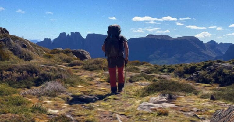
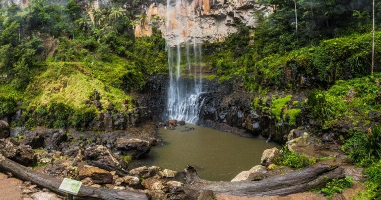
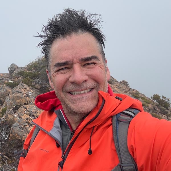



The Bibbulmun Track began with a simple idea: encourage people to leave the city behind and discover Western Australia’s bush.
As I researched the history of this remarkable trail over the past few months, I was reminded of the vision of Geoff Schafer, whose original proposal in 1972 helped set the journey in motion. With Geoff’s recent passing, it feels like a fitting time to share the story of how that idea became one of Australia’s great long-distance walks.
Bibbulmun Track Foundation