Hike at a Glance
Max elevation: 571m
Min elevation: 0m
Total Ascent: 18732m
Hike overview
The Bibbulmun Track is a 1,000km, grade 4 hike that stretches through Western Australia’s South West. Typically, this incredible journey takes around 50 days to complete, offering a true adventure for those who take on the full trail. Running from Kalamunda, a suburb in the hills on the outskirts of Perth, all the way to the historic town of Albany on the southern coast, the track passes through some of the most stunning landscapes in the region, from towering forests to rugged coastlines.
This trail is exclusively for walkers and is clearly marked with yellow triangular markers that symbolise the Waugal, the rainbow serpent in Aboriginal Dreaming. These markers are spaced about 500 metres apart, becoming more frequent at intersections or when the track takes a turn, ensuring you stay on the right path. Along the way, the track also provides insight into the region's rich Aboriginal heritage, with additional information available about the Nyoongar culture.
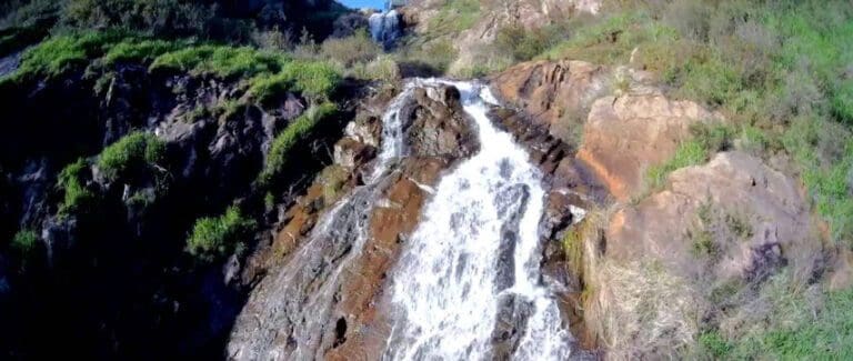
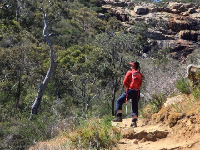
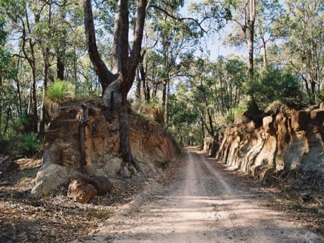
As you make your way along the Bibbulmun Track, you’ll walk through towering karri and tingle forests, traverse misty valleys, climb over massive granite boulders, and explore coastal heathlands that seem to stretch endlessly. The track passes through 22 national parks and reserves, each offering its own unique beauty and character. The northern section of the trail features vast forests of jarrah, marri, and wandoo trees, while the southern section is dominated by ancient karri and tingle trees, with sections offering spectacular views of the Southern Ocean. Between June and October, it’s not uncommon to spot migrating whales as they travel along the coastline.
The Bibbulmun Track links many of the state’s most iconic attractions, such as Mundaring Weir, the Gloucester Tree, the Valley of the Giants Tree Top Walk, and the serene Mandalay Beach. Whether you're after a short, peaceful stroll or the challenge of an eight-week trek, the track offers something for everyone. For those who complete the entire route, there’s the opportunity to be recognised as an ‘end-to-ender’.
There are plenty of ways to experience the track, depending on how immersed you want to be in the wilderness. For the full experience, you can camp along the way, join a guided group, or take a more relaxed approach by staying in the nearby towns and enjoying day walks. The track passes through towns like Dwellingup, Collie, Balingup, Donnelly River Village, Pemberton, Northcliffe, Walpole, Peaceful Bay, and Denmark, all offering a variety of accommodation options.
Given that the Bibbulmun Track is a linear walk, some planning is required if you don’t want to retrace your steps. This could mean organising a car shuffle, arranging to swap keys with other walkers at a campsite, or having someone drop you off and pick you up at the other end. Many of the track’s towns are accessible by public transport, making it easier to plan your hike and manage your logistics along the way.
See the Section by Section Guide for more details on getting there.
For more information on the Bibbulmun Track, visit Walk the Bibbulmun Track
Tips
- It is not possible to walk consecutive sections of the Track as day walks or to do it staying in accommodation each night. Some sections have many days between permitted access points (up to four days) and long distances between towns (the longest being 12 days).
- In addition, there are several facilities designed to enhance the walker's experience. Boardwalks, well positioned lookouts and footbridges all form part of the trail.
- The best times to walk the Track are in autumn (April to May), winter (June to August) and indeed spring (September to mid-November), our wildflower season. On cooler days, walking during summer is possible but should be restricted to the karri forest around Pemberton.
- Walkers should visit the FAQs and the Trip Planner pages before walking the Track for the first time and then check the Track Conditions prior to every walk. Sections may have diversions or closures which may affect the best plans.
Gallery
Got some great shots from this hike? Upload your photos here to inspire others and show off the beauty of the trail!
Click to view form >>
Submitting your photos doesn’t mean you lose ownership. You can be credited for your contributions, and you can request removal at any time.
Content use
Please don’t copy GPX files or content from this site to AllTrails or other platforms. Each trail has been personally mapped, documented, and refined to support Australia’s bushwalking and hiking community. While some details come from land managers, every listing reflects significant personal effort. This is a free, community-driven initiative—your respect helps keep it that way.
Walk map and GPX file
Max elevation: 571 m
Min elevation: 0 m
Total climbing: 18732 m
Total descent: -19013 m
Getting there
Getting to the trailhead: Western Australia’s South West.
To get to the start of the Bibbulmun Track, head to Kalamunda, located 24km east of Perth in the Perth Hills. The Northern Terminus is easily accessible, and the Perth Hills Visitor Centre, located at the Zig Zag Cultural Centre on 50 Railway Road, is a great first stop. Here, you can find information on local events, accommodation, restaurants, natural attractions, and other things to do in the area. The friendly staff are more than happy to provide helpful advice and insights to help you plan your hike. For those finishing the trail, the Southern Terminus is near the Albany Visitor Information Centre, 418km south of Perth. You can reach Albany in about 4.5 hours by car, making it a scenic drive from Perth to the trail’s end point.
Closest towns to this walk: Albany, Augusta, Balingup, Boyanup, Bridgetown, Bunbury, Busselton, Capel, Collie, Denmark, Donnelly River, Donnybrook, Dwellingup, Jarrahdale, Jarrahwood, Karridale, Kojonup, Manjimup, Margaret River, Mundaring, Nannup, Northcliffe, Pemberton, Quinninup, Walpole, Warrenup
About the region
Western Australia's South West
Western Australia's South West offers a perfect mix of relaxation and outdoor adventure. Known for its Mediterranean climate, beautiful beaches, and world-class wine, the region invites you to unwind or explore at your own pace.
From Margaret River’s gourmet experiences to secluded beaches further east, the South West is an ideal destination for both luxury and nature lovers. Its unique biodiversity, abundant wildlife, and natural attractions will captivate anyone, whether you're hiking, surfing, or simply soaking in the scenery.
The best time to visit is from August to November when over 8,000 species of wildflowers bloom, including 300 species of orchids. The 1,200-kilometre road trip from Perth to Esperance takes you through towering karri forests, sandy beaches, and coastal cliffs, all waiting to be explored on foot.
Highlights include the Elephant Rocks, massive boulders along Elephant Cove, and the Valley of the Giants Treetop Walk, which offers breathtaking views of the ancient tingle tree canopy.
Want to find the best trails in the South West for an adventurous hike, casual walk, or a family trip? Trail Hiking Australia has the best trails for walking, hiking, running, and more.
Similar walks nearby
Looking for more walks in or near Western Australia’s South West? Try these trails with a similar difficulty grade.
Track grade
Grade 4 (Hard) - Challenging Walks for Experienced Walkers: Grade 4 on the AWTGS signifies challenging walking tracks. Bushwalking experience is recommended for these tracks, which may be long, rough, and very steep. Directional signage may be limited, requiring a good sense of navigation. These walks are suited for experienced walkers who are comfortable with steeper inclines, rougher terrain, and potentially longer distances.
Explore safe
Plan ahead and hike safely! Carry enough water, pack layers for changing conditions, and bring safety gear like a torch, PLB, and reliable communication device. Check official sources for trail updates, closures, and access requirements, and review local weather and bushfire advice. Most importantly, share your plans with someone before you go. Being prepared makes for a safer and more enjoyable hike! Stay Safe, Explore More, and Always #ExploreSafe.
Packing checklists
What you carry in your pack depends on factors like weather, terrain, and your adventure type. Not sure what to bring? My free planning, food, and packing checklists are a great starting point, covering day hikes, overnight trips, and multi-day adventures. Use them to customise your kit and always prioritise safety.
Let someone know
Before heading out, take a moment to fill out your trip intentions form. It’s a quick way to share your hike details with family or friends. If something goes wrong, they can notify emergency services, ensuring a faster response and peace of mind. Stay safe and enjoy your adventure
Suggest an edit
Spotted a change on this trail? Maybe there are new features, the route has shifted, or the trail is permanently closed. Whatever the update, I’d love your input. Your feedback helps fellow hikers stay informed and ensures that our trail info stays fresh and reliable.
Acknowledgement of Country
Trail Hiking Australia acknowledges the Traditional Owners of the lands on which we hike and pay respects to their Elders, past and present, and we acknowledge the First Nations people of other communities who may be here today.


5 Reviews on “Bibbulmun Track Hike (1,000km)”
This is a fabulous hike. So if you get the opportunity, grab it with both hands. You won’t regret it.
Kerri Clayden reckon we could swing 2 months away for this adventure. Dreaming ?
Julie Palmer Jacqui McNeil
Its on my list to walk it E2E
Mary Elle
one for the list Brooke Louisa Nolan
This is definitely on my bucket list ?
Lisa Brettschneider
Shauneel Mesuria
James Thomas!