Sorry, no records were found. Please adjust your search criteria and try again.
Sorry, unable to load the Maps API.
Explore stunning hiking trails of Wooroonooran National Park
Discover the diverse trails of Wooroonooran National Park, Queensland, offering hikes and walks for all skill levels and interests. Find your perfect adventure today.
Discover 5 hiking trails in Wooroonooran National Park







Where Queensland’s Highest Peaks Meet the Wet Tropics
Overview
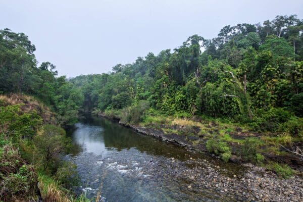
Wooroonooran National Park sits in the Wet Tropics of Queensland and protects a big sweep of steep rainforest country south of Cairns. It stretches across mountain ranges, deep valleys and fast-flowing creeks, with a landscape shaped by heavy rainfall, rugged slopes and dense tropical forest. This is one of those parks where the scale of the country stands out straight away, from lowland river flats to the high summits of the Bellenden Ker Range.
The park is closely tied to two of north Queensland’s best-known peaks, Bartle Frere and Bellenden Ker, and it includes places around Babinda, the Palmerston Highway and Goldsborough Valley. For readers trying to place it on the map, it lies inland from the Cassowary Coast and south of Cairns, in the mountainous heart of the Wet Tropics World Heritage Area.
Highlights
The defining character of Wooroonooran is its dramatic relief. Mountains rise sharply from the coastal plain, cloud and rain hang on the higher slopes, and creeks spill through gorges and over rock shelves on their way down to the lowlands. Bartle Frere, at 1,611m, is Queensland’s highest mountain, and the nearby bulk of Bellenden Ker helps give the park its striking skyline.
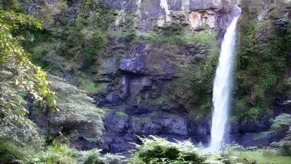
Water is a big part of the scenery here. Rainforest streams, cascades and well-known falls give the park a cooler, wetter feel than many other parts of the state, while lookouts in the Palmerston section open up broad views across forested ridges and valleys. The contrast between enclosed rainforest and sudden glimpses out over the surrounding country is one of the things that makes this park feel so distinctive.
Best Time to Visit
The drier months from about May to October are generally the most comfortable time to spend time in Wooroonooran. Conditions are usually cooler and less humid then, which suits longer walks and makes the mountain and rainforest scenery easier to enjoy.
At any time of year, this is a very wet park by Queensland standards, and that constant moisture is part of what gives it its lush character. In the warmer, wetter months the forest feels especially rich and green, with creeks and waterfalls often at their liveliest.
Plants and Animals
Wooroonooran protects tropical rainforest in one of the most biologically rich parts of Australia. The forest ranges from lower slopes to high-altitude country, so the plant life changes with elevation, rainfall and exposure. That mix of habitats is a big reason the park feels so varied, from tall, closed-canopy rainforest to misty upland forest around the higher peaks.
The wildlife reflects that Wet Tropics setting. Animals associated with north Queensland rainforest, including the southern cassowary, are part of the park’s living character, and the dense forest and creek lines support a wide range of birds, mammals, reptiles and frogs. In a place like this, even the vegetation feels alive and active, with buttressed trees, palms, vines and moisture-loving understorey plants shaping almost every view.
Culture and Heritage
Wooroonooran National Park is Country for several Traditional Owner groups with strong and ongoing connections to the area. These include the Malanbarra Yidinji, Wanyurr Majay Yidinji, Ngadjon-Jii and Mamu peoples. In the Goldsborough Valley part of the park, the land and waters are identified specifically as the traditional country of the Malanbarra people, a Yidinji-speaking clan.
That long cultural history is part of the park itself rather than a separate layer added later. In different parts of Wooroonooran, rainforest, rivers and mountain country all sit within Aboriginal cultural landscapes that remain important today.
Find more places to explore…
Help expand the trail collection!
Know of an official trail not listed on Trail Hiking Australia? I’m focused on showcasing the best tracks managed by land managers, and I’d love your help! Sharing a trail adds to our community and helps others discover safe, new adventures.
Submit your trail here

