Trail Fast Facts
Bartle Frere Summit Trail is a 15km, grade 5 hike in Wooroonooran National Park, QLD. This hike typically takes 2 days to complete.
Warning
Getting lost is a real concern in this remote area. Your safety is your top priority. Before attempting this hike, be well-prepared, and consult the official park website for crucial information.
Hike Overview
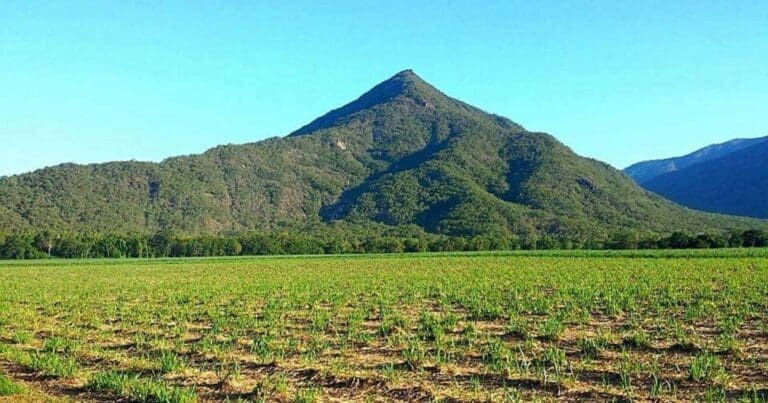
Queensland's highest peak, Mount Bartle Frere (1,611 metres), welcomes experienced hikers with a challenging climb through the world-heritage rainforests of the Bellenden Ker Range. The traditional owners, the Noongyanbudda Ngadjon people, welcome you to explore their land of lush rainforest, untamed rivers, and cascading waterfalls.
This hike isn't easy. The Bartle Frere trail is rugged and remote, demanding experience and good physical condition. Campsites are isolated and lack facilities, so careful planning is important for a safe and enjoyable adventure.
Eastern access to the trail begins at Josephine Falls car park, with campsites accessible only by foot. Alternatively, western access starts from Junction camp (reachable by car), followed by walk-in campsites.
Four designated camping areas exist along the trail: Junction, Western Summit, Eastern Summit, and Big Rock. Each has a maximum capacity of eight people per night and a group size limit of four. Remember, camping permits are mandatory, so book your spot in advance.
The well-marked trail itself is unmaintained and very steep, demanding a high level of fitness and experience. Rock scrambling sections add another layer of challenge. Always hike in groups and stay on the designated trail to minimise risk.
The provided walk times are estimates only and should be adjusted based on your group's experience and fitness level. Remember to factor in rest breaks, meals, and time for sightseeing. Distance markers placed along the trail indicate the distance to the east or west trailheads, helping you pinpoint your location and track progress.
Decide if you'll return to your starting point or complete a one-way hike. For one-way journeys, arrange private transportation for pick-up at the opposite end.
Undertaking this challenging hike allows you to explore a breathtaking part of Queensland's wilderness. Remember, be safe, plan meticulously, and respect the natural environment for an unforgettable experience.
Track Grade
Grade 5 (Difficult) - Walks for the Most Experienced: Grade 5 represents the most challenging walking tracks on the AWTGS. These are only recommended for very experienced and fit walkers with specialised skills, including navigation and emergency first aid. Tracks are likely to be very rough, very steep, and unmarked. Walks may be more than 20 kilometers. These challenging walks demand a high level of fitness and experience to navigate difficult terrain, significant elevation changes, and potentially unformed paths.
Map and GPX file
Josephine Falls to Bartle Frere summit (15km return)
Josephine Falls to Big Rock camping area (2hr)
The walk from Josephine Falls car park to Big Rock camping area is relatively easy, with only a moderate climb (rising 400m over 3km; allow about 2hr). Many campers choose to leave their overnight packs at Big Rock camping area and carry only day packs to the Bartle Frere summit.
Big Rock camping area to Eastern Summit camping area (5hr)
This section is a steep climb (rising 1,000m over 4km; allow about 5hr). There is a camping pad at Eastern Summit camping area to reduce impacts on the environment. Do not leave equipment on the camping pad during the day as the pad may be used to land a helicopter in an emergency.
Eastern Summit camping area to Bartle Frere summit (1hr)
The final ascent (rising 300m over 500m; allow about 1hr) to the broad summit of Bartle Frere requires scrambling over boulders and can be slippery when wet. For your safety, grip bars have been installed to help you through the boulder field. Enjoy fabulous views over the township of Innisfail and the coast to the east. To the west you will see the undulating landscape of the Atherton Tableland.
From the summit, walkers can either return to Josephine Falls or continue on to Junction camping area using the reverse of the description below.
Max elevation: 1601 m
Min elevation: 118 m
Total climbing: 1524 m
Total descent: -1525 m
Junction camp to Bartle Frere summit (15km return)
Junction camping area to North West Peak (5hr)
The trail starts at Junction camping area. A short distance from the start of the trail is a turn-off to the picturesque Bobbin Bobbin Falls. The trail to North West Peak is steep (rising 700m over 5km). This part of the trail has occasional rock scrambles and long sections of continuous uphill walking.
North West Peak to Western Summit camping area (2hr)
On a clear day, enjoy excellent views of Bellenden Ker and the Mulgrave River valley from an exposed outcrop of rocks 1km from North West Peak. The trail continues to Western Summit camping area. This camping area is in a very small clearing beside a creek. The site is suitable as a rest point before the climb to the summit, or as a camping area for an overnight stay.
Western Summit camping area to Bartle Frere summit (1hr)
From Western Summit camp it is 750m to the summit. The trail becomes a scramble over and through numerous granite boulders to the broad summit of Bartle Frere. This part of the climb can be very slippery when wet. Enjoy fabulous views over the township of Innisfail and the coast to the east. To the west, enjoy views of the undulating landscape of the Atherton Tableland.
Max elevation: 1599 m
Min elevation: 693 m
Total climbing: 1164 m
Total descent: -1164 m
Trail Location (trailhead)
Sorry, no records were found. Please adjust your search criteria and try again.
Sorry, unable to load the Maps API.
Getting there
The Bartle Frere trail can be accessed from the coast at Josephine Falls or from the west via the Atherton Tableland. From the summit you can return to your starting point or continue to complete the 15km trail.
From Josephine Falls: Josephine Falls is 75km south of Cairns. Turn right off the Bruce Highway 2km south of Miriwinni and drive 8km to Josephine Falls. Access is suitable for conventional vehicles.
From Atherton Tableland: From Malanda, travel 5.5km along the Malanda–Yungaburra road then turn into Topaz Road and travel 2km past Butchers Creek School. Turn left to Lamins Hill lookout—this gravel road can be slippery when wet—and follow the signs for 7km to the end of Gourka Road and the national park boundary. Junction camp, 2km along the gravel road from the national park boundary, marks the start of the walking trail.
Access conditions
- 2WD Access
- Bitumen Road
- Large Car Park
- Accessible Parking
- Accessible Toilet
- Public Toilets
- Picnic Shelter
- Picnic Table
Photo gallery
Image: Tourism Tropical North Queensland
If you have any photos from this hike and are happy to share them, please upload your .jpg files here.
Please note: Uploading photos does not transfer ownership of copyright away from you. If requested, you will be credited for any photos you provide and can ask they be deleted at any time.
About the region
Wooroonooran National Park, aptly named "Black Rock" by the Aboriginal people, offers a treasure trove of outdoor experiences for visitors seeking adventure amidst stunning natural beauty. Located between Innisfail and Cairns, this World Heritage Site boasts some of the world's oldest rainforests and boasts Queensland's two highest peaks: Mount Bartle Frere and Mount Bellenden Ker.
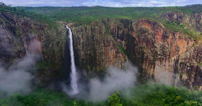
Josephine Falls, a cascading jewel nestled within the rainforest, provides a refreshing escape. Here, a well-maintained walking track leads you to viewing platforms, offering a safe vantage point to admire the falls' grandeur.
Venture deeper into the park's Palmerston section, renowned for its wild rivers, dramatic gorges, and cascading waterfalls. This section also boasts the Mamu Tropical Skywalk, a unique opportunity to experience the rainforest canopy from a breathtaking perspective.
Wooroonooran National Park is divided into two distinct areas – Palmerston and Josephine. The Palmerston section is bisected by both the North and South branches of the Johnstone River, while Josephine Falls is fed by the slopes of Mount Bartle Frere and flows into the Russell River. Remember, safety is paramount. The granite rocks around Josephine Falls are slippery, so access beyond the designated viewing platforms is strictly prohibited.
Wooroonooran National Park offers something for everyone. Whether you seek an adrenaline rush, a peaceful communion with nature, or a glimpse into the rainforest's ancient wonders, this park promises an unforgettable experience.
Similar trails nearby
Explore Safe
While planning your hike, it’s important to check official government sources for updated information, temporary closures and trail access requirements. Before hitting the trail, check local weather and bushfire advice for planned burns and bushfire warnings and let someone know before you go. Plan ahead and hike safely.
Let someone know
Adventure with peace of mind: Fill out your trip intentions form. Before you hit the trail, fill out an online form to privately send important details about your hike to your family or friends. If you don’t return on time, they can easily alert emergency services, preventing worry and ensuring a swift response. Hike with peace of mind and enjoy your outdoor adventure to the fullest. Be smart, be safe: Register your plans here.
Gear to consider
What you carry in your pack will depend on the weather, terrain, time of year, type of adventure, and personal preferences. Having trouble deciding what gear’s right for you? My free planning, food and packing checklists provide an introduction to things your could consider (as well as the Ten Essentials) on your day, overnight and multi-day adventures. Customise your kit according to your personal needs, always considering safety first.
Suggest an edit
Trail changed? New features discovered? Has the route changed? Trail permanently closed? Help fellow hikers by suggesting edits! Click above to update route descriptions, GPX file, trail features (like boardwalks), or access conditions (like parking availability). Help me keep the trails info fresh!
Weather
Acknowledgement of Country
Trail Hiking Australia acknowledges the Traditional Owners of the lands on which we hike and pay respects to their Elders, past and present, and we acknowledge the First Nations people of other communities who may be here today.


