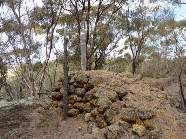
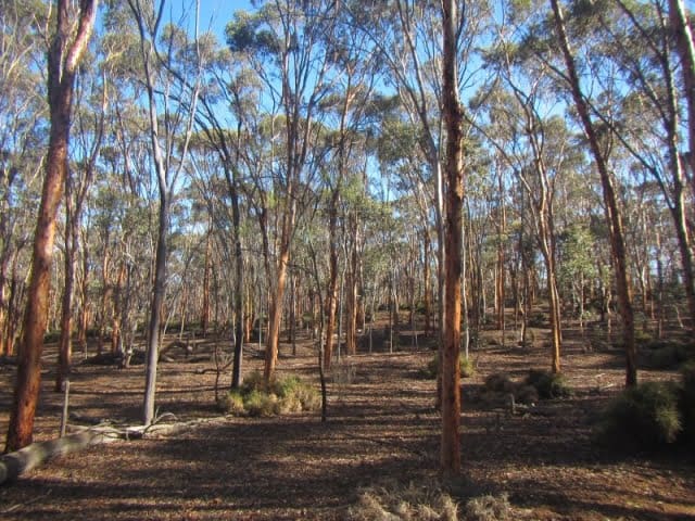
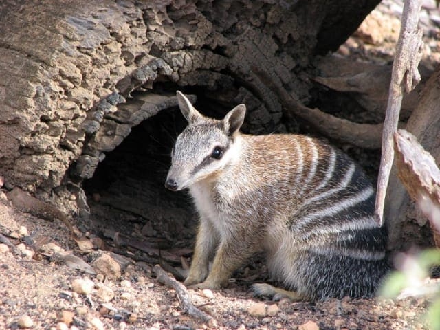
Recovery Walk is a 1.6km, grade 2 hike located in Toolibin Nature Reserve, Western Australia. The hike should take around 45 minutes to complete.
Hike overview
Toolibin Lake is an area of high conservation value being one of the last remaining inland freshwater lakes in the south west. This easy 1.6 kilometre loop walk takes about 45 minutes and you can learn about the lake from the interpretive signs. 41 species of waterBird have been recoRoaded here including rare species like the freckled duck.
Toolibin Lake is a seasonal wetland, meaning it only has water at certain times of the year. When the wetland is full its woodland trees, sheoak (Casuarina obesa) and paperbark (Melaleuca strobophylla) are partially submerged in water. The wetland has some of the richest habitat found in the region and provides a home for many kinds of plants and animals including waterBirds. An impressive 41 species of waterBirds have been recoRoaded at the wetland, with 24 species breeding in the reserve. The threatened red-tailed phascogale also lives there. Where is it found? Toolibin Lake is found in the Upper Blackwood River catchment, 200km south east of Perth. It occurs in a low rainfall area of the Wheatbelt with average annual falls between 370mm and 420mm. Some years, rainfall is well below average. Unfortunately, Toolibin Lake is one of only half a dozen wetlands of its type remaining. This type of wetland used to be common throughout the Wheatbelt but most have now become saline. The Upper Blackwood River catchment is in the Southwest Australia Ecoregion, a biodiversity hotspot. The area is high in plant and animal diversity but has also been severely degraded. If the lakebed is flooded, you will not be able to complete this walk. However, you can still see the inflow channel, separator gate and vegetation around the lake edge. Observe how the vegetation changes along the walk. Look for lichen on trees that marks high water when the lake floods. Imagine water depths reaching over your head. Watch for old nests used by waterBirds when the lake floods.
Route and GPX file
Help fellow hikers navigate with confidence. Share your GPX or KML file for this trail and help build a more comprehensive resource with precise waypoints and elevation profiles. Your contribution will empower adventurers with details they need for a safer and more enjoyable experience. I meticulously verify every file using official maps and surveys, ensuring the highest level of accuracy and reliability. Submit your file now and become a trailblazer for your fellow outdoor enthusiasts.
Tips
Start Point: Toolibin Lake Car Park is off Wickepin-Harrismith Road, 235km (2 h 45 min) (232km) south east of Perth
End Point: Toolibin Lake Car Park is off Wickepin-Harrismith Road, 235km (2 h 45 min) (232km) south east of Perth
Region: Toolibin Lake, Golden Outback
For more information, a location map and GPS file please visit Trails WA.
Trail location
Sorry, no records were found. Please adjust your search criteria and try again.
Sorry, unable to load the Maps API.
Gallery
If you have any photos from this hike and are happy to share them, please upload your .jpg files here.
Please note: Uploading photos does not transfer ownership of copyright away from you. If requested, you will be credited for any photos you provide and can ask they be deleted at any time.
About the region
Toolibin Lake, in southwest Australia, is an area of high conservation value being one of the last remaining inland freshwater lakes found there. It is an ecological community, an area of unique and naturally occurring groups of plants and animals, and is the largest remaining wetland of this type in south west Australia. Toolibin Lake is a seasonal wetland, meaning it only has water at certain times of the year. When the wetland is full its woodland trees, sheoak (Casuarina obesa) and paperbark (Melaleuca strobophylla) are partially submerged in water.
The wetland has some of the richest habitat found in the region and provides a home for many kinds of plants and animals including waterbirds. An impressive 41 species of waterbirds have been recorded at the wetland, including rare species like the freckled duck. The threatened red-tailed phascogale also lives there.
Similar trails nearby
Explore Safe
While planning your hike, it’s important to check official government sources for updated information, temporary closures and trail access requirements. Before hitting the trail, check local weather and bushfire advice for planned burns and bushfire warnings and let someone know before you go. Plan ahead and hike safely.
Let someone know
Adventure with peace of mind: Fill out your trip intentions form. Before you hit the trail, fill out an online form to privately send important details about your hike to your family or friends. If you don’t return on time, they can easily alert emergency services, preventing worry and ensuring a swift response. Hike with peace of mind and enjoy your outdoor adventure to the fullest. Be smart, be safe: Register your plans here.
Gear to consider

My free planning, food and packing checklists provide an introduction to things your could consider (as well as the Ten Essentials) on your day, overnight and multi-day adventures. Customise your kit according to your personal needs, always considering safety first.
Suggest an edit
Does this hikes information need updating? Sometimes the route, trail features or access conditions change.
Acknowledgement of Country
Trail Hiking Australia acknowledges the Traditional Owners of the lands on which we hike and pay respects to their Elders, past and present, and we acknowledge the First Nations people of other communities who may be here today.


