Trail Fast Facts
Jabitj Trail is a 12km, grade 3 hike in Wellington National Park, Western Australia. This hike typically takes 3 hours to complete.
Hike Overview
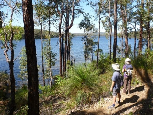
The Jabitj Trail meaning running water in the Noongar language, is a 12 kilometre return trail that follows the Collie River between Wellington Dam and Honeymoon Pool in Wellington National Park. It offers delightful views of the rapids and pools along the way. An excellent trail, this is a perfect walk for a weekend away from Perth.
This trail, although descending along the river, has some steep and rocky ascents and descents, with some climbing over logs required. However it provides wonderful views of the rapids and the tranquil pools of the Collie River. The amount of water running depends on the amount being released from the bottom of the dam. This water is used for irrigation downstream. It is possible to swim in the quiet pools along the way. Note that LeonaRoad Drive, the road running alongside the river on the opposite bank, is one way from the dam to Honeymoon Pool.
Track Grade
Grade 3 (Moderate) - Walks for Most Fitness Levels: Grade 3 on the AWTGS represents moderate walking tracks. These are ideal for walkers with some fitness who are comfortable with some hills and uneven terrain. While suitable for most ages, some bushwalking experience is recommended to ensure a safe and enjoyable experience. Tracks may have short, steep hill sections, a rough surface, and many steps. The total distance of a Grade 3 walk can be up to 20 kilometers.
Tips
Start Point: Wellington Dam kiosk, Wellington National Park, 200km (2.5 hours) south of Perth
End Point: Wellington Dam kiosk, Wellington National Park, 200km (2.5 hours) south of Perth
Region: Wellington National Park, South West
For more information, a location map and GPS file please visit Trails WA.
Map and GPX file
Help fellow hikers navigate with confidence. Share your GPX or KML file for this trail and help build a more comprehensive resource with precise waypoints and elevation profiles. Your contribution will empower adventurers with details they need for a safer and more enjoyable experience. I meticulously verify every file using official maps and surveys, ensuring the highest level of accuracy and reliability. Submit your file now and become a trailblazer for your fellow outdoor enthusiasts.
Trail Location (trailhead)
Sorry, no records were found. Please adjust your search criteria and try again.
Sorry, unable to load the Maps API.
Photo gallery
If you have any photos from this hike and are happy to share them, please upload your .jpg files here.
Please note: Uploading photos does not transfer ownership of copyright away from you. If requested, you will be credited for any photos you provide and can ask they be deleted at any time.
Similar trails nearby
Explore Safe
While planning your hike, it’s important to check official government sources for updated information, temporary closures and trail access requirements. Before hitting the trail, check local weather and bushfire advice for planned burns and bushfire warnings and let someone know before you go. Plan ahead and hike safely.
Let someone know
Adventure with peace of mind: Fill out your trip intentions form. Before you hit the trail, fill out an online form to privately send important details about your hike to your family or friends. If you don’t return on time, they can easily alert emergency services, preventing worry and ensuring a swift response. Hike with peace of mind and enjoy your outdoor adventure to the fullest. Be smart, be safe: Register your plans here.
Gear to consider
What you carry in your pack will depend on the weather, terrain, time of year, type of adventure, and personal preferences. Having trouble deciding what gear’s right for you? My free planning, food and packing checklists provide an introduction to things your could consider (as well as the Ten Essentials) on your day, overnight and multi-day adventures. Customise your kit according to your personal needs, always considering safety first.
Suggest an edit
Trail changed? New features discovered? Has the route changed? Trail permanently closed? Help fellow hikers by suggesting edits! Click above to update route descriptions, GPX file, trail features (like boardwalks), or access conditions (like parking availability). Help me keep the trails info fresh!
Weather
Acknowledgement of Country
Trail Hiking Australia acknowledges the Traditional Owners of the lands on which we hike and pay respects to their Elders, past and present, and we acknowledge the First Nations people of other communities who may be here today.


