Sorry, no records were found. Please adjust your search criteria and try again.
Sorry, unable to load the Maps API.
Explore stunning hiking trails of South Arm
Discover the diverse trails of South Arm, Tasmania, offering hikes and walks for all skill levels and interests. Find your perfect adventure today.
Discover 2 hiking trails in South Arm
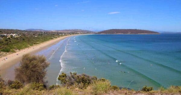

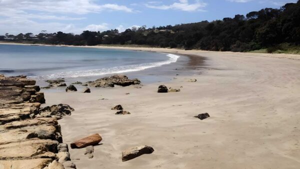

Tidal flats and open estuary at South Arm
Overview
South Arm sits on the edge of Ralphs Bay, on the south-eastern side of the Derwent estuary not far from Hobart. The reserve area here is best known for its broad intertidal sand flats and low-lying coastal edge, where the shape of the shoreline matters as much as the land itself. South Arm Nature Recreation Area covers a relatively small piece of coast on land, while the adjoining South Arm Marine Conservation Area protects the shallow tidal environment beside it.
What gives this place its character is that mix of exposed flats, quiet shore, and open water. It feels less like a single landmark and more like a coastal system, with the land and sea changing noticeably through the tide.
Highlights
The defining feature at South Arm is the sweep of tidal sand flats in Ralphs Bay. At low tide, the shoreline opens out into wide intertidal ground, giving the area a spare, open feel that is quite different from Tasmania’s rockier coasts. These flats are important enough to be recognised as the Ralphs Bay Tidal Flat geoconservation site.
There are also long views across the estuary and bay, with beaches and low coastal points giving the area a calm, expansive character rather than a dramatic one. Around Arm End, the coast looks out over much of the Derwent estuary, and the scenery is shaped by headlands, open water and the shifting line between sand and sea.
Best Time to Visit
South Arm is rewarding year-round, but it is especially appealing in the milder months when longer daylight and settled weather make the coast easier to appreciate at an unhurried pace. Conditions can look very different from one visit to the next depending on the tide, so timing around tidal movement can shape what you see more than the season alone.
For birdlife, the cooler months and migration periods can be particularly interesting, with the tidal flats drawing in shorebirds that rely on these feeding grounds.
Plants and Animals
The marine reserve protects an intertidal ecosystem built around shallow sediments, microalgae and invertebrates. That might sound understated, but it is the foundation for much of the wildlife value here, especially along the tidal shoreline.
South Arm is particularly important for shorebirds. Species recorded using the flats and shore include sandpipers, pied oystercatchers and red-capped plovers, and the area has high conservation significance for migratory shorebirds such as the eastern curlew. Birdlife around Arm End also includes larger raptors, with wedge-tailed eagles seen in the area.
Culture and Heritage
Near Mary Ann Bay, the Gellibrand Vault marks the burial place of William Gellibrand, an early grantee at South Arm. It is a small but notable reminder that this coastline has a longer human story as well as its natural one.
Find more places to explore…
Help expand the trail collection!
Know of an official trail not listed on Trail Hiking Australia? I’m focused on showcasing the best tracks managed by land managers, and I’d love your help! Sharing a trail adds to our community and helps others discover safe, new adventures.
Submit your trail here

