Cape to Cape Track is a 135km, grade 4 hike located in Margaret River, Western Australia. The hike should take around 6-7 days to complete.
Hike overview
Totally immerse yourself into the boundless natural beauty of Your Margaret River Region and take a walk, hike or ride on one of the region's amazing tracks.
The 130km Cape to Cape Track traverses the length of Leeuwin-Naturaliste National Park and overlooks the adjoining Ngari Capes Marine Park, alternating spectacular sweeping cliff-top views with stretches of pristine beach.
At any time of the year there's a good chance of seeing dolphins, and between June and September whales pass close to shore on their annual migration between the Southern Ocean and their breeding areas further north. Most are humpbacks, the species that breaches the surface more than any other, but you may also see southern right whales and, if you're very lucky, a blue whale.
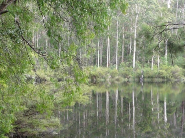
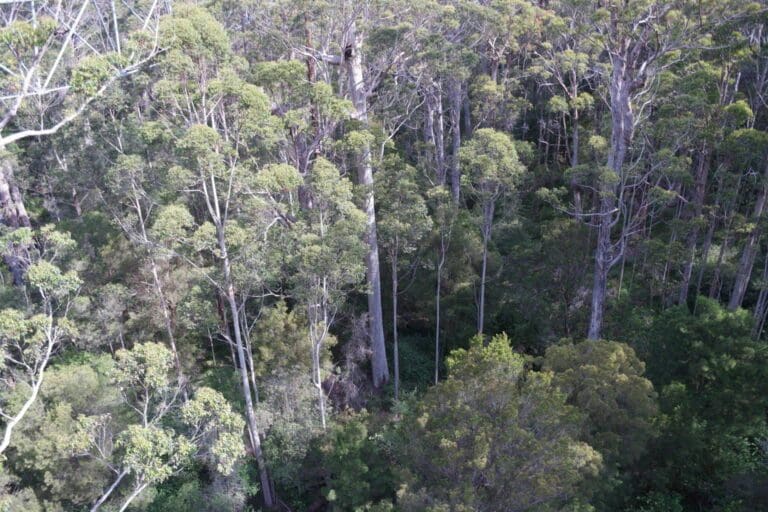
It's not all about the coast though, there are several inland forays which take in some lovely sheltered woodland sections as well as the magnificent Boranup Forest of towering karri.
The Track varies from the 'access for more' section to Cape Naturaliste with a shallow gradient and a smooth, wide constructed surface to steep, rough stony paths and sandy beaches. It is for walkers only - except where the route follows some of the 4WD tracks that are frequented by surfers accessing their favourite breaks at this world-famous surf location.
To tackle the whole track in one trip is a great challenge (usually 6 - 7 days), but multiple vehicle access points allow the Cape to Cape Track to be completed in smaller segments. The overnight options include some very basic camping areas for Track walkers only, campgrounds with more facilities and vehicle access and, this being the tourist mecca of the Margaret River wine region, plenty of other accommodation right up to the highest levels of luxury and pampering.
For most of the year Margaret River, about mid-way along the track, can be crossed with care at its mouth, but there are periods in winter when conditions don't allow a safe crossing and walkers will have to take an inland diversion to cross at the bridge upstream. (The river mouth can be accessed by vehicle at the southern side, but not from the north - walkers from the north have no alternative but to retrace their steps if the river mouth cannot be crossed).
Route and GPX file
Max elevation: 193 m
Min elevation: 2 m
Total climbing: 2632 m
Total descent: -2713 m
Tips
- In my research I have found this hike advertised at lengths ranging from 125km through to 140km so I decided to go with the most common length and list this as 135km
- The Track is open year-round, with sea breezes moderating the extreme heat of summer. However, fire danger at this time of year can still be very high, with the wind adding to the risk.
- Start Point: Cape Naturaliste Lighthouse, Leeuwin-Naturaliste National Park, 13km from Dunsborough, which is 255km (3 hours) south of Perth
- End Point: Cape Leeuwin Lighthouse, Leeuwin Road, Augusta which is 306km (3hrs 15mins) south of Perth.
Trail location
Sorry, no records were found. Please adjust your search criteria and try again.
Sorry, unable to load the Maps API.
Gallery
If you have any photos from this hike and are happy to share them, please upload your .jpg files here.
Please note: Uploading photos does not transfer ownership of copyright away from you. If requested, you will be credited for any photos you provide and can ask they be deleted at any time.
About the region
Flanked by national parks including towering forests, pristine coastlines and rugged granite outcrops, the Margaret River region is the quintessential Western Australian holiday destination. This is award-winning wine country with a thriving art scene, incredible hiking trails, and a distinctly circular food philosophy with a great respect for the land. With sheltered bays to the north, vineyards and surf coast along its length, and two oceans meeting at the southern tip, it's time to rediscover The Margaret River Region.
Similar trails nearby
Explore Safe
While planning your hike, it’s important to check official government sources for updated information, temporary closures and trail access requirements. Before hitting the trail, check local weather and bushfire advice for planned burns and bushfire warnings and let someone know before you go. Plan ahead and hike safely.
Let someone know
Adventure with peace of mind: Fill out your trip intentions form. Before you hit the trail, fill out an online form to privately send important details about your hike to your family or friends. If you don’t return on time, they can easily alert emergency services, preventing worry and ensuring a swift response. Hike with peace of mind and enjoy your outdoor adventure to the fullest. Be smart, be safe: Register your plans here.
Gear to consider

My free planning, food and packing checklists provide an introduction to things your could consider (as well as the Ten Essentials) on your day, overnight and multi-day adventures. Customise your kit according to your personal needs, always considering safety first.
Suggest an edit
Does this hikes information need updating? Sometimes the route, trail features or access conditions change.
Acknowledgement of Country
Trail Hiking Australia acknowledges the Traditional Owners of the lands on which we hike and pay respects to their Elders, past and present, and we acknowledge the First Nations people of other communities who may be here today.


