Trail Fast Facts
Cape Naturaliste to Sugarloaf Rock is a 3.5km, grade 1 hike in Dunsborough, Western Australia. This hike typically takes 1.5 hours to complete.
Hike Overview
This 3.5 kilometre length of the Cape to Cape track is wheelchair accessible and provides stunning coastal views between Cape Naturaliste and Sugarloaf rock.
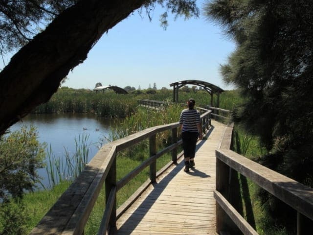
The new 'Access for More' section of the Cape to Cape Walk Track runs between the Cape Naturaliste Lighthouse and Sugarloaf Rock. This is a world class, levelled and bituminised Class 1 trail that provides an exceptional experience to walkers of all abilities. It also incorporates more than 1 kilometre of timber Boardwalk.nIt is suitable for wheelchairs, being graded 1 in 12. It can be accessed by road at either end. It offers excellent views of the coast and whales may be spotted June- October.
Track Grade
Grade 1 (All-abilities) - Perfect for Families and Beginners: Grade 1 on the AWTGS represents the easiest walking tracks, perfect for families with young children or those new to bushwalking. No prior experience is required. These gentle walks feature a flat, even surface with no steps or steep sections. They are suitable for wheelchair users with assistance due to the even terrain. The total distance of a Grade 1 walk is typically no greater than 5 kilometers, making them a comfortable and manageable option for all ages and fitness levels.
Tips
Start Point: End of Cape Naturaliste Road, Near Dunsborough, 270km (3.5 hours) south of Perth
End Point: Sugarloaf Rock WA
Region: Dunsborough, South West
For more information, a location map and GPS file please visit Trails WA.
Map and GPX file
Help fellow hikers navigate with confidence. Share your GPX or KML file for this trail and help build a more comprehensive resource with precise waypoints and elevation profiles. Your contribution will empower adventurers with details they need for a safer and more enjoyable experience. I meticulously verify every file using official maps and surveys, ensuring the highest level of accuracy and reliability. Submit your file now and become a trailblazer for your fellow outdoor enthusiasts.
Trail Location (trailhead)
Sorry, no records were found. Please adjust your search criteria and try again.
Sorry, unable to load the Maps API.
Photo gallery
If you have any photos from this hike and are happy to share them, please upload your .jpg files here.
Please note: Uploading photos does not transfer ownership of copyright away from you. If requested, you will be credited for any photos you provide and can ask they be deleted at any time.
About the region
Located on the stunning turquoise banks of Geographe Bay, Dunsborough would have to have one of the most tranquil and magnificent locations in the world.
Sparkling calm clear water and white sandy Dunsborough beaches are linked to town by lush green grass and shady paths. There is a bustling café atmosphere and plenty of gorgeous boutique shops. At night there's a great vibe with brew houses, wine bars and pubs with a live music scene, restaurants and cafes.
Beachfront cycle ways and walking paths turn into a hiking trail through the regional park along the bay. With ideal beaches for swimming it is also a great location for diving, snorkelling, kayaking and other water sports. There are even two golf courses!
Out on the most north-western point is the top end of the Leeuwin-Naturaliste National Park, which is one of the many Dunsborough attractions. This precinct is home to Dunsborough's working lighthouse, Cape Naturaliste and the starting point of the Cape to Cape Track.
Built on the foundation of surfing and family holidays, this resort town has grown into a holiday spot rich in luxury and fun, ideal for family, friends, couples and backpackers.
Similar trails nearby
Explore Safe
While planning your hike, it’s important to check official government sources for updated information, temporary closures and trail access requirements. Before hitting the trail, check local weather and bushfire advice for planned burns and bushfire warnings and let someone know before you go. Plan ahead and hike safely.
Let someone know
Adventure with peace of mind: Fill out your trip intentions form. Before you hit the trail, fill out an online form to privately send important details about your hike to your family or friends. If you don’t return on time, they can easily alert emergency services, preventing worry and ensuring a swift response. Hike with peace of mind and enjoy your outdoor adventure to the fullest. Be smart, be safe: Register your plans here.
Gear to consider
What you carry in your pack will depend on the weather, terrain, time of year, type of adventure, and personal preferences. Having trouble deciding what gear’s right for you? My free planning, food and packing checklists provide an introduction to things your could consider (as well as the Ten Essentials) on your day, overnight and multi-day adventures. Customise your kit according to your personal needs, always considering safety first.
Suggest an edit
Trail changed? New features discovered? Has the route changed? Trail permanently closed? Help fellow hikers by suggesting edits! Click above to update route descriptions, GPX file, trail features (like boardwalks), or access conditions (like parking availability). Help me keep the trails info fresh!
Weather
Acknowledgement of Country
Trail Hiking Australia acknowledges the Traditional Owners of the lands on which we hike and pay respects to their Elders, past and present, and we acknowledge the First Nations people of other communities who may be here today.


