Warepil Lookout Loop is a 6.8km, grade 3 hike located in Hattah-Kulkyne National Park, Victoria. The hike should take around 2 hours to complete.
Hike overview
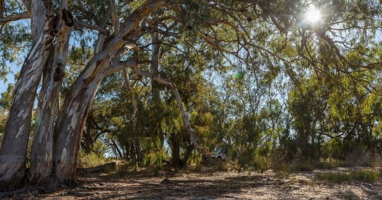
Commence the Warepil Lookout Loop at the Old Calder Highway carpark and take a short stroll up the steady incline to the lookout tower where you will be rewarded with great views of the surrounding Mallee Region. Look north-west and see the vast Murray Sunset National Park. The circuit then continues east along Buloke Track to Lake Mournpall before circling back through mallee dunes covered with tussocks of Porcupine Grass and the occasional native Cypress Pine or Bullock trees. Black Box woodlands dominate further away from the lakes, preferring areas where flooding is less frequent. Slender Cypress Pine and Buloke occupy the rolling sand-plains. Mallee eucalypts flourish on the higher, dry, less fertile sand ridges.
If you don't want to complete the entire loop you can complete the 600m return walk to the Warepil Lookout.
This is a great place to witness the magnificent Mallee sunsets.
Image: Visit Mildura
Camping
There are two designated campgrounds in the park with basic facilities, including non-flush toilets, fireplaces and picnic tables. They are at Lake Hattah and further north at Lake Mournpall. Advance bookings and payment are required for these sights via the Parks Victoria website. Other river camping areas without facilities are available at Ki Bend, Firemans Bend and Jinkers Bend, all along the Murray at the eastern edge of the park. No booking or fees are required, although these areas are best accessed with a 4WD.
Route and GPX file
Max elevation: 75 m
Min elevation: 45 m
Total climbing: 134 m
Total descent: -134 m
Trail location
Sorry, no records were found. Please adjust your search criteria and try again.
Sorry, unable to load the Maps API.
Getting there
Hattah-Kulkyne National Park is half way between Ouyen and Mildura, off the Calder Highway. It's a hefty 5.5 hours' drive from Melbourne, but only 45 minutes due south of Mildura. Most visitors enter via the Hattah Entrance Road and head directly for the Lake Hattah Campground. The park extends north and east, covering 48,000 hectares, before hitting the Murray River off HattahRobinvale Road not far from the small village of Liparoo. Many of the park's best spots are accessible in a 2WD car, but some tracks are 4WD only. Be especially careful if there's been recent rain.
Gallery
If you have any photos from this hike and are happy to share them, please upload your .jpg files here.
Please note: Uploading photos does not transfer ownership of copyright away from you. If requested, you will be credited for any photos you provide and can ask they be deleted at any time.
About the region
Hattah-Kulkyne National Park lies in typical mallee country with extensive low scrub and open native pine woodland. Superbly adapted birds, animals and vegetation thrive in the poor, sandy soils and searing summers. The freshwater Hattah Lakes is seasonally filled by creeks connected to the Murray, providing food and shelter for waterbirds and fish. These lakes can remain full for up to ten years without flooding, but flooding generally occurs once every two years. Camping, walking, bike riding and canoeing are popular here and in the adjoining Murray-Kulkyne Park.
Similar trails nearby
Explore Safe
While planning your hike, it’s important to check official government sources for updated information, temporary closures and trail access requirements. Before hitting the trail, check local weather and bushfire advice for planned burns and bushfire warnings and let someone know before you go. Plan ahead and hike safely.
Let someone know
Adventure with peace of mind: Fill out your trip intentions form. Before you hit the trail, fill out an online form to privately send important details about your hike to your family or friends. If you don’t return on time, they can easily alert emergency services, preventing worry and ensuring a swift response. Hike with peace of mind and enjoy your outdoor adventure to the fullest. Be smart, be safe: Register your plans here.
Gear to consider

My free planning, food and packing checklists provide an introduction to things your could consider (as well as the Ten Essentials) on your day, overnight and multi-day adventures. Customise your kit according to your personal needs, always considering safety first.
Suggest an edit
Does this hikes information need updating? Sometimes the route, trail features or access conditions change.
Acknowledgement of Country
Trail Hiking Australia acknowledges the Traditional Owners of the lands on which we hike and pay respects to their Elders, past and present, and we acknowledge the First Nations people of other communities who may be here today.


