Sorry, no records were found. Please adjust your search criteria and try again.
Sorry, unable to load the Maps API.
Hikes and walks in Wolli Creek Regional Park
Here you’ll find every hike we list in Wolli Creek Regional Park, New South Wales. Each listing has the distance, grade and time it takes, so you can pick one that suits you. You can also search hikes across Australia.
Discover 1 hiking trail in Wolli Creek Regional Park
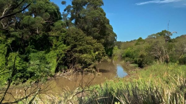

Sandstone Bushland Along Wolli Creek
Overview
Wolli Creek Regional Park is a long, narrow stretch of bushland in Sydney’s inner south-west, following the north side of Wolli Creek from around Bexley North to Unwins Street. Even though it sits within a heavily built-up part of the city, the park still holds a substantial corridor of remnant native vegetation, creek-edge habitats and steep sandstone country that gives it a very different feel from the suburbs around it.
The park covers about 60 hectares and is shaped by a steep south-facing sandstone escarpment, with bushland above and beside the creek. That combination of escarpment, waterway and urban setting is what makes the place memorable. It feels less like a conventional suburban park and more like a surviving slice of Sydney’s older landscape.
Highlights
The strongest draw here is the landscape itself. Much of the park is defined by sandstone slopes and escarpments, with visual highlights that include the rock faces between Girrahween Park and Turrella Reserve, areas of cross-bedded sandstone known as Wave Rock, a fern gully east of Girrahween Park, and mangroves and saltmarsh in the eastern section.
Because the park runs as a linear corridor beside the creek, its scenery changes as you move through it. In some sections the character is dry sandstone bushland on steep ground, while closer to the estuarine end the scene shifts to mangroves, saltmarsh and wetlands. That contrast is a big part of the park’s appeal.
Best Time to Visit
Wolli Creek Regional Park can be rewarding at any time of year, but the milder months of autumn and spring usually show it at its best for a longer walk, with more comfortable temperatures and clear light on the escarpments and creek flats. The park’s birdlife and varied vegetation also make these seasons especially interesting.
At other times of year, the appeal is less about a single season and more about the park’s changing mix of bushland, wetland and creek-edge scenery. This is one of those urban parks where small seasonal shifts in foliage, water levels and bird activity can noticeably change the feel of the place.
Plants and Animals
The park protects several remnant plant communities, including Sydney Sandstone Gully Complex and a small remnant of closed-forest. Typical species in the sandstone bushland include smooth-barked apple, blackbutt, Sydney peppermint, red bloodwood and turpentine, with tick bush appearing on shallow rock outcrops and ridgelines.
Along the creek, the vegetation changes again. Mangroves and associated saltmarshes fringe the estuarine section, and off-stream wetlands sit near Henderson Street and Hartill-Law Avenue. Taken together, the bushland, creek, mangroves and wetlands create a valuable pocket of habitat in an otherwise urban setting, and the park is well known locally for its rich birdlife.
Culture and Heritage
Wolli Creek Regional Park forms part of a broader cultural landscape connected with Aboriginal culture and place, including ideas of journey, trade, and social and ceremonial values. The valley also contains evidence of Aboriginal occupation, with midden sites recorded at the north-eastern end of Wolli Creek.
More recently, the valley has its own layered urban history, from quarrying and market gardening to long-running community efforts that helped preserve this bushland corridor within suburban Sydney.
Find more places to explore…
Help expand the trail collection!
Know of an official trail not listed on Trail Hiking Australia? I’m focused on showcasing the best tracks managed by land managers, and I’d love your help! Sharing a trail adds to our community and helps others discover safe, new adventures.
Submit your trail here