Sorry, no records were found. Please adjust your search criteria and try again.
Sorry, unable to load the Maps API.
Explore stunning hiking trails of Western Creek
Discover the diverse trails of Western Creek, Tasmania, offering hikes and walks for all skill levels and interests. Find your perfect adventure today.
Discover 1 hiking trail in Western Creek
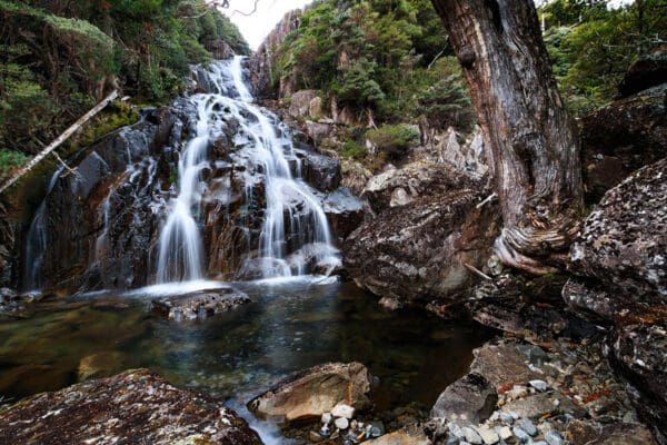

Where the Great Western Tiers Rise Above Western Creek
Overview
Western Creek sits on the northern side of the Great Western Tiers in Tasmania’s central north, in the country between Deloraine and Mole Creek. This is the lower access side of a much larger upland landscape, where the escarpment lifts sharply toward the Central Plateau and the northern edge of the Tasmanian Wilderness World Heritage Area. In this part of the Tiers, the country changes quickly from settled valley land to steep forested slopes, alpine edges and lake country higher up.
What makes Western Creek distinctive is that sense of climbing into the range from its base. The surroundings are part of the Great Western Tiers Conservation Area, a reserve made up of separate sections spread along the escarpment. Across that broader area, dolerite columns, deep gorges and heavily forested faces define the skyline for kilometres.
Highlights
The big draw here is the escarpment itself. Western Creek lies below one of the most dramatic stretches of the Great Western Tiers, where dark dolerite walls and bluffs mark the edge of the Central Plateau. The contrast between the steep face of the range and the more open country below gives this area a strong sense of scale.
Higher up, the landscape opens into a mix of alpine lakes, waterfalls, rocky slopes and subalpine woodland. Ironstone Mountain, at 1443 metres, is the highest mountain in the Tiers, and helps explain the elevated, rugged character of this section of the range.
Best Time to Visit
Western Creek changes a lot with the seasons. The warmer months usually bring the clearest access to the higher country, while cooler months can give the escarpment a sharper, more atmospheric feel, especially when cloud catches on the cliffs. Because this is an alpine and subalpine landscape above the lower slopes, conditions can shift quickly at any time of year, so the most appealing time often comes down to whether you want greener forests and flowing water, or broader views in drier weather.
Plants and Animals
The vegetation around Western Creek is unusually varied because the Tiers pack several different environments into a relatively short rise in elevation. Across the conservation area there are wet and dry eucalypt forests, rainforest, subalpine forest, grassland, shrubland and sphagnum peatland. On the lower slopes, myrtle, sassafras and ferns are part of the cool, sheltered forest, while higher ground supports Pencil Pine, a Tasmanian conifer that can live for well over a thousand years.
This range of habitats supports a rich spread of wildlife. Around 70 bird species have been recorded in the Great Western Tiers Conservation Area, including grey goshawks and Tasmanian wedge-tailed eagles. Native mammals including Tasmanian devils and quolls also occur in the area.
Culture and Heritage
Aboriginal connection with this area stretches back tens of thousands of years. The Great Western Tiers are known as Kooparoona Niara, meaning Mountains of the Spirits, and the Pallittore band of the north nation were based around nearby Mole Creek and Meander. Aboriginal sites occur through the area, including around lakes and sandstone rock shelters, and the country remains culturally important to the Aboriginal community today.
European history in the Tiers is tied to grazing, timber cutting, trapping and snaring. Some of the old routes made by graziers and timber workers later became the basis for access into the range, and traces of that period still remain in huts, fences, yards and other remnants scattered through the broader escarpment country.
Find more places to explore…
Help expand the trail collection!
Know of an official trail not listed on Trail Hiking Australia? I’m focused on showcasing the best tracks managed by land managers, and I’d love your help! Sharing a trail adds to our community and helps others discover safe, new adventures.
Submit your trail here

