Sorry, no records were found. Please adjust your search criteria and try again.
Sorry, unable to load the Maps API.
Explore stunning hiking trails of West Takone
Discover the diverse trails of West Takone, Tasmania, offering hikes and walks for all skill levels and interests. Find your perfect adventure today.
Discover 1 hiking trail in West Takone
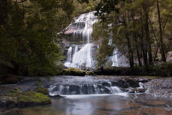

Where the Campbell Range feeds the Flowerdale
Overview
West Takone sits in the upper part of north-west Tasmania, where the northern flank of the Campbell Range begins to break into steep valleys and river country. It is part of the Flowerdale River headwaters, with the river rising here before running north towards Flowerdale and the Inglis River system. The country is elevated, wet and strongly shaped by its catchments, which gives the area a more rugged feel than the gentler farming land further north.
This is a place best understood through its landscape rather than through a single developed reserve. The upper catchment around Takone receives high rainfall and includes a mix of natural vegetation and forestry land, with the terrain shifting from steep upper valleys to more deeply incised hills below.
Highlights
The standout feature of West Takone is its headwater landscape. The slopes of the Campbell Range, the upper Flowerdale River and the broken valleys below give the area a distinctly folded, upland character. In parts of the catchment, basalt and mudstone country gives way to poorer quartzite soils and rocky outcrops, which creates a noticeable change in both landform and vegetation.
That mix of wetter forested slopes, creek lines and more rugged rocky ground is what gives West Takone its sense of place. It is less about one landmark and more about the way river, range and forest come together across the upper catchment.
Best Time to Visit
Late spring through autumn is generally the easiest time to appreciate West Takone’s landscape, when longer daylight makes the upper valleys and forested country easier to enjoy. The area has a wet climate, with rainfall increasing towards the higher parts of the Campbell Range and typically peaking in winter, so the colder months often feel greyer and more saturated.
Plants and Animals
The native vegetation in this part of the catchment includes stringybark forest with peppermint and mountain white gum on the upper slopes, while drainage lines support swamp gum, silver wattle, blackwood, myrtle, sassafras, manuka and tree ferns. On the more rugged quartzite country, the vegetation shifts towards scrub and heath, with peppermint, paperbark, banksia, silver wattle and grass tree.
West Takone also sits within a catchment known to support important freshwater species. The upper and middle reaches of the Inglis-Flowerdale system include habitat for the giant freshwater crayfish and the Australian grayling, both tied to the health of cool, intact northern Tasmanian waterways.
Find more places to explore…
Help expand the trail collection!
Know of an official trail not listed on Trail Hiking Australia? I’m focused on showcasing the best tracks managed by land managers, and I’d love your help! Sharing a trail adds to our community and helps others discover safe, new adventures.
Submit your trail here

