Sorry, no records were found. Please adjust your search criteria and try again.
Sorry, unable to load the Maps API.
Explore stunning hiking trails of Subiaco to New Norcia
Discover the diverse trails of Subiaco to New Norcia, Western Australia, offering hikes and walks for all skill levels and interests. Find your perfect adventure today.
Discover 1 hiking trail in Subiaco to New Norcia

From City Streets to Wheatbelt Woodlands on the Way to New Norcia
Overview
Subiaco to New Norcia is a long inland walking route that links suburban Perth with the monastic town of New Norcia, about 130 kilometres north-east of the city. Rather than staying in one landscape, it moves through a broad cross-section of south-west Western Australia, beginning in the built-up inner west, passing the Swan Valley and the upper reaches of the Swan-Avon system, then continuing into the hills, farmland and open forest country to the north-east.
What makes this route distinctive is that sense of gradual transition. The country changes in stages, from river corridors and granite-lined reaches of the Avon River to wandoo woodland, jarrah and marri forest, and finally the more open agricultural landscapes that lead towards New Norcia. It gives a strong feel for the way Perth gives way to the Wheatbelt fringe.
Highlights
The natural appeal here is in the changing character of the country rather than a single landmark. One of the most striking stretches is around Walyunga National Park, where the Avon River runs past smooth granite boulders, deep pools and wooded banks. Further on, the route edges into the Julimar area, where rolling country and mixed woodland create a quieter, more spacious feel.
Season also changes the experience. In spring, woodland floors around the inland park and forest sections are known for wildflowers, while the river country adds another layer of contrast with flooded gums along the water and drier forest on the slopes above.
Best Time to Visit
The cooler months are the most comfortable time for this route, generally from autumn through spring. Late winter and spring are especially rewarding because the inland woodlands are greener, the river sections are more lively after rain, and wildflowers are more likely through places such as Walyunga and the forest country beyond.
By contrast, the exposed stretches through farmland and open country can feel harsh in the hotter part of the year, particularly once you are well away from Perth’s river corridors and shade.
Plants and Animals
This route crosses several plant communities, which is part of its appeal. Along the Avon River there are flooded gums and other riverbank trees, while nearby slopes and uplands carry wandoo woodland, marri and jarrah. In the Julimar area, wandoo woodland and jarrah-marri forest are a defining part of the landscape, with a notable richness of native shrubs and wildflowers.
Animal life changes with the habitat. River sections support birdlife drawn to permanent water, while the forested country further inland provides habitat for native mammals including chuditch and dunnarts recorded in Julimar. Even when wildlife stays out of sight, the shift from riparian country to open woodland and forest is easy to notice as you move north-east.
Culture and Heritage
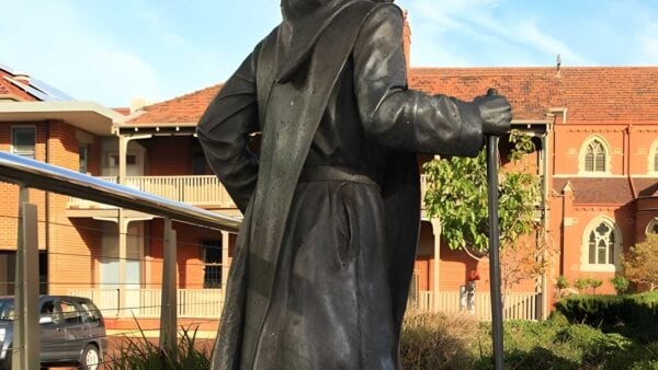
This route is closely tied to the story of New Norcia and to the long walks associated with Dom Rosendo Salvado in the mid nineteenth century. The modern Camino Salvado pilgrimage retraces that broad connection between Subiaco and New Norcia, ending in a town founded in 1847 that remains Australia’s only monastic town.
There is also Aboriginal cultural significance along parts of the route. At Walyunga National Park, the area is recognised as Whadjuk country and includes one of the largest known Aboriginal campsites around Perth.
Find more places to explore…
Help expand the trail collection!
Know of an official trail not listed on Trail Hiking Australia? I’m focused on showcasing the best tracks managed by land managers, and I’d love your help! Sharing a trail adds to our community and helps others discover safe, new adventures.
Submit your trail here

