Sorry, no records were found. Please adjust your search criteria and try again.
Sorry, unable to load the Maps API.
Explore stunning hiking trails of Popran National Park
Discover the diverse trails of Popran National Park, New South Wales, offering hikes and walks for all skill levels and interests. Find your perfect adventure today.
Discover 4 hiking trails in Popran National Park
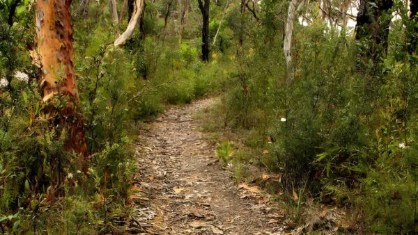

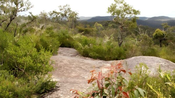
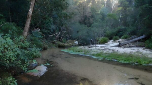


Sandstone creeks and Hawkesbury escarpments at Popran
Overview
Popran National Park sits on the lower Hawkesbury, around 55km north of central Sydney and about 25km south of Gosford. It covers 3,970 hectares in five separate sections, protecting a stretch of bushland between Brisbane Water National Park to the east and Dharug National Park to the west. That link matters because it helps form a continuous wildlife corridor across the sandstone country north of the Hawkesbury River.
This is a park shaped by water and sandstone. Much of it lies on the Hornsby Plateau, where Hawkesbury Sandstone has been cut by Ironbark, Popran, Bedlam and Hominy creeks, while the southern edge meets the drowned river valley of the Hawkesbury. The result is a landscape of ridges, gullies, cliff lines and sheltered creek systems rather than one single broad plateau.
Highlights
The most distinctive part of Popran is its mix of deeply incised creeks and Hawkesbury foreshore. Dramatic sandstone cliff lines rise above the river valley, and the dissected plateau gives the park a more folded, broken feel than many flatter bushland reserves nearby.
There is also a strong contrast between exposed ridges and the cooler, more protected valleys. Along the lower country and creek systems, alluvial flats and swampy pockets add another layer to the scenery, giving the park a varied character that shifts quite noticeably from one section to the next.
Best Time to Visit
Popran can be rewarding at any time of year, but the more comfortable months are usually autumn through spring, when the ridges and creek valleys are generally better for longer walks. Spring is especially appealing if you enjoy seeing sandstone country in flower, while cooler winter days tend to suit the more exposed parts of the park.
After dry periods, the shape of the country stands out more than the water, while greener conditions tend to bring out the sheltered gullies and creeklines. If you are choosing for scenery rather than logistics, aim for a mild day with clear light so the cliffs, ridges and folds of the Hawkesbury landscape are easier to appreciate.
Plants and Animals
Popran protects an important transition zone between the moister coastal sandstone vegetation of Brisbane Water and the drier sandstone vegetation of Dharug. Open forest and woodland dominate much of the park, with Sydney red gum, red bloodwood and grey gum common on the sandstone ridges and slopes. In the deeper sheltered valleys along Popran, Bedlam and Hominy creeks, patches of rainforest appear, while alluvial flats support swamp oak, paperbark, swamp mahogany and reed beds.
The plant life is unusually varied for a park of this size. Surveys identified 19 vegetation types and 450 plant species in and around the park, reflecting changes in geology, water, aspect and fire history. Two threatened plants, Acacia bynoeana and Tetratheca glandulosa, have been recorded here.
The animal life is just as rich. Ninety-three bird species have been recorded, and the park is known for threatened species including the glossy black cockatoo, powerful owl, masked owl and tiger quoll. Platypus occur in the area, and the rocky sandstone country also supports specialised reptiles and frogs, including the broad-headed snake and red-crowned toadlet. The mix of ridges, rock shelters, gullies and creeks creates a wide range of habitats in a relatively compact area.
Culture and Heritage
Popran has strong Aboriginal cultural significance, and one of the main reasons for its dedication was the high density of Aboriginal sites within the park. The area contains evidence of long occupation, including sandstone shelter deposits, foreshore middens, rock engravings, stone arrangements, paintings and axe-grinding grooves. Around 800 sites have been recorded, with engravings and grinding grooves especially prominent.
The park also has connections to more than one Aboriginal group. It covers an area used by the Ku-ringai, Darkinjung and possibly Dharug people, and it is thought to have been crossed by a travel route linking inland and coastal groups. One of the best known places in the park is Upside Down Man Cave near Ironbark Creek, a significant art site.
Find more places to explore…
Help expand the trail collection!
Know of an official trail not listed on Trail Hiking Australia? I’m focused on showcasing the best tracks managed by land managers, and I’d love your help! Sharing a trail adds to our community and helps others discover safe, new adventures.
Submit your trail here

