Sorry, no records were found. Please adjust your search criteria and try again.
Sorry, unable to load the Maps API.
Explore stunning hiking trails of Nattai National Park
Discover the diverse trails of Nattai National Park, New South Wales, offering hikes and walks for all skill levels and interests. Find your perfect adventure today.
Discover 3 hiking trails in Nattai National Park



Sandstone Country on Sydney’s South-West Fringe
Overview
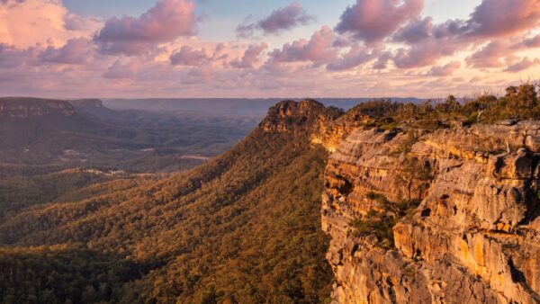
Nattai National Park sits south-west of Sydney, west of Mittagong, in a rugged section of the Greater Blue Mountains World Heritage Area. It protects a large sandstone landscape of plateaus, escarpments and deeply cut river valleys, with the Nattai River and its tributaries draining toward Lake Burragorang, part of Sydney’s major water supply catchment. The park itself covers about 47,500 hectares and includes a substantial undeveloped core that gives the country its remote feel.
What stands out here is how quickly settled tablelands give way to rough, folded country. High ridges and cliff lines drop into gorges cut through Hawkesbury Sandstone, and isolated peaks such as Mount Jellore add to the park’s strong relief and sense of scale.
Highlights
The scenery in Nattai National Park is defined by sandstone. Hawkesbury Sandstone forms the prominent scarps and cliffs, while river erosion has carved deep gorges through the plateau over a very long period. That mix of high ridges, cliff edges and valley floors gives the park its big, open character and many of its long-range views.
The Nattai River is central to the landscape, winding through broad sections of valley before narrowing into steeper country. Around it, the park’s escarpments, tablelands and isolated peaks create a striking contrast between dry ridge country above and sheltered river flats below. Mount Jellore, a remnant of an igneous intrusion, is one of the landforms that breaks up the sandstone country and adds another layer to the skyline.
Best Time to Visit
Autumn and spring are usually the most comfortable seasons to spend time in Nattai National Park, when temperatures are milder and the contrast between exposed ridges and cool, sheltered gullies is especially pleasant. The park spans plateau tops, valleys and gorge country, so conditions can vary quite a bit across short distances.
Spring also tends to show off the bush at its most colourful, while the clearer air that often comes with cooler months can make the escarpments and river valleys feel even more expansive.
Plants and Animals
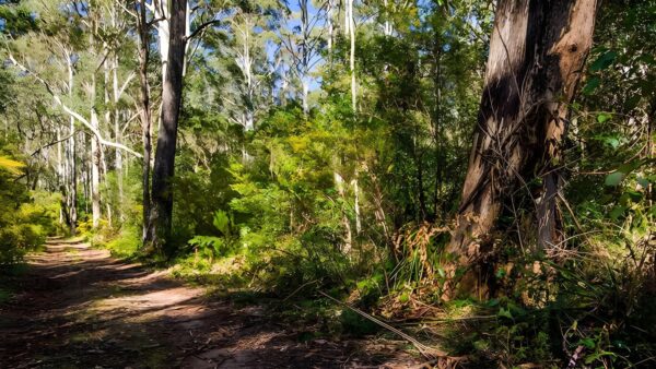
Nattai National Park supports a wide range of plant communities shaped by its topography, soils and rainfall. Much of the park is dry sclerophyll forest and woodland with a strong eucalypt character, including red bloodwood, Sydney blackbutt, red ironbark, scribbly gum, Sydney peppermint and smooth-barked apple on less sheltered ridges and slopes.
Down in the major river valleys, communities shift to species such as river she-oak, mountain blue gum and river peppermint. In the more protected eastern gullies there are small patches of warm temperate rainforest, with sassafras and coachwood, as well as moist mixed forest where rainforest species sit beneath taller eucalypts and turpentine. This constant change from exposed plateau to sheltered gully gives the park a richer botanical mix than the dry ridgelines alone might suggest.
Culture and Heritage
Nattai National Park has strong Aboriginal cultural connections. The Nattai area was the traditional home of the D’harawal and Gundangarra peoples, while the northern part of the Burragorang was also the traditional home of Dharug people. The Wollondilly and Burragorang valleys formed a boundary or transition zone between these groups, and the country also functioned as a corridor linking people travelling north to major gathering and ceremonial grounds near the Nepean.
The Nattai River valley and adjoining country known as Gwaigl held particular significance in D’harawal tradition, with access into the area closely controlled. The park also preserves historic traces of early European use, but its deeper story is as an Aboriginal cultural landscape shaped by movement, boundaries and long-standing connections to river valleys and passes.
Find more places to explore…
Help expand the trail collection!
Know of an official trail not listed on Trail Hiking Australia? I’m focused on showcasing the best tracks managed by land managers, and I’d love your help! Sharing a trail adds to our community and helps others discover safe, new adventures.
Submit your trail here

