Sorry, no records were found. Please adjust your search criteria and try again.
Sorry, unable to load the Maps API.
Explore stunning hiking trails of Mullion Range State Conservation Area
Discover the diverse trails of Mullion Range State Conservation Area, New South Wales, offering hikes and walks for all skill levels and interests. Find your perfect adventure today.
Discover 1 hiking trail in Mullion Range State Conservation Area
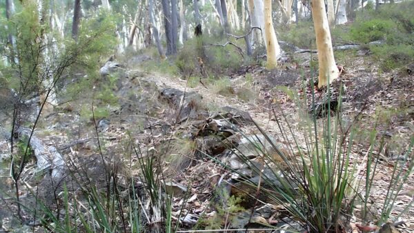

Where Summer Hill Creek Cuts Through the Mullion Range
Overview
Mullion Range State Conservation Area sits in the Central West of New South Wales, about 20 kilometres north-east of Orange. It covers 1,025 hectares in three separate parcels within the Mullion Range, where steep hills, rocky slopes and creek flats create a landscape that feels a little more rugged than the surrounding farmland.
The area protects a substantial remnant of Central Tablelands woodland and forest, with a strong emphasis on the riparian country along Summer Hill Creek. That mix of ridges, gullies and creekline vegetation gives the place much of its character, and it is also why the scenery shifts so quickly from dry, open slopes to shaded watercourse.
Highlights
The defining feature here is the range itself: a band of volcanic rhyolite, dacite and tuff that forms a prominent hilly spine north-east of Orange. In the conservation area the land rises from about 670 to 960 metres above sea level, so there is a real sense of climbing into higher, rockier country.
Summer Hill Creek adds another layer to the scenery as it cuts through the reserve, softening the dry slopes with pockets of taller creekside vegetation. Waterfalls, rock pools and the contrast between open woodland and denser creek flats give Mullion Range its strongest visual appeal.
Best Time to Visit
Spring and autumn are usually the most comfortable times to spend longer out in Mullion Range State Conservation Area. The higher elevation and hilly terrain make these seasons a good fit for walking, with milder temperatures and clearer light across the ridges and creek country.
At any time of year, the place is best appreciated when Summer Hill Creek is flowing well enough to bring out the contrast between the dry woodland slopes and the greener riparian corridor.
Plants and Animals
The vegetation is centred on three main communities: inland scribbly gum and red stringybark woodland, red stringybark and bundy woodland, and river oak riparian forest along the creek. Brittle gum and manna gum also appear through the open forests and woodlands, while the slopes and ranges support plant communities that are poorly represented elsewhere in the Central West and sit near the north-western edge of their known range.
Seventy-three native animal species have been recorded here, including red-necked wallabies, eastern grey kangaroos and wallaroos. The reserve also has habitat suited to a number of more sensitive species, with predicted fauna including squirrel glider, yellow-bellied glider, powerful owl, barking owl, koala and regent honeyeater.
Culture and Heritage
Mullion Range State Conservation Area lies within Wiradjuri Country, and recorded Aboriginal heritage in the area includes an occupation site, a scarred tree and stone tools. Summer Hill Creek and nearby waterways were also identified as part of a likely travel route through the district toward Mount Canobolas, a place of major importance to the Wiradjuri.
The area also carries a strong record of early gold mining. Some of the first gold mining in New South Wales took place in and around these reserves, and evidence of that history remains in old mining areas, water races, ruins and scattered shafts.
Find more places to explore…
Help expand the trail collection!
Know of an official trail not listed on Trail Hiking Australia? I’m focused on showcasing the best tracks managed by land managers, and I’d love your help! Sharing a trail adds to our community and helps others discover safe, new adventures.
Submit your trail here

