Sorry, no records were found. Please adjust your search criteria and try again.
Sorry, unable to load the Maps API.
Explore stunning hiking trails of Mimosa Rocks National Park
Discover the diverse trails of Mimosa Rocks National Park, New South Wales, offering hikes and walks for all skill levels and interests. Find your perfect adventure today.
Discover 3 hiking trails in Mimosa Rocks National Park
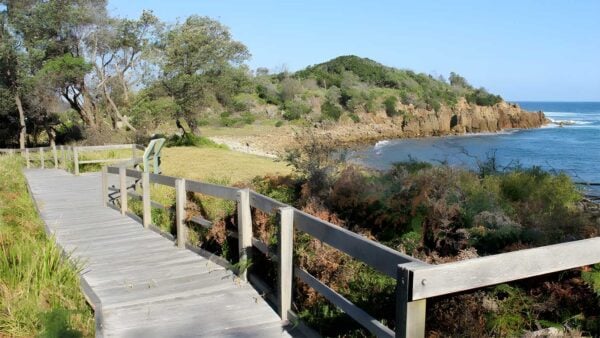

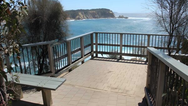
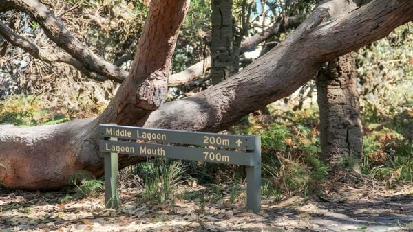
Folded headlands, lagoons and old coastal forest at Mimosa Rocks
Overview
Mimosa Rocks National Park sits on the far south coast of New South Wales near Bega, protecting a long stretch of shoreline shaped by beaches, rocky points, estuaries and coastal forest. It has grown in stages since 1973 and now forms part of a broader chain of protected coast in the South East Corner region, which helps explain why the landscape still feels so continuous from one headland and inlet to the next.
What gives the park its character is the way land and water keep changing places. Lagoons and creek mouths sit behind the beach line, low dunes run into forest, and exposed headlands break into sheltered coves. That mix makes the park feel distinctly south coast, but with a stronger geological edge than many nearby beach reserves.
Highlights
The standout feature here is the coastline itself. The rock platforms and headlands show off tightly folded, faulted and intruded rocks, creating the rugged, almost sculpted forms that gave the park its name. Around Bunga Head and other exposed points, that geology is a big part of the scenery rather than just a detail underfoot.
Just as memorable are the water bodies tucked behind the shore. Middle and Nelson Lagoons, along with the inlets and creek systems feeding them, soften the coastline and create long views across still water to forested slopes and sandy edges. Pockets of littoral rainforest add another layer, especially around Bunga Head, where the vegetation feels unexpectedly lush so close to the sea.
Best Time to Visit
This coast is rewarding year-round, but the most comfortable walking weather is usually from spring to autumn, when days are generally milder and longer. Summer brings the warmest conditions, while winter is cooler but often clear, and the exposed headlands can be especially good for taking in the open coastal outlook.
If you are more interested in the park’s plant life and bird activity than beach weather, spring is a particularly appealing time. The mix of heath, forest, wetland and shoreline habitats tends to feel especially lively then, without the heavier heat that can settle over the coast in peak summer.
Plants and Animals
Mimosa Rocks National Park protects an unusually rich range of coastal vegetation. Three plant communities here are listed as endangered ecological communities in New South Wales: littoral rainforest, Bangalay Sand Forest and Themeda grassland. The Bunga Head rainforest is especially significant because it includes species more typical of rainforests farther north.
Beyond the immediate shore, the vegetation shifts into eucalypt forest and gully communities. Bangalay forest backs much of the coast, while the near-coastal hills carry spotted gum with an understorey of burrawangs. Around the lagoons and estuaries there are saltmarsh, mangroves and seagrass meadows, which add another set of habitats within a relatively compact area.
The birdlife is one of the park’s strengths. Shorebirds and waterbirds use the beaches, estuaries and lagoons, while forest birds and birds of prey occupy the inland slopes and gullies. Threatened species recorded in the park include swift parrots, hooded plovers and little terns, and the area also supports species such as white-bellied sea eagles, osprey and several owls.
Culture and Heritage
Mimosa Rocks National Park has a direct and continuing connection with Yuin Country. The park contains Aboriginal sites that reflect long use of the coast, estuaries and nearby forest, including middens, open campsites, a rock shelter and a Bunan ground in the Mogareeka-Moon Bay area associated with male initiation ceremonies.
These places are part of a much larger cultural landscape rather than isolated relics. Coastal food resources, fresh water, stone sources and forest products all supported repeated use of the area, and that connection continues today through family ties, camping, fishing and the passing on of cultural knowledge. Management of Aboriginal cultural values in the park is carried out with the Bega and Merrimans Local Aboriginal Land Councils and relevant Aboriginal families and individuals.
Find more places to explore…
Help expand the trail collection!
Know of an official trail not listed on Trail Hiking Australia? I’m focused on showcasing the best tracks managed by land managers, and I’d love your help! Sharing a trail adds to our community and helps others discover safe, new adventures.
Submit your trail here

