Sorry, no records were found. Please adjust your search criteria and try again.
Sorry, unable to load the Maps API.
Explore stunning hiking trails of Hunter Wetlands National Park
Discover the diverse trails of Hunter Wetlands National Park, New South Wales, offering hikes and walks for all skill levels and interests. Find your perfect adventure today.
Discover 3 hiking trails in Hunter Wetlands National Park
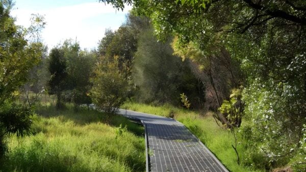

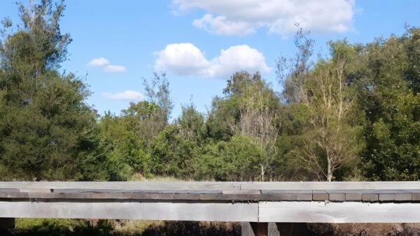

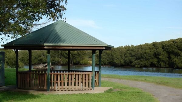
Where Newcastle Gives Way to Estuary and Swamp
Overview
Hunter Wetlands National Park protects a broad sweep of estuarine country in the lower Hunter River, just north of Newcastle. It stretches from Hexham in the west to Stockton and Fern Bay in the east, and brings together places as varied as Hexham Swamp, Fullerton Cove, Tomago Wetlands and the islands around Kooragang and Ash Island. At 4,549 hectares, it is a large and surprisingly varied wetland landscape on the edge of the city.
What makes the park distinctive is its scale and setting. This is not a single compact bushland block, but a connected system of tidal flats, mangroves, saltmarsh, river edges and swamp country that forms part of a green corridor running between Port Stephens, Hexham Swamp and the Watagan Ranges. Most of the Hunter Estuary Wetlands Ramsar site sits within the park, which gives a good sense of how important this landscape is beyond the local area.
Highlights
The character of the park comes from water, open sky and low-lying country shaped by the estuary. Fullerton Cove, the broad reaches of the Hunter River and the wide sweep of Hexham Swamp give the area a sense of space that feels very different from the nearby city. Around the eastern side of the park, the mix of mudflats, tidal channels and island edges creates a landscape that changes constantly with the light and the tide.
There is also real visual contrast here. Dense mangrove margins sit beside open saltmarsh, and reclaimed or rehabilitated wetland areas meet older estuarine country. That mix gives the park a strong, unmistakably coastal Hunter character, with Newcastle’s industrial shoreline never too far away yet often feeling held at a distance by this wide wetland buffer.
Best Time to Visit
This park can be rewarding at any time of year, but the milder months usually make for the most comfortable walking conditions. Autumn, winter and spring tend to bring cooler temperatures and clearer air, which suits a landscape where much of the pleasure comes from long views across exposed wetland and estuary.
Spring is especially interesting if you enjoy seeing the wetlands at an active time for birdlife, while summer can feel hotter and more exposed across open ground with little shelter. Because the park is made up of tidal and freshwater wetland environments, its appearance can also shift a lot through the seasons and with changing water levels.
Plants and Animals
This is one of the most ecologically important wetland areas on the New South Wales coast. The park contains the second largest area of mangroves in the state, along with extensive coastal saltmarsh and large areas of freshwater wetland on coastal floodplains. Those plant communities are not just scenic background. They are the structure that holds the whole estuary system together.
The range of wildlife is one of the park’s defining strengths. It provides habitat for 41 threatened species, including the Australasian bittern, the green and golden bell frog and breeding habitat for the eastern freetail-bat. It is also an important site for migratory birds on the East Asian–Australasian Flyway, with shorebirds using these wetlands as feeding and roosting habitat.
Restoration work has become part of the park’s ecological story too. At Tomago Wetlands, tidal rehabilitation has brought migratory shorebirds back to areas where they had not been recorded since the 1970s, and Hexham Swamp has seen major work aimed at restoring estuarine habitat across a large section of the floodplain.
Culture and Heritage
Hunter Wetlands National Park lies in the traditional Countries of the Awabakal and Worimi peoples. Within the Hunter Estuary, it forms part of a broader Aboriginal cultural landscape that extends east to Stockton Beach and west toward the woodland country around Minmi.
The park also holds layers of more recent history linked to the working life of the lower Hunter. Its heritage includes evidence of shipping, industry, flood mitigation, farming and food production, along with the Ash Island Schoolmasters House from 1890 and World War II radar station buildings on Ash Island.
Find more places to explore…
Help expand the trail collection!
Know of an official trail not listed on Trail Hiking Australia? I’m focused on showcasing the best tracks managed by land managers, and I’d love your help! Sharing a trail adds to our community and helps others discover safe, new adventures.
Submit your trail here

