Sorry, no records were found. Please adjust your search criteria and try again.
Sorry, unable to load the Maps API.
Explore stunning hiking trails of Gundabooka National Park
Discover the diverse trails of Gundabooka National Park, New South Wales, offering hikes and walks for all skill levels and interests. Find your perfect adventure today.
Discover 3 hiking trails in Gundabooka National Park


Where Sandstone Rises from the Outback Plains
Overview
Gundabooka National Park sits in north-western New South Wales, about 50km south-west of Bourke and roughly 820km from Sydney. It covers a large semi-arid landscape where open plains, grassy woodlands and creeklines meet the Gunderbooka Range, with the Darling River along the northern edge. The park protects more than 63,000 hectares, and its scale is part of what gives it such a strong sense of country.
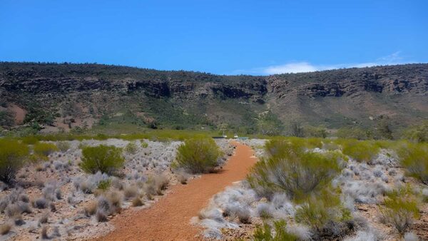
This is a place of contrast rather than density. Broad lowlands stretch away from the base of the range, then the country suddenly lifts into rust-red sandstone ridges and escarpments. That mix of plains, range country and river frontage gives Gundabooka a character that feels distinctly western NSW, with long views, big skies and landforms that stand out clearly in the surrounding landscape.
Highlights
The defining feature here is Mount Gunderbooka and the Gunderbooka Range, an impressive sandstone outcrop that rises to about 500 metres above sea level and covers around 70 square kilometres. It is the landform that anchors the whole park, creating a rugged skyline above the flatter country around it.
The geology adds another layer to the scenery. Mount Gunderbooka is an outcrop of quartzitic sandstone laid down around 385 million years ago, and the range sits at the junction of two major geological zones. Around it, the landscape shifts between ridges, escarpments, creeklines and open plains, so the scenery changes subtly as you move through the park rather than staying the same from one area to the next.
Best Time to Visit
Gundabooka’s climate is marked by hot summers, mild winters and highly variable rainfall, which is typical of this part of inland New South Wales. The cooler months are generally the most comfortable time to spend longer periods out in the park, especially when you want to appreciate the open country and rocky range without the full heat of summer.
Rain can change the look of the park quickly. In drier periods the plains and woodland can feel stark and spare, while good seasons bring a softer, greener look across the grasses and creeklines. That means the best timing is often less about a fixed month and more about aiming for cooler weather and, if possible, a period after decent rain.
Plants and Animals
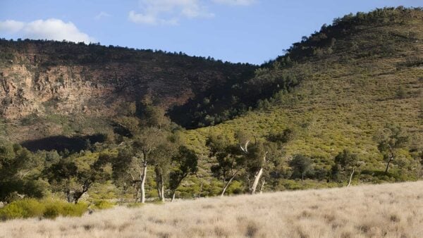
Gundabooka protects 21 recorded plant communities, which is a lot of variety for an outback park. Mulga is a major part of the vegetation, alongside bimble box, red box, ironwood, white cypress pine, belah, leopardwood, western bloodwood and grey mallee. Different communities sit in different parts of the landscape, with mulga, mallee and white cypress pine on the range and ridges, woodland across the plains, and denser tree cover along the creeks.
The park is also important habitat for threatened species. Surveys have recorded threatened plants including curly bark wattle on Mount Gunderbooka, where a population of about 150 trees has been found. Birdlife is especially notable, with species such as pink cockatoo and painted honeyeater recorded here, along with a broad mix of other native birds, reptiles, amphibians and mammals.
Culture and Heritage
Gundabooka has direct and specific cultural significance for the Ngemba and Baakandji people, and the park and adjoining conservation area are jointly managed through a memorandum of understanding established in 2015. The Gunderbooka Range is a homeland place with strong cultural links, and the wider Gundabooka area was traditionally a meeting place for neighbouring groups from the Cobar Peneplain and the Darling River country.
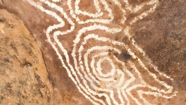
There are 37 recorded Aboriginal sites in the park, including places of spiritual and ceremonial importance, burial sites, scarred trees, stone quarries and art shelters. Part of the art site complex on Mulgowan is listed on the Register of the National Estate, and the range is also associated with Biaime, an ancestral being connected to the creation of landscape in western New South Wales.
Find more places to explore…
Help expand the trail collection!
Know of an official trail not listed on Trail Hiking Australia? I’m focused on showcasing the best tracks managed by land managers, and I’d love your help! Sharing a trail adds to our community and helps others discover safe, new adventures.
Submit your trail here

