Sorry, no records were found. Please adjust your search criteria and try again.
Sorry, unable to load the Maps API.
Explore stunning hiking trails of Deriah Aboriginal Area
Discover the diverse trails of Deriah Aboriginal Area, New South Wales, offering hikes and walks for all skill levels and interests. Find your perfect adventure today.
Discover 1 hiking trail in Deriah Aboriginal Area
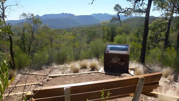

Volcanic Cliffs and Gamilaraay Country at Deriah
Overview
Deriah Aboriginal Area lies on the western slopes of the Nandewar Range, about 25km east of Narrabri in north-west New South Wales. Covering roughly 2,240 hectares, it adjoins Mount Kaputar National Park and protects a compact but distinctive area where Aboriginal cultural values and rugged inland scenery sit closely together.
This is a landscape shaped by both ancient volcanism and long Aboriginal connection to Country. Steep rocky slopes, cliff lines and weathered sandstone formations give the area a strong sense of character, while the reserve also forms an important habitat link between the Brigalow Belt South and Nandewar bioregions.
Highlights
The standout feature here is the meeting of volcanic and sandstone country. Old eruptions from the Nandewar shield volcano left behind hard volcanic rock, while softer sandstone has worn into striking shapes over time. That contrast gives Deriah a craggy, layered look that feels quite different from the surrounding farmland.
Its position on the slopes of the range also creates broad scenic character, with forested country, rocky outcrops and escarpment edges that make the area feel more elevated and enclosed than the plains around Narrabri.
Best Time to Visit
Cooler months are usually the most comfortable time to spend time in this part of inland New South Wales, when temperatures are milder and the dry forest country is generally easier to appreciate at a slower pace. Spring can also be a rewarding season, particularly when bird activity lifts and the bush starts to freshen after winter.
Summer can be very hot in the Narrabri district, so the feel of the place is often better suited to autumn, winter and spring.
Plants and Animals
Deriah Aboriginal Area supports dry forest and woodland communities that help connect larger habitats across the western Nandewar slopes. That linking role matters for native plants and animals moving between adjoining bioregions.
Birdlife is one of the strongest natural features of the area, with a notably diverse mix of species recorded. Among them are spotted harrier, little eagle, little lorikeet, black-chinned honeyeater, rainbow bee-eater and hooded robin, along with vulnerable species such as superb parrot, turquoise parrot and speckled warbler.
Culture and Heritage
Deriah Aboriginal Area is in the traditional Country of the Gamilaraay People and is recognised as an important part of their cultural landscape, expressing connections between people, land and spirit. It was reserved as an Aboriginal area in 2005, and joint management has been in place through a co-management committee made up of local Aboriginal community members with historical connections to the area.
The reserve contains a large number of significant Aboriginal sites, including scarred and modified trees, grinding grooves, open artefact scatters and sandstone shelters. These places are a direct record of long occupation and continuing cultural connection, giving Deriah a significance that goes well beyond its scenic setting.
Find more places to explore…
Help expand the trail collection!
Know of an official trail not listed on Trail Hiking Australia? I’m focused on showcasing the best tracks managed by land managers, and I’d love your help! Sharing a trail adds to our community and helps others discover safe, new adventures.
Submit your trail here

