Sorry, no records were found. Please adjust your search criteria and try again.
Sorry, unable to load the Maps API.
Explore stunning hiking trails of Burnie
Discover the diverse trails of Burnie, Tasmania, offering hikes and walks for all skill levels and interests. Find your perfect adventure today.
Discover 1 hiking trail in Burnie

Coastal Burnie and Its Green Corridors
Overview
Burnie sits on Tasmania’s north-west coast, where the city meets Bass Strait and a network of creeks, foreshore paths and suburban reserves threads back inland. The walking areas around Burnie are shaped as much by this meeting of coast and town as by bushland alone, with open sea edges, creek gullies, wetland pockets and larger community reserves all close to the city centre.
Across the municipality, the character of a walk can change quickly. One stretch follows the waterfront and beaches, another drops into a sheltered creek line, while places like View Road Reserve open out into broad green space with a natural waterway running through the middle of the city.
Highlights
What stands out in Burnie is the contrast between coastal scenery and quieter inland pockets. Along the foreshore, the city’s edge is defined by sea views, beaches and a boardwalk-linked shoreline that ties together the waterfront, West Beach and the western penguin habitat area. Inland, reserves add a different kind of scenery, with gullies, creek flats, ponds, wetland edges and established parkland all part of the wider landscape.
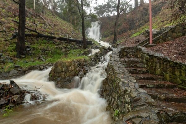
Burnie Park brings a more formal green setting, with rolling lawns, mature trees and Oldaker Falls cutting through the park on its way to a pond. View Road Reserve, also known as Stoney Creek Reserve, has a broader, more open feel, with Shorewell Creek, a marshy wetland at the northern end, and an almost unbroken corridor of open space linking the foreshore with the southern suburbs.
Best Time to Visit
Burnie can be visited year-round, but the feel of the place shifts with the seasons. The warmer months suit the foreshore particularly well, when the coast is at its clearest and the sea-facing parts of town feel more open and bright. Cooler months tend to bring out the greener side of the creek reserves and established parks, especially where gullies, ferns and wetter ground give the landscape a softer look.
Spring is a particularly pleasant time if you enjoy Burnie’s garden character as well as its natural features, with places such as Burnie Park showing more colour alongside the coast and creek corridors.
Plants and Animals
Burnie’s reserves support a mix of planted parkland, remnant native vegetation and wetter creek-side habitat. In View Road Reserve, the southern gully includes tree ferns and other remnant native flora, while replanting along the creek line has aimed to build up denser bushland and rainforest-style vegetation. The northern end opens into a marshy wetland, giving the reserve more habitat variety than its open grassy areas might first suggest.
Shorewell Creek and its adjoining wet areas are especially important for native fauna. Verified records from the reserve include the Burnie Burrowing Crayfish and the giant freshwater lobster, both associated with local streams and creek habitat. Elsewhere in Burnie, reserves such as Fern Glade are also known for their river setting and wildlife values, adding to the sense that the city’s walking country is stitched together by water, vegetation and small habitat corridors rather than one single bush block.
Culture and Heritage
Burnie is situated on Country recognised locally as pataway/Burnie, and the city council acknowledges the pakana/palawa as the original owners and cultural custodians of the lands and waters here.
Find more places to explore…
Help expand the trail collection!
Know of an official trail not listed on Trail Hiking Australia? I’m focused on showcasing the best tracks managed by land managers, and I’d love your help! Sharing a trail adds to our community and helps others discover safe, new adventures.
Submit your trail here

