Hike at a Glance
Max elevation: 1504m
Min elevation: 333m
Total Ascent: 1971m
Important info
Due to the remote nature of this park, you must be self sufficient with food, water, first aid and camping gear, and be skilled in the use of maps and compass navigation.
Hike overview
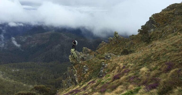
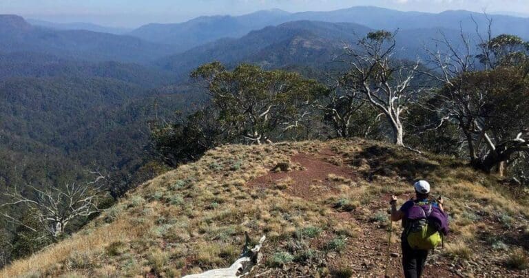
The Mount Ligar and Tamboritha hike (The Crinoline) climbs from Breakfast Creek, on the Tamboritha Road, north of Licola, to the top of Mount Ligar (The Crinoline). It then follows a ridge top loop via Long Hill to Mount Tamboritha before returning to Breakfast Creek via McMillans Walking Track. Mount Ligar (also called the Crinoline due to it's similarity to a stiffened or structured petticoat designed to hold out a woman's skirt, popular at various times since the mid-19th century) is considered by some to be one of the more challenging summits for hikers in Victoria.
Alternative Route
The Old Crinoline Track leaves the Breakfast Creek camp site and heads north on the east side of Breakfast Creek. It is reputed to be a channlenging climb, straight up the south-side spur of Castle Hill and then across a ridge to Mount Ligar. This path 'straight to the top is now deprecated, and the Macmillan Walking Track is preferred.
Refer to maps below.
Tips
Campsites
There's room around the rock shelter for tents but it's a bit rocky to get pegs in.
Water
There are little or no reliable sources of fresh stream water on this hike. Be prepared to carry all of your water with you for the two or three days. If comleting this hike clockwise, you may find water on day one during the approach to the Crinoline. It can be found in plastic drums to the east of the track. Note these are often empty and when full, are likely to be riddled with mosquito larvae and have an unpleasant odor.
One potential option is to search in Long Hill Creek which can be accessed via an overgrown track approximately 1km north of the Crinoline. This creek only flows after heavy rain, so relying on it is risky. Due to the unreliable water sources, strongly consider carrying all your water for the entire hike.
Unpredictable Weather
Walkers should be aware that the weather can deteriorate suddenly and without warning, and snow can fall at any time of year, including mid-summer. Don't hesitate to turn back if the trip becomes too difficult or the weather deteriorates.
Be sure to check the advice on safety and regulations before walking or hiking in the park.
Content use
Please don’t copy GPX files or content from this site to AllTrails or other platforms. Each trail has been personally mapped, documented, and refined to support Australia’s bushwalking and hiking community. While some details come from land managers, every listing reflects significant personal effort. This is a free, community-driven initiative—your respect helps keep it that way.
Walk map and GPX file
Max elevation: 1504 m
Min elevation: 333 m
Total climbing: 1971 m
Total descent: -1971 m
Alternative route (29km)
Max elevation: 1504 m
Min elevation: 333 m
Total climbing: 1916 m
Total descent: -1916 m
Getting there
Getting to the trailhead: Alpine National Park.
From Melbourne travel 243km to Licola via Moe, Glengarry and Glenmaggie. Travel 18.6km past Licola on the Tamboritha Road. You will find the trail head on the left before Breakfast Creek.
Closest towns to this walk: Benalla, Bright, Dinner Plain, Falls Creek, Harrietville, Hotham Heights, Mansfield, Mitta Mitta, Mount Beauty, Mount Hotham, Myrtleford, Omeo, Porepunkah, Tawonga South, Wangaratta
About the region
The Mount Ligar and Tamboritha circuit hike is in the Victorian Alps, an extensive mountain range that forms the southern part of the Australian Alps and is part of the Great Dividing Range.
Similar walks nearby
Looking for more walks in or near Alpine National Park? Try these trails with a similar difficulty grade.
Track grade
Grade 5 (Difficult) - Walks for the Most Experienced: Grade 5 represents the most challenging walking tracks on the AWTGS. These are only recommended for very experienced and fit walkers with specialised skills, including navigation and emergency first aid. Tracks are likely to be very rough, very steep, and unmarked. Walks may be more than 20 kilometers. These challenging walks demand a high level of fitness and experience to navigate difficult terrain, significant elevation changes, and potentially unformed paths.
Explore safe
Plan ahead and hike safely! Carry enough water, pack layers for changing conditions, and bring safety gear like a torch, PLB, and reliable communication device. Check official sources for trail updates, closures, and access requirements, and review local weather and bushfire advice. Most importantly, share your plans with someone before you go. Being prepared makes for a safer and more enjoyable hike! Stay Safe, Explore More, and Always #ExploreSafe.
Packing checklists
What you carry in your pack depends on factors like weather, terrain, and your adventure type. Not sure what to bring? My free planning, food, and packing checklists are a great starting point, covering day hikes, overnight trips, and multi-day adventures. Use them to customise your kit and always prioritise safety.
Let someone know
Before heading out, take a moment to fill out your trip intentions form. It’s a quick way to share your hike details with family or friends. If something goes wrong, they can notify emergency services, ensuring a faster response and peace of mind. Stay safe and enjoy your adventure
Suggest an edit
Spotted a change on this trail? Maybe there are new features, the route has shifted, or the trail is permanently closed. Whatever the update, I’d love your input. Your feedback helps fellow hikers stay informed and ensures that our trail info stays fresh and reliable.
Acknowledgement of Country
Trail Hiking Australia acknowledges the Traditional Owners of the lands on which we hike and pay respects to their Elders, past and present, and we acknowledge the First Nations people of other communities who may be here today.
/Mount-Ligar-&-Tamboritha-The-Crinoline-Hike_28.jpg)
/Mount-Ligar-&-Tamboritha-The-Crinoline-Hike_79.jpg)
/Mount-Ligar-&-Tamboritha-The-Crinoline-Hike_84.jpg)
/Mount-Ligar-&-Tamboritha-The-Crinoline-Hike_21.jpg)
/Mount-Ligar-&-Tamboritha-The-Crinoline-Hike_64.jpg)
/Mount-Ligar-&-Tamboritha-The-Crinoline-Hike_49.jpg)
/Mount-Ligar-&-Tamboritha-The-Crinoline-Hike_90.jpg)
/Mount-Ligar-&-Tamboritha-The-Crinoline-Hike_22.jpg)
/Mount-Ligar-&-Tamboritha-The-Crinoline-Hike_70.jpg)
/Mount-Ligar-&-Tamboritha-The-Crinoline-Hike_33.jpg)
/Mount-Ligar-&-Tamboritha-The-Crinoline-Hike_102.jpg)
/Mount-Ligar-&-Tamboritha-The-Crinoline-Hike_41.jpg)
/Mount-Ligar-&-Tamboritha-The-Crinoline-Hike_51.jpg)
/Mount-Ligar-&-Tamboritha-The-Crinoline-Hike_87.jpg)
/Mount-Ligar-&-Tamboritha-The-Crinoline-Hike_46.jpg)


6 Reviews on “Mount Ligar & Tamboritha: The Crinoline Hike (31km)”
Recently completed the crinoline/Mt Tamboritha/McMillan’s circuit with my brother.
Was definitely challenging but very rewarding walk, markers and ribbons and rock piles are most of the way of the walk but seem to be in consistent someone had been through with fresh pink ribbon along the fire affected section but stopped half way through, did find our way through though.
Did it in 2 days 2nd day was a big day from long Hill back to breakfast creek camp area.
Beautiful and challenging hike. WARNING: Impossible without GPS, do not attempt without one. Very minimal water along the circuit, one billabong around 8km in and a few streams of running water when hiking 1km off-track.