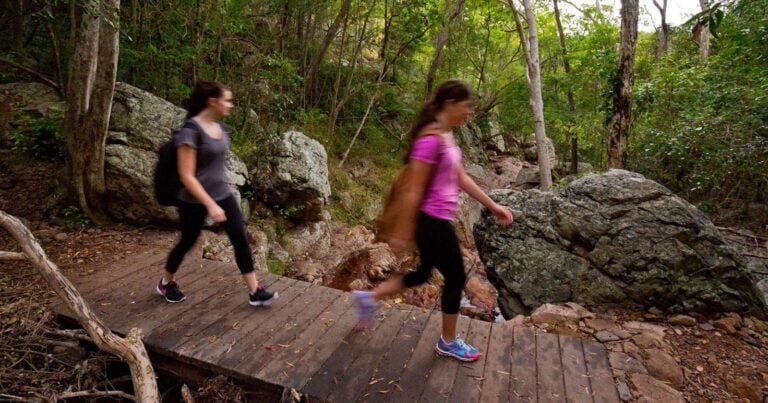
Shepherd's Peak Trail is a 3.6km, grade 4 hike located in Expedition National Park, Queensland. The hike should take around 1.5 hours to complete.
Hike overview
Shepherd's Peak Trail is located within Expedition National Park, Robinson Gorge section. Expedition National Park is part of the Central Queensland Sandstone Belt. Scenic Robinson Gorge is one of the main features of Expedition National Park, located on the Expedition Range between Taroom and Rolleston. The gorge winds 14 kilometres between sheer sandstone cliffs up to 100 metres high. It begins as a broad shallow basin in the north and narrows to a deep pool and narrow gorge towards its southern end. Lined with cabbage palms (a relic from the era of dinosaurs), bottlebrushes and wattles, this section of park is home to several rare plant species including Eucalyptus rubiginosa and Leucopogon grandiflorus.
Route and GPX file
Help fellow hikers navigate with confidence. Share your GPX or KML file for this trail and help build a more comprehensive resource with precise waypoints and elevation profiles. Your contribution will empower adventurers with details they need for a safer and more enjoyable experience. I meticulously verify every file using official maps and surveys, ensuring the highest level of accuracy and reliability. Submit your file now and become a trailblazer for your fellow outdoor enthusiasts.
Trail location
Sorry, no records were found. Please adjust your search criteria and try again.
Sorry, unable to load the Maps API.
Gallery
If you have any photos from this hike and are happy to share them, please upload your .jpg files here.
Please note: Uploading photos does not transfer ownership of copyright away from you. If requested, you will be credited for any photos you provide and can ask they be deleted at any time.
About the region
Expedition is a national park in Queensland, Australia, 490 km northwest of Brisbane. It is named for the Expedition Range of mountains.
The park is part of the Brigalow Belt bioregion.[1]
Robinson Gorge was the first section to be declared a national park in 1951.
For more information on this hiking trail, please visit Queensland.com
Similar trails nearby
Explore Safe
While planning your hike, it’s important to check official government sources for updated information, temporary closures and trail access requirements. Before hitting the trail, check local weather and bushfire advice for planned burns and bushfire warnings and let someone know before you go. Plan ahead and hike safely.
Let someone know
Adventure with peace of mind: Fill out your trip intentions form. Before you hit the trail, fill out an online form to privately send important details about your hike to your family or friends. If you don’t return on time, they can easily alert emergency services, preventing worry and ensuring a swift response. Hike with peace of mind and enjoy your outdoor adventure to the fullest. Be smart, be safe: Register your plans here.
Gear to consider

My free planning, food and packing checklists provide an introduction to things your could consider (as well as the Ten Essentials) on your day, overnight and multi-day adventures. Customise your kit according to your personal needs, always considering safety first.
Suggest an edit
Does this hikes information need updating? Sometimes the route, trail features or access conditions change.
Acknowledgement of Country
Trail Hiking Australia acknowledges the Traditional Owners of the lands on which we hike and pay respects to their Elders, past and present, and we acknowledge the First Nations people of other communities who may be here today.


