Sorry, no records were found. Please adjust your search criteria and try again.
Sorry, unable to load the Maps API.
Explore stunning hiking trails of Ravine des Casoars Wilderness Protection Area
Discover the diverse trails of Ravine des Casoars Wilderness Protection Area, South Australia, offering hikes and walks for all skill levels and interests. Find your perfect adventure today.
Discover 3 hiking trails in Ravine des Casoars Wilderness Protection Area




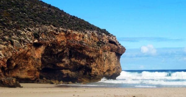
Deep valleys, remote coast and old-growth bush on Kangaroo Island’s far west
Overview
Ravine des Casoars Wilderness Protection Area sits at the north-western end of Kangaroo Island, about 35 kilometres west of Parndana and roughly 80 kilometres west of Kingscote. Proclaimed in 1993, it covers a little over 41,000 hectares of largely unaltered country, protecting a big, continuous stretch of native vegetation and several complete natural drainage systems running from inland catchments to the sea.
What sets this area apart is its scale and its condition. This land has never been cleared, and the sense of continuity is striking, from laterite and metamorphic slopes inland to coastal cliffs, lakes and sandy shoreline at the edge of the island.
Highlights
The character of the place comes from its broad sweep of intact bushland and the way water shapes the country. Stream courses cut through the laterite surface and expose older metamorphic rock, creating a landscape of low hills, sheltered valleys and a deeply incised ravine that leads towards the coast.
Along the shoreline, the scenery shifts again. Cliffs, small lakes and remote beaches break up the coast, giving the area a much wilder, less developed feel than many better-known parts of Kangaroo Island. The combination of inland forested country, river systems and rugged coastal edges gives the reserve a strong sense of remoteness.
Best Time to Visit
The cooler months are generally the most comfortable time to be out here, especially from autumn through spring, when walking conditions are milder and the bush is often at its freshest after seasonal rain. Winter and early spring can also bring more life to the creeks and sheltered gullies, which helps this landscape show its softer side.
Summer can still be rewarding for the clarity of the coastal scenery, but the exposed western end of Kangaroo Island is usually harsher and drier at that time of year.
Plants and Animals
The vegetation is mostly low open mallee forest and sugar gum woodland, with the plant communities changing subtly across slopes, crests, stream lines and the coast. Because the area remains so intact, it plays an important role in protecting habitat on the western end of Kangaroo Island, including for a number of threatened plant species recorded from this broader reserve system.
Wildlife is one of the quiet strengths of the area. Its rivers and streams are important enough for platypus research and management to be a priority, while the wider bush supports species such as tammar wallabies and threatened birds including western whipbirds, glossy black cockatoos, white-bellied sea-eagles, ospreys, southern emu-wrens and hooded plovers.
Culture and Heritage
This area contains ancient evidence of Aboriginal occupation, and Aboriginal sites have been identified at Ravine des Casoars. The cultural record is part of what makes the reserve significant, adding a very long human history to a landscape that can at first feel entirely untouched.
Find more places to explore…
Help expand the trail collection!
Know of an official trail not listed on Trail Hiking Australia? I’m focused on showcasing the best tracks managed by land managers, and I’d love your help! Sharing a trail adds to our community and helps others discover safe, new adventures.
Submit your trail here

