Sorry, no records were found. Please adjust your search criteria and try again.
Sorry, unable to load the Maps API.
Explore stunning hiking trails of Moreton Island National Park
Discover the diverse trails of Moreton Island National Park, Queensland, offering hikes and walks for all skill levels and interests. Find your perfect adventure today.
Discover 2 hiking trails in Moreton Island National Park
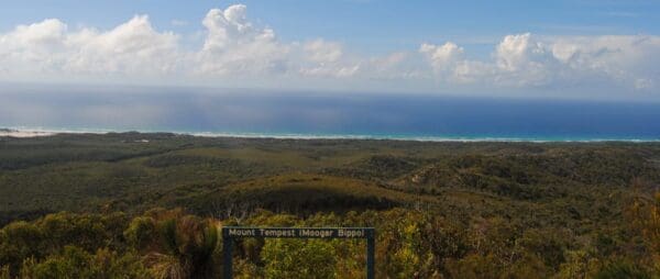

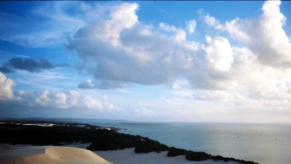

Sand Dunes, Freshwater Lakes and Ocean Edge Country on Moreton Island
Overview
Moreton Island National Park protects most of this long sand island on the eastern edge of Moreton Bay, about 40km offshore from Brisbane. The island itself is around 37km long and 10km wide, with a landscape shaped by wind, waves and moving sand. Much of what makes the place memorable sits in that contrast between surf beaches, sheltered bay shore, high dunes, heath and surprisingly clear freshwater wetlands tucked into the island’s interior.
It is a park with an unusual level of natural integrity for south-east Queensland. Around 95 per cent of the island is within national park, and the island’s dune systems, lakes and swamps remain far less altered than comparable coastal environments elsewhere in the region. That gives the whole place a wild, elemental feel, even though it sits relatively close to the state capital.
Highlights
The defining feature here is the sand island landscape itself. Moreton Island carries active dune blowouts, mobile dune sheets and long beaches, with wind-shaped features such as The Desert and the Big and Little Sandhills showing the island’s shifting character in a very direct way. In the interior, Mt Tempest rises to 285m and is regarded as the highest stabilised sand dune in the world, giving a sense of just how large and complex this dune system is.
Freshwater is another standout. More than 70 dune lakes and swamps occur across the island, and they sit in striking contrast to the dry sand country around them. Blue Lagoon and Lake Jabiru are among the best-known examples, while the Mirapool area adds another layer again, where sand build-up has formed lagoons that are important to shorebirds. Cape Moreton also stands out for its panoramic coastal setting at the island’s northern end.
Best Time to Visit
The cooler months are usually the most comfortable time for walking on Moreton Island, especially from autumn through spring when temperatures are milder and the inland sand country is generally easier going. From September to April, the island is also part of a major seasonal cycle for migratory waders moving through Moreton Bay, so that period can be especially rewarding if you notice birds as much as landforms.
If wildflowers are part of the appeal for you, the heath and wallum country can be particularly good in the milder months, when the island’s inland landscapes feel less harsh and more varied. Summer brings the strongest sense of beach season, but for hiking, the shoulder seasons tend to suit the place better.
Plants and Animals
For a sand island, the park supports a surprisingly rich mix of plant communities. Mangroves, Melaleuca swamps, sedgelands, heath and eucalypt communities all occur here, helping explain why the island feels so different from one area to the next. The freshwater systems are especially significant, with lakes, creeks and swamps that are among the cleanest and most ecologically intact in south-east Queensland.
Birdlife is one of the park’s strengths, with more than 180 species recorded on the island. Mirapool Lagoon and the Heath Island area are important feeding and roosting sites for waders, and the wider bay supports large numbers of migratory shorebirds between September and April. Around the wetlands, the island also supports species tied to acidic wallum waters, including the vulnerable Oxleyan pygmy perch and three vulnerable wallum frog species: the wallum froglet, wallum rocketfrog and wallum sedgefrog.
The island’s beaches and nearby marine habitats matter for larger fauna too. Limited numbers of green turtles and loggerhead turtles nest on Moreton Island, while surrounding seagrass areas support dugong. Even when you are walking well away from the shoreline, those marine connections are part of what shapes the park.
Culture and Heritage
Moreton Island sits within Quandamooka, and the island’s Traditional Owners are the Nughi people. The park is now jointly managed with the Quandamooka People, and the cultural connection here is deep and long-standing. Archaeological surveys on the island have recorded extensive evidence of Aboriginal occupation, including places that reflect a long relationship with coastal wallum country and the island’s marine resources.
Historic heritage is present as well, though it tends to sit within the wider landscape rather than define it. Cape Moreton contains the lighthouse complex established in 1857, and there are also remnants from later periods including the old telegraph line and World War II sites scattered across the island.
Find more places to explore…
Help expand the trail collection!
Know of an official trail not listed on Trail Hiking Australia? I’m focused on showcasing the best tracks managed by land managers, and I’d love your help! Sharing a trail adds to our community and helps others discover safe, new adventures.
Submit your trail here

