Sorry, no records were found. Please adjust your search criteria and try again.
Sorry, unable to load the Maps API.
Explore stunning hiking trails of Merredin Railway Dam
Discover the diverse trails of Merredin Railway Dam, Western Australia, offering hikes and walks for all skill levels and interests. Find your perfect adventure today.
Discover 1 hiking trail in Merredin Railway Dam
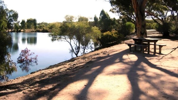

Granite Catchments and Quiet Water at Merredin Peak
Overview
Merredin Railway Dam sits against the granite slopes of Merredin Peak on the north-eastern side of Merredin, about 260 kilometres east of Perth. It is a substantial historic water catchment and storage place, where stone contour walls and rock channels were built to guide runoff from the peak into the dam below. The setting still feels shaped by both geology and engineering, with the bare granite outcrop and the waterbody forming one connected landscape.
The place developed as part of the railway water supply system for the Eastern Goldfields line and later passed into local management. Even now, its character is defined by that combination of natural rock, carefully directed water flow and the broad open Wheatbelt setting around it.
Highlights
The standout feature here is the way Merredin Peak’s granite surface has been used as a catchment. Low stone walls trace the contours of the rock, feeding runoff into a channel and then into the dam, so the whole site reads as one long piece of landscape design rather than a simple reservoir. From ground level, the contrast between the smooth granite, the built stonework and the still water gives the area a very distinctive look.
Merredin Peak itself is the larger scenic anchor. It rises abruptly from the surrounding town edge and farmland, making the dam feel tucked into the base of a much older granite landform. That meeting of exposed rock, open sky and reflective water is what gives the place its sense of scale.
Best Time to Visit
The cooler months are generally the most comfortable time to spend time around Merredin Railway Dam, particularly from late autumn through spring. Winter and early spring usually bring milder temperatures and a greener look to the surrounding Wheatbelt landscape, while spring can add seasonal colour around the granite country nearby.
After decent rain, the relationship between the peak, the channels and the dam is easier to appreciate because water is central to how the place was designed to work. In the hotter months, the granite and open ground can feel stark and intensely exposed.
Plants and Animals
Detailed official information about the plants and animals at Merredin Railway Dam itself is limited, but the site sits within Wheatbelt granite country where rock outcrops create pockets of habitat that differ from the surrounding cleared farmland. The combination of exposed granite, dam water and remnant vegetation around the base of the peak gives the area more ecological variety than the paddocks beyond it.
Nearby official material for Merredin Peak Reserve notes that these granite environments support rich biodiversity and provide refuge for wildlife, which helps explain why the area feels quite distinct from the broader agricultural landscape.
Culture and Heritage
Merredin Railway Dam is closely tied to the history of water supply in the eastern Wheatbelt and Goldfields rail corridor. The place includes Hunt’s Well No. 8, linked to Charles Hunt’s 1865 exploration of the district, and the larger railway dam system built from the 1890s onward. Together they show how water collection was adapted to a dry inland environment, first for overland travel and later for steam locomotives on the Eastern Goldfields railway.
The dam remained in railway use until 1969, making it the last railway water supply still operating on the Eastern Goldfields line. Its stone walls, rock channels, embankments and reservoir are still valued because they show, in a very physical way, how local materials and the shape of Merredin Peak were used to solve a practical problem in a low-rainfall part of Western Australia.
Find more places to explore…
Help expand the trail collection!
Know of an official trail not listed on Trail Hiking Australia? I’m focused on showcasing the best tracks managed by land managers, and I’d love your help! Sharing a trail adds to our community and helps others discover safe, new adventures.
Submit your trail here

