Sorry, no records were found. Please adjust your search criteria and try again.
Sorry, unable to load the Maps API.
Explore stunning hiking trails of Lol Gray State Forest
Discover the diverse trails of Lol Gray State Forest, Western Australia, offering hikes and walks for all skill levels and interests. Find your perfect adventure today.
Discover 1 hiking trail in Lol Gray State Forest
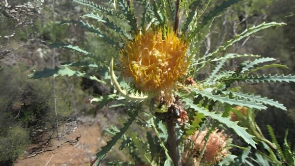

Laterite Hills and Woodland Country at Lol Gray
Overview
Lol Gray State Forest forms part of Dryandra Woodland, about 160 kilometres south-east of Perth in Western Australia’s Wheatbelt. Together with nearby forest and reserve areas, it protects one of the biggest and most varied remnants of central western Wheatbelt vegetation, where broad areas of native woodland still survive in a largely cleared farming landscape.
This is gently undulating country on an ancient plateau of granite and dolerite capped with laterite. That underlying geology shapes the look of the place, from woodland-covered rises to breakaway slopes and broad valley floors, giving Lol Gray a landscape that feels distinct from the flatter farmland around it.
Highlights
The appeal of Lol Gray lies in its contrast. Forested hills, lateritic ridges and breakaway country sit above open agricultural land, so even short rises can open out to wide views across Dryandra and the surrounding Wheatbelt. Around Contine Hill and the old fire tower area, that meeting point between wooded country and cleared plains is especially striking.
Another standout is the variety packed into the vegetation itself. Within this part of Dryandra, the scenery shifts between wandoo woodland, powderbark woodland, heathier ground with banksias and pea flowers, and stands of rock sheoak, so the character of the bush changes noticeably from one part of the forest to another.
Best Time to Visit
The cooler months are generally the most comfortable time to spend time in Lol Gray State Forest, when daytime temperatures suit longer walks and the woodland is often at its freshest. Spring is especially rewarding for wildflowers, with the varied soils and plant communities across Dryandra supporting a rich display rather than a single uniform bloom.
Autumn and winter can also be a good fit if you prefer milder weather and softer light across the hills and farmland margins.
Plants and Animals
Over two-thirds of Dryandra is natural bushland, dominated by wandoo and powderbark wandoo woodlands. Across the wider woodland system there are 12 distinct vegetation associations and more than 800 native plant species, which helps explain why Lol Gray feels so botanically varied for a Wheatbelt forest.
The area is also important habitat for threatened fauna. Dryandra supports numerous threatened and specially protected species, and its transitional position between the drier interior and the wetter south-west contributes to that biological richness. Animals associated with the wider woodland include species such as the numbat, woylie and echidna, along with a strong birdlife presence through the woodland and heath.
Brown mallet occurs on the breakaway slopes, while woodland and heath in the Lol Gray area add banksias, woolly bush, rock sheoak and flowering peas to the mix. That blend of taller woodland and lower shrubby country gives the forest much of its texture through the seasons.
Find more places to explore…
Help expand the trail collection!
Know of an official trail not listed on Trail Hiking Australia? I’m focused on showcasing the best tracks managed by land managers, and I’d love your help! Sharing a trail adds to our community and helps others discover safe, new adventures.
Submit your trail here

