Sorry, no records were found. Please adjust your search criteria and try again.
Sorry, unable to load the Maps API.
Explore stunning hiking trails of Karratha
Discover the diverse trails of Karratha, Western Australia, offering hikes and walks for all skill levels and interests. Find your perfect adventure today.
Discover 1 hiking trail in Karratha
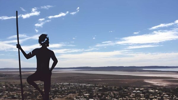

Ancient Stone Country on the Burrup Peninsula
Overview
Murujuga National Park sits on the Burrup Peninsula beside Karratha on the Pilbara coast, around 1,500 kilometres north of Perth. The park covers 4,913 hectares, taking in a striking mix of steep rocky slopes, narrow valleys, sea cliffs, mangroves, mudflats and spinifex-covered ground. It is part of the broader Murujuga landscape, a place where rugged coastal land meets an intricate scatter of islands and inlets.
This is a compact but very distinctive part of north-western Australia. Rather than broad forests or alpine scenery, Murujuga is shaped by weathered rock, open views to the coast and the bold red-brown tones of the Pilbara. The country feels exposed, sculptural and old, with landforms that change character through the day as the light shifts across the stone.
Highlights
The park’s scenery comes from the Burrup Peninsula’s rocky terrain and coastal edge. Steep outcrops, broken ridgelines and tight gullies give the landscape a raw, craggy feel, while mangroves and mudflats along the shoreline soften the transition to the sea. In places, the contrast between dark rock surfaces, pale tidal flats and bright Pilbara sky is what makes the area so memorable.
Murujuga also stands out for the way inland rock country and marine views sit close together. From higher ground, the peninsula opens towards the Dampier Archipelago, with its islands, bays and tidal inlets adding another layer to the landscape.
Best Time to Visit
The cooler months are generally the most comfortable time to spend time around Karratha and Murujuga, when walking and time out on exposed rock are more pleasant than they are through the build-up and hotter parts of the year. Clear winter light also suits the peninsula’s stony landforms particularly well, bringing out the texture and colour of the rock.
Even outside winter, early mornings and the later part of the afternoon tend to show the country at its best visually, with lower light picking up the shape of the slopes, cliffs and coastal inlets.
Plants and Animals
Much of the park is covered by hummock grasslands, the familiar spinifex country of the Pilbara, growing among boulders and shallow rocky soils. Around the coast, the vegetation shifts to mangroves and other salt-tolerant plant communities associated with mudflats and tidal margins.
The meeting of rocky uplands, sheltered inlets and coastal wetlands creates habitat for a range of animals, including birds and marine-linked species along the shore. The natural character here is less about dense vegetation and more about hardy plant communities adapted to heat, salt and thin soils.
Culture and Heritage
Murujuga National Park is jointly managed and is recognised as the country of the Mardudhunera, Ngarluma, Wong-Goo-Tt-Oo, Yaburara and Yindjibarndi people. Murujuga means “hip bone sticking out†in the Ngarluma language and refers to the Burrup Peninsula and the islands of the Dampier Archipelago.
The park is internationally significant for its vast concentration of Aboriginal rock art, with engravings that record people, animals and cultural knowledge across an immense span of time. This cultural landscape is central to what makes Murujuga unlike anywhere else in Australia, with heritage embedded directly in the rock surfaces and landforms of the peninsula.
Find more places to explore…
Help expand the trail collection!
Know of an official trail not listed on Trail Hiking Australia? I’m focused on showcasing the best tracks managed by land managers, and I’d love your help! Sharing a trail adds to our community and helps others discover safe, new adventures.
Submit your trail here

