Sorry, no records were found. Please adjust your search criteria and try again.
Sorry, unable to load the Maps API.
Explore stunning hiking trails of Jarrahdale
Discover the diverse trails of Jarrahdale, Western Australia, offering hikes and walks for all skill levels and interests. Find your perfect adventure today.
Discover 1 hiking trail in Jarrahdale
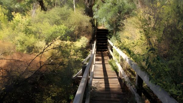

Granite Valleys and Jarrah Forest Around Jarrahdale
Overview
Jarrahdale sits on the western edge of the Darling Scarp, where forested uplands drop into steep valleys and the country begins to open towards the coastal plain. The surrounding national park country is about 49 kilometres south-east of central Perth and lies between Jarrahdale, Serpentine Dam and the town of Serpentine. What stands out here is the meeting of rugged scarp terrain, deeply cut watercourses and broad areas of native bushland close to the city.
This is a landscape shaped by elevation and water. The ground rises from about 60 to 300 metres above sea level, with the Serpentine River and Gooralong Brook cutting through the scarp to create a more dramatic setting than many people expect so close to Perth.
Highlights
The scenery around Jarrahdale is defined by the edge of the Darling Scarp and the strong relief of its valleys. There are long views west across the Swan Coastal Plain, while closer in the country feels more enclosed, with steep slopes, rocky gullies and forested ridgelines giving the area a distinct sense of depth and shape.
Granite outcrops add another layer to the landscape, along with open woodlands, rock pools and stretches of creekline vegetation. Around the Serpentine River and Gooralong Brook, water has carved some of the most striking features in the area, and in winter the usually quieter channels become far more active through the gorge country.
Best Time to Visit
The cooler months are generally the most rewarding time to be in the Jarrahdale area. Winter brings flowing water back into the creeks and river, and the change is especially noticeable in the scarp country where the streams and falls become a much stronger part of the landscape.
Spring is also a good time, when the forest and heath communities are at their richest in flowering plants. Seasonal change is a big part of what gives this area its character, from winter water to spring colour and the dry, shaded feel of jarrah forest through summer.
Plants and Animals
The vegetation around Jarrahdale is varied for a relatively compact area. Jarrah and marri forest are a big part of the picture, but there are also wandoo woodlands, scarp heaths and specialised plant communities associated with granite outcrops. On heavier soils, marri, wandoo and jarrah occur together, while sandier areas support a different mix including sheoak.
Some parts of this country are especially rich in plant life, particularly jarrah-sheoak forest. Granite hillsides also support geographically restricted eucalypts, including Darling Range ghost gum above Serpentine Falls. For wildlife, the range of habitats matters. Hollow-bearing trees support birds such as parrots, owls and tree-martins, dense shrub cover around granite outcrops shelters smaller bush birds, and stream zones provide habitat for reptiles and amphibians including the long-necked tortoise.
Culture and Heritage
Jarrahdale is part of the traditional lands and waters of the Whadjuk Noongar people. The wider district also carries a strong historical identity through its long association with timber milling and mining, which helped shape the settled landscape around the old townsite.
Find more places to explore…
Help expand the trail collection!
Know of an official trail not listed on Trail Hiking Australia? I’m focused on showcasing the best tracks managed by land managers, and I’d love your help! Sharing a trail adds to our community and helps others discover safe, new adventures.
Submit your trail here