Sorry, no records were found. Please adjust your search criteria and try again.
Sorry, unable to load the Maps API.
Explore stunning hiking trails of Bayside Parklands
Discover the diverse trails of Bayside Parklands, Queensland, offering hikes and walks for all skill levels and interests. Find your perfect adventure today.
Discover 1 hiking trail in Bayside Parklands
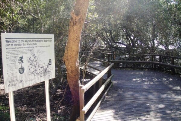

Where Mangroves, Wetlands and Moreton Bay Meet
Overview
Bayside Parklands is a long chain of connected coastal parkland on Brisbane’s south-western edge of Moreton Bay. It stretches for about 16 kilometres, from Whyte Island in the north along the Wynnum, Manly and Lota foreshores and into the bushland around Tingalpa and Lota creeks. What gives the area its character is that mix of open bay frontage, tidal flats, mangrove country and pockets of bushland, all threaded together through the eastern suburbs of Brisbane.
Rather than feeling like a single enclosed reserve, it reads as a broad coastal landscape. Along the foreshore, the outlook opens across Moreton Bay toward islands including St Helena, Moreton Island, Green Island and Stradbroke Island, while the inland sections hold on to the remaining wetland and bushland habitat connected to local creek systems.
Highlights
The scenic pull of Bayside Parklands comes from its variety. One moment the landscape is all wide bay views and tidal flats, and the next it shifts into mangroves, creek mouths and quieter wetland edges. Fig Tree Point and much of the Wynnum, Manly and Lota foreshore have especially broad outlooks across the bay, which is a big part of why the area feels so open despite sitting within suburban Brisbane.
The mangrove-fringed shoreline is another defining feature, especially around the northern foreshore where boardwalk access brings you right into that tidal environment. Farther south, the parklands continue into bushland and wetland corridors around Lota and Tingalpa creeks, giving the whole area a more layered feel than a simple waterfront reserve.
Best Time to Visit
Bayside Parklands is at its best in the cooler, drier months from autumn through spring, when the exposed foreshore and wetland edges are more comfortable for longer walks. Clear winter and early spring days also tend to sharpen the views across Moreton Bay and make the contrasts between open water, mudflats and mangroves stand out more clearly.
If you are drawn to the coastal character of the place, a calm day can make a real difference. Much of the appeal here is visual, with shifting light over the bay, islands on the horizon and the changing textures of the intertidal flats.
Plants and Animals
This is one of the key values of Bayside Parklands. The connected parklands conserve remaining tidal wetland and bushland habitat, including mangrove communities along the foreshore and around creek mouths. Those habitats link with ecological corridors reaching through Lota and Tingalpa creeks, which helps support wildlife movement across the area.
The tidal flats beside the foreshore are an important feeding and resting area for migratory wading birds. Beyond the birdlife, the broader connected habitat around the parklands supports a range of native species, with nearby restoration work focused on strengthening habitat for animals such as koalas, greater gliders, powerful owls and brown goshawks.
Find more places to explore…
Help expand the trail collection!
Know of an official trail not listed on Trail Hiking Australia? I’m focused on showcasing the best tracks managed by land managers, and I’d love your help! Sharing a trail adds to our community and helps others discover safe, new adventures.
Submit your trail here

