Trail Fast Facts
Mount Greville Track is a 5km, grade 5 hike in Moogerah Peaks National Park, Queensland. This hike typically takes 3 hours to complete.
Hike Overview
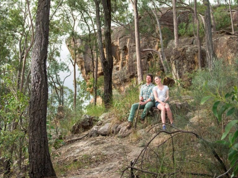
This rough bush trail, via the Southeast Ridge Track, leads up through open forest, vine forest and low heath to the summit of Mount Greville, which is part of the Moogerah Peaks National Park. In this undeveloped section of the park, tracks up the mountain are not marked but are quite easy to follow.
A few hundred metres from the start, the track forks with options to Palm Gorge, South East Ridge and Waterfall Gorge. Palm Gorge is the best route up the mountain however this route follows the Southeast Ridge Track. Just past the turnoff, you enter dry vine forest and walk up a rocky scree slope. Prickly shrubs, ferns, lianes, and palm trees grow in the rainforest that is delightfully cool in summer.
Continue for approximately two hours to get a good view from the summit. Return along the same route and enjoy great views over Lake Moogerah and the Fassifern Valley.
The Mount Greville track is located within Moogerah Peaks National Park, Mount Greville section. The volcanic peaks are significant refuges for rare and vulnerable wildlife. Close to Brisbane yet rugged and relatively undeveloped, they are popular with experienced bushwalkers and climbers. This small, rugged section of the park takes in the peak and slopes of Mount Greville (767 metres). Two gorges, known as Palm Gorge and Waterfall Gorge, cut into its south-eastern side. This section of the park is surrounded by private property; please keep to designated trails.
Track Grade
Grade 5 (Difficult) - Walks for the Most Experienced: Grade 5 represents the most challenging walking tracks on the AWTGS. These are only recommended for very experienced and fit walkers with specialised skills, including navigation and emergency first aid. Tracks are likely to be very rough, very steep, and unmarked. Walks may be more than 20 kilometers. These challenging walks demand a high level of fitness and experience to navigate difficult terrain, significant elevation changes, and potentially unformed paths.
Map and GPX file
Max elevation: 742 m
Min elevation: 180 m
Total climbing: 575 m
Total descent: -575 m
For more information on this hiking trail, please visit Queensland.com
Trail Location (trailhead)
Sorry, no records were found. Please adjust your search criteria and try again.
Sorry, unable to load the Maps API.
Photo gallery
If you have any photos from this hike and are happy to share them, please upload your .jpg files here.
Please note: Uploading photos does not transfer ownership of copyright away from you. If requested, you will be credited for any photos you provide and can ask they be deleted at any time.
About the region
The ancient, volcanic peaks of mounts French, Greville, Moon and Edwards are recognised not only for their unique shapes and as favourite bushwalking destinations, they are also remnant habitats of key conservation value within South East Queensland. The peaks are mostly covered in open eucalypt forest with montane heath on the exposed rock faces and rainforest in some sheltered areas.
Similar trails nearby
Explore Safe
While planning your hike, it’s important to check official government sources for updated information, temporary closures and trail access requirements. Before hitting the trail, check local weather and bushfire advice for planned burns and bushfire warnings and let someone know before you go. Plan ahead and hike safely.
Let someone know
Adventure with peace of mind: Fill out your trip intentions form. Before you hit the trail, fill out an online form to privately send important details about your hike to your family or friends. If you don’t return on time, they can easily alert emergency services, preventing worry and ensuring a swift response. Hike with peace of mind and enjoy your outdoor adventure to the fullest. Be smart, be safe: Register your plans here.
Gear to consider
What you carry in your pack will depend on the weather, terrain, time of year, type of adventure, and personal preferences. Having trouble deciding what gear’s right for you? My free planning, food and packing checklists provide an introduction to things your could consider (as well as the Ten Essentials) on your day, overnight and multi-day adventures. Customise your kit according to your personal needs, always considering safety first.
Suggest an edit
Trail changed? New features discovered? Has the route changed? Trail permanently closed? Help fellow hikers by suggesting edits! Click above to update route descriptions, GPX file, trail features (like boardwalks), or access conditions (like parking availability). Help me keep the trails info fresh!
Weather
Acknowledgement of Country
Trail Hiking Australia acknowledges the Traditional Owners of the lands on which we hike and pay respects to their Elders, past and present, and we acknowledge the First Nations people of other communities who may be here today.


3 Reviews on “Mount Greville Track (5km)”
Yup yup..going up here in a few weeks time! ?