Hike at a Glance
Max elevation: 461m
Min elevation: 444m
Total Ascent: 24m
Hike overview
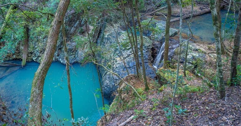
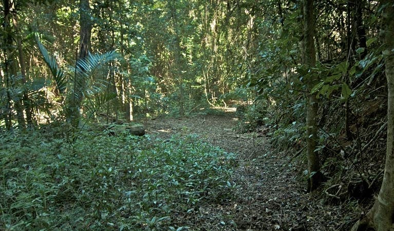
Surround yourself with the lush subtropical rainforest of World Heritage-listed Wollumbin National Park by taking a short hike on Lyrebird track. Experience this beautiful Gondwana Rainforest of Australia on this easy walking track that takes you across Breakfast Creek, then winds through palm forest to a scenic viewing platform.
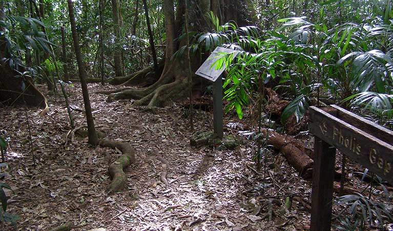
A huge diversity of animals, birds and plants exist here and each plays an important role in the rainforest ecosystem. Leaves, branches, fruit and seeds constantly drop from the tree canopy to form leaf litter. This provides shelter and camouflage for many creatures on the forest floor such as frogs and ground birds. Fungi, insects and animals help to break the organic matter down, which the trees can then reabsorb as nutrients. Brush turkey can be seen foraging through this leaf litter for insects and seeds. They always have one eye on the job and another looking out for predators, because it doesn't need to be a special occasion for carpet pythons to enjoy a turkey lunch.
Tips
Remember to take your binoculars if you want to birdwatch
You'll need to bring your own cooking water
The weather in this area can be extreme and unpredictable, so please ensure you're well-prepared for your visit.
It can be a busy place on sunset, so parking might be limited.
Check the weather before you set out as the road to Lyrebird track can become flooded when it rains
There is no/limited mobile reception in this park
This is a high risk area for theft, so please don't leave valuables in your car.
Visit NSW National Parks and Wildlife Service for more information on this trail.
Gallery
Got some great shots from this hike? Upload your photos here to inspire others and show off the beauty of the trail!
Click to view form >>
Submitting your photos doesn’t mean you lose ownership. You can be credited for your contributions, and you can request removal at any time.
Content use
Please don’t copy GPX files or content from this site to AllTrails or other platforms. Each trail has been personally mapped, documented, and refined to support Australia’s bushwalking and hiking community. While some details come from land managers, every listing reflects significant personal effort. This is a free, community-driven initiative—your respect helps keep it that way.
Walk map and GPX file
Max elevation: 461 m
Min elevation: 444 m
Total climbing: 24 m
Total descent: -24 m
Getting there
Getting to the trailhead: Wollumbin National Park.
Wollumbin National Park is located 12km south-west of Murwillumbah, off Kyogle Road.
From Murwillumbah: Take the Kyogle Rd towards Uki. Around 10km from Murwillumbah, before you reach Uki, turn right into Mount Warning Road. Continue 3.5km to the end of Mount Warning Rd, where you’ll reach Breakfast Creek carpark in the national park.
Mount Warning Road is a sealed road, subject to rapidly rising floodwaters, even during localised storms.
Limited parking is available at Breakfast Creek carpark. Not suitable for longer vehicles including coaches, caravans, and camper trailers. This is a high-risk area for theft, please don’t leave valuables in your car. Please make sure you don’t obstruct the emergency vehicle parking zone.
Closest towns to this walk: Chillingham, Mount Warning, Murwillumbah, Tyalgum, Uki
About the region
Wollumbin, which rises from World Heritage-listed Wollumbin National Park to a height of 1,157 metres above sea level, is a remnant central vent of an ancient volcano. Formerly known as Mount Warning, this spectacular peak can be viewed from a range of vantage points in the surrounding massive crater (caldera), including Cudgen Nature Reserve, Border Ranges National Park and Nightcap National Park, Cape Byron Lighthouse and various settlements.
Similar walks nearby
Looking for more walks in or near Wollumbin National Park? Try these trails with a similar difficulty grade.
Track grade
Grade 3 (Moderate) - Walks for Most Fitness Levels: Grade 3 on the AWTGS represents moderate walking tracks. These are ideal for walkers with some fitness who are comfortable with some hills and uneven terrain. While suitable for most ages, some bushwalking experience is recommended to ensure a safe and enjoyable experience. Tracks may have short, steep hill sections, a rough surface, and many steps. The total distance of a Grade 3 walk can be up to 20 kilometers.
Explore safe
Plan ahead and hike safely! Carry enough water, pack layers for changing conditions, and bring safety gear like a torch, PLB, and reliable communication device. Check official sources for trail updates, closures, and access requirements, and review local weather and bushfire advice. Most importantly, share your plans with someone before you go. Being prepared makes for a safer and more enjoyable hike! Stay Safe, Explore More, and Always #ExploreSafe.
Packing checklists
What you carry in your pack depends on factors like weather, terrain, and your adventure type. Not sure what to bring? My free planning, food, and packing checklists are a great starting point, covering day hikes, overnight trips, and multi-day adventures. Use them to customise your kit and always prioritise safety.
Let someone know
Before heading out, take a moment to fill out your trip intentions form. It’s a quick way to share your hike details with family or friends. If something goes wrong, they can notify emergency services, ensuring a faster response and peace of mind. Stay safe and enjoy your adventure
Suggest an edit
Spotted a change on this trail? Maybe there are new features, the route has shifted, or the trail is permanently closed. Whatever the update, I’d love your input. Your feedback helps fellow hikers stay informed and ensures that our trail info stays fresh and reliable.
Acknowledgement of Country
Trail Hiking Australia acknowledges the Traditional Owners of the lands on which we hike and pay respects to their Elders, past and present, and we acknowledge the First Nations people of other communities who may be here today.


