Could this be a wake-up call?
A recent AllTrails survey, published by The Guardian, reveals an alarming lack of outdoor preparedness among Australians. Just one in three Aussies know how to handle getting lost, while a staggering two-thirds avoid trail walks altogether due to safety concerns. The survey paints a worrying picture, with only 38% confident in basic first aid and a mere 6% prepared to deal with a venomous bite. This lack of knowledge leaves millions vulnerable in the wilderness.
Could this be a wake-up call for a nation that prides itself on its love for the great outdoors?
AllTrails startling stats about hikers getting lost, and their surprise at the findings left me scratching my head. After all, how can an app whose core function is navigation be surprised by users getting disoriented? The answer, I believe, lies in a worrying trend: the erosion of self-reliance in the face of technological convenience.
Remember the days of Melways, a street directory and map book specifically designed for Melbourne, Victoria? Those trusty paper maps that forced us to actually study and plan our routes, memorising turn by turn navigation? Google Maps and in-car navigation systems promised a simpler way, and we eagerly embraced it. But somewhere along the line, we traded traditional analogue navigation skills for the ease of a downloaded file.
The same thing is happening with hiking apps. They offer convenience, but at the cost of self-reliance. We download a trail, hit the “start” button, and blindly follow the blue line, lulled into a false sense of security. But what happens when the battery dies, the signal drops, or the app leads us astray? We’re left vulnerable, lost in the wilderness with little to rely on but panic.
I should be clear: navigation apps are valuable tools that many people use, but they do have their limitations and as such, should never be the sole factor in our safety. They’re like a hammer – great for building a home, but useless without the knowledge and skills to use it effectively. Blindly following an app’s blue line might get you to the finish point, but it can also lead you down a slippery slope of unpreparedness. True safety on the trail comes from competence, preparation and planning, not relying solely on an app.

Tips for becoming a self-reliant hiker
1. Plan your hike: Planning is the most important part of hiking. Before you hit the trail, do your research. Study detailed maps, understand the terrain, know the hike grade, identify potential hazards, plan an escape route, check the weather, and check for trail closures. Don’t just download a file and head out; learn the route and plan for the worst.
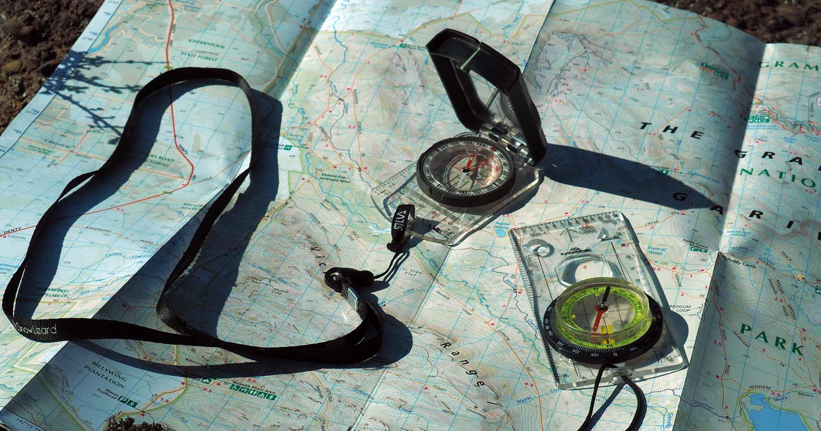
2. Sharpen your skills: Learn basic navigation with map and compass. Take a first aid course. Practice in safe environments to build confidence and further refine your skills. These skills are not just nice-to-haves; they’re lifesavers.
3. Embrace the “what ifs”: Before every hike, ask yourself, “What could go wrong?” and plan for those scenarios. What if the weather changes? What if I get injured? What if I get lost? Having answers to these questions can make the difference between a minor inconvenience and a major disaster.
4. Pack smart: Leave nothing to chance. Bring essential gear for all conditions, including a map and compass (even with the app!), first-aid kit, emergency shelter, and enough food, water and clothing for the duration of your hike. Make sure you take enough clothing to keep you warm and dry if the weather turns bad.
5. Know your limitations: Nature is not a theme park. It’s beautiful, but it can also be extremely unforgiving. Leave No Trace, be mindful of wildlife, and know your limits. The bush doesn’t care much for ego. Turn back when necessary; it’s not a sign of weakness, it’s a sign of wisdom.
6. Let someone know: Always leave your trip intentions with someone who can raise the alarm if you do not make it back in time. This can be as simple as letting someone know the official name of the trail you will be hiking, the park you will be in, when you plan to start and when you will return. For more complex or remote trips, complete an online trip intentions form that captures information that might help search and rescue teams find you in the event of an emergency.

Cross-check your route: Beyond the blue line
I am a huge believer in thorough planning so want to expand on the point about planning above. To improve self-reliance and competence, and ensure a safe, enjoyable adventure, cross-checking your chosen path with multiple resources is key. Think of it like triangulating your position on a map – each source adds a crucial layer of information, painting a clearer picture of the journey ahead. By using a combination of sources, you can be more certain of the route, terrain, features, challenges, official track names, and emergency exit points before heading out.
Here’s how to diversify your trail intel
1. Official Maps and Resources:
Invest in topographic maps specific to your chosen region. While learning to read a map might take some practice, the rewards are significant. Supplement this knowledge with information from land manager websites. These websites often offer detailed trail maps, brochures, and downloadable files with official track names, distances, elevation profiles, and difficulty ratings. Don’t forget to look for interactive platforms that can provide up-to-date information. Local hiking groups and forums are another valuable resource. Tap into their experience for insights on current trail conditions, potential challenges, and real-time updates from the community.
2. Third-Party Apps and Guides:
Third-party apps like AllTrails can be tempting for their user-generated trails, reviews, and photos. However, it’s critical to approach this information with a healthy dose of skepticism. These apps are not immune to inaccuracies, and incorrect, outdated or misleading information does find its way in. Search and rescue volunteers, myself included, have unfortunately seen firsthand how dependence on such inaccurate app data can lead hikers astray and into dangerous situations.
Here’s how to leverage these apps safely: Treat all user-generated content with caution, always prioritising information from official sources like land management websites or park maps. Additionally, consider using apps that offer downloadable topographic maps for offline use. These can be invaluable for navigation, especially in areas with unreliable cell service. Finally, remember that no single app should be your sole source of truth. Always cross-reference information from these apps with official sources and guidebooks to build a well-rounded picture of the trail. By using these apps cautiously and alongside reliable information, you can use them as a helpful supplement to your hike planning, but they should never be your primary guide.
3. Guidebooks and Trail Descriptions:
Invest in a good guidebook specific to your chosen region. These often have in-depth descriptions of trails, waypoints, flora and fauna, and historical context, which can enrich your understanding of the hike’s challenges. Read online trail descriptions from reputable sources, paying attention to user comments and feedback. Look for consistency in information across different sources to ensure accuracy.
4. Local Knowledge and Expertise:
Talk to park rangers, bushwalking clubs, and experienced hikers familiar with the area. Their insights on current conditions, potential hazards, best practices, and emergency exits are invaluable for a safe and enjoyable hike. Don’t underestimate the wisdom of local communities. Their knowledge of the land and its history can not only enrich your experience but also ensure you respect the natural environment.
5. Cross-checking is key:
Remember, cross-checking information from various sources is about building a holistic picture of the trail. By triangulating information, you can verify the trail’s existence, identify potential obstacles, discover hidden gems along the way, and get the most accurate picture of the hike’s difficulty. This level of preparation fosters confidence and equips you to handle the unexpected, turning your hike into a true adventure, not a gamble.
Let’s make self-reliance the new trend on the trails
Hiking should be a journey of discovery, not a gamble with your safety. While technology can be a valuable tool, true competence comes from mastering the basics. Learn to navigate with a map and compass, know basic first-aid, understand weather patterns, and pack for the unexpected. By embracing self-reliance, you’ll not only ensure your safety but also deepen your connection to the wilderness. So, next time you plan a hike, pack your knowledge alongside your gear, and remember: your safety is in your hands. The path to a rewarding experience is paved with preparation.
Remember, respecting the environment is crucial. Always follow Leave No Trace principles to minimise your impact on the wilderness. Hike on designated trails, dispose of waste properly, and be mindful of wildlife. Leave no trace, and take only memories.


It’s ironic that a survey by an app company leads you to suggest that people shouldn’t use apps (except as a backup) !!! 😀 In NSW, 683 people were rescued in land searches by police in the last financial year. To see how they get into difficulties, have a look at http://www.mountainsmishaps.com.au
Mountains Mishaps yes it is ironic. I expect they were hoping their survey would lead to a great story about why more people need to use the app. I tend to look at the root of the problem, not the Band-Aid solutions. Don’t get me wrong, apps are convenient but where competence and safety are concerned, what we need is more education around thorough planning and skills development.
Planning is part of the fun! The research, reading guides, trail reviews, watching vlogs. It’s all part of the process for me. My navigation and map reading isn’t my strongest skill but it’s slowly getting better with each route I plot and adventure I have🙂
Tracey Quinn totally agree. I really enjoy the planning stage.
Keep in mind that the survey was for an app that is used by many novice bushwalkers, and lots of skilled people would still use paper maps or good quality gps devices and have all the skills for navigation and survival. These same people might never feel the need to use an app like alltrails on a a regular basis and therfore respond to a survey request. Just sayin…
Nathan Bishop that’s a great point.
Related to this, Backpacking Light just published an excellent podcast about resilience in the back country. https://backpackinglight.com/podcast-96-building-resilience-for-backcountry-adversity/