Trail Fast Facts
Yacaaba Headland walking track is a 7km, grade 4 hike in Myall Lakes National Park, New South Wales. This hike typically takes 3.5 hours to complete.
Hike Overview
If you enjoy a challenging walk and scenic views rolled into one, then grab your hiking boots and make your way to Yacaaba Headland walking track. This lightly challenging walk leads up and across the northern headland of Port Stephens, in the southern reaches of Myall Lakes National Park.
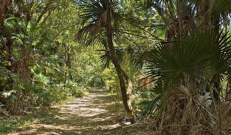
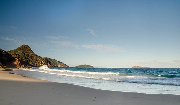
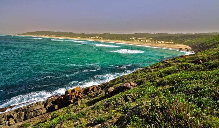
From the southern end of Bennetts Beach, the track climbs steeply and you'll notice smooth barked angophoras giving way to gnarly banksias and grass trees. As the track veers north, take a break and admire the inspiring views up the coastline. On a clear day, the distant blue ridgeline of Barrington Tops is visible.
The track gets rockier and steeper, but along the forested ridge top you'll be treated to coastal views of Seal Rocks and Tomaree Headland. Out to sea, Cabbage Tree Island, known as John Gould Nature Reserve, protects the only known breeding colony of one of the world's rarest birds; the Gould's petrel.
Track Grade
Grade 4 (Hard) - Challenging Walks for Experienced Walkers: Grade 4 on the AWTGS signifies challenging walking tracks. Bushwalking experience is recommended for these tracks, which may be long, rough, and very steep. Directional signage may be limited, requiring a good sense of navigation. These walks are suited for experienced walkers who are comfortable with steeper inclines, rougher terrain, and potentially longer distances.
Tips
The rocks on the steeper parts of the track can be very slippery
Toilets and picnic facilities can be found at Jimmys Beach reserve
Visit NSW National Parks and Wildlife Service for more information on this trail.
The longitude and latitude of the start and end points are approximately only and should not be used for navigation purposes. Please contact me if you know the correct coordinates.
Map and GPX file
Help fellow hikers navigate with confidence. Share your GPX or KML file for this trail and help build a more comprehensive resource with precise waypoints and elevation profiles. Your contribution will empower adventurers with details they need for a safer and more enjoyable experience. I meticulously verify every file using official maps and surveys, ensuring the highest level of accuracy and reliability. Submit your file now and become a trailblazer for your fellow outdoor enthusiasts.
Trail Location (trailhead)
Sorry, no records were found. Please adjust your search criteria and try again.
Sorry, unable to load the Maps API.
Getting there
To Yacaaba Headland carpark. Yacaaba Headland walking track is in the southern precinct of Myall Lakes National Park. To get there:Follow Pacific Highway, north of Newcastle, past Raymond Terrace.Drive for approximately 40km and turn right into Tea Gardens RoadFollow signs for Myall Way/Hawks Nest via Myall and Kingfisher streets Park entry points Yacaaba Headland carpark See on map Parking Parking is available at Bennetts Beach or along Beach Road.
Photo gallery
If you have any photos from this hike and are happy to share them, please upload your .jpg files here.
Please note: Uploading photos does not transfer ownership of copyright away from you. If requested, you will be credited for any photos you provide and can ask they be deleted at any time.
About the region
Myall Lakes National Park, on the north coast not far from Newcastle, features one of the State's largest coastal lake systems that offers countless opportunities for canoeing and kayaking, boating and fishing. The park also boasts more than 40kms of beaches that offer some good swimming and surfing spots. You can visit for a daytrip to enjoy a barbecue or picnic and some walking, but it's better to come for the weekend or longer to enjoy all that the park has to offer. There are lots of great campgrounds, some large and some small, including campsites for tents, trailers, caravans, motorhomes, and even boats, so you're bound to find the perfect site to suit your needs. If camping is not your style, you can book in to the heritage listed accommodation at Sugarloaf Point Lighthouse.
Similar trails nearby
Explore Safe
While planning your hike, it’s important to check official government sources for updated information, temporary closures and trail access requirements. Before hitting the trail, check local weather and bushfire advice for planned burns and bushfire warnings and let someone know before you go. Plan ahead and hike safely.
Let someone know
Adventure with peace of mind: Fill out your trip intentions form. Before you hit the trail, fill out an online form to privately send important details about your hike to your family or friends. If you don’t return on time, they can easily alert emergency services, preventing worry and ensuring a swift response. Hike with peace of mind and enjoy your outdoor adventure to the fullest. Be smart, be safe: Register your plans here.
Gear to consider
What you carry in your pack will depend on the weather, terrain, time of year, type of adventure, and personal preferences. Having trouble deciding what gear’s right for you? My free planning, food and packing checklists provide an introduction to things your could consider (as well as the Ten Essentials) on your day, overnight and multi-day adventures. Customise your kit according to your personal needs, always considering safety first.
Suggest an edit
Trail changed? New features discovered? Has the route changed? Trail permanently closed? Help fellow hikers by suggesting edits! Click above to update route descriptions, GPX file, trail features (like boardwalks), or access conditions (like parking availability). Help me keep the trails info fresh!
Weather
Acknowledgement of Country
Trail Hiking Australia acknowledges the Traditional Owners of the lands on which we hike and pay respects to their Elders, past and present, and we acknowledge the First Nations people of other communities who may be here today.


