Hike at a Glance
Max elevation: 123m
Min elevation: 0m
Total Ascent: 762m
Hike overview
Experience 27km of coastal hiking over 2 or 3 days along Tomaree Coastal Walk, near Port Stephens. Start on a high at Tomaree Head Summit, and stay overnight at a holiday park or accommodation of your choice at the coastal village of One Mile. Learn about Worimi culture at Birubi Point Aboriginal Place, and finish with a swim at the largest moving sand dune in the southern hemisphere. Choose your own adventure and explore the walk your way over 2 or 3 days.
The track retraces ancient routes used by the Worimi People and you’ll finish at Birubi Point Aboriginal Place where you can learn the stories of this land through cultural artwork. If you're keen to stay longer and explore the largest moving sand dune in the southern hemisphere visit Worimi Conservation Lands and try guided camel rides, quad biking, sandboarding, and more.
Day 1: Tomaree Head Summit to One Mile (18 km)
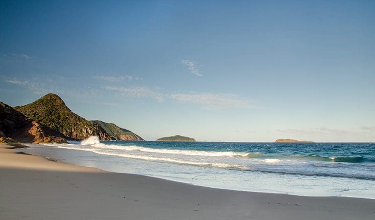
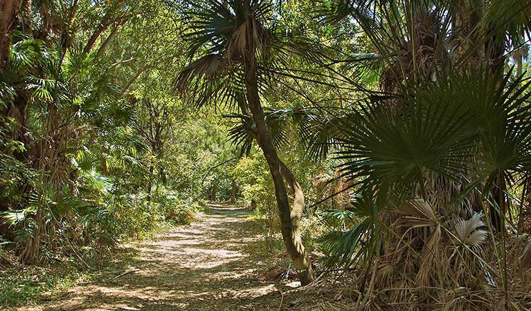
Rise early and climb Tomaree Head Summit for spectacular sunrise views. After descending, pick your way across the sandy shores of Zenith Beach and begin the journey south. Reward yourself with lunch and a swim at Fingal Bay. Although it's an open coastal walk you'll also enjoy the cool shade of smooth barked apple or angophora trees. End the adventure at One Mile with a relaxing overnight stay at one of the holiday parks or accommodation options. Find out more...
Day 2: One Mile to Birubi Point (9km)
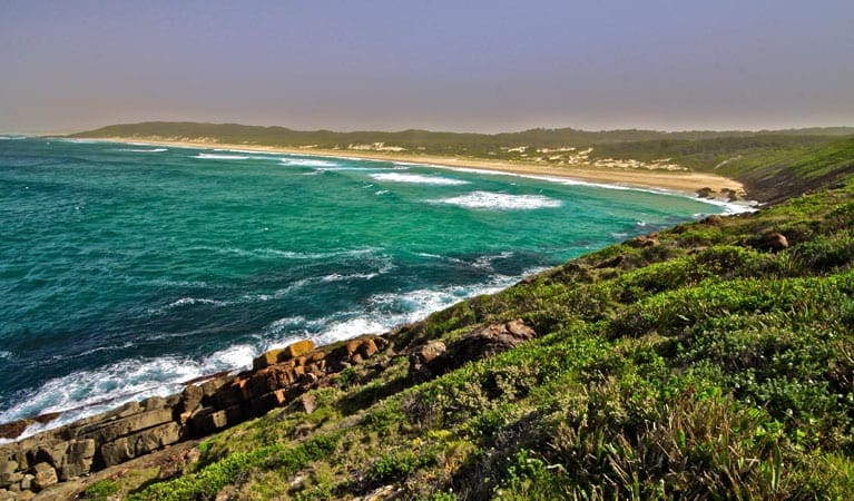
Day 2 is your shortest day, but there are plenty of rewards in store. After an optional visit to the local koala sanctuary at One Mile and thread your way south across secluded bays, beaches, tiny bridges, and sweeping volcanic rock shelfs. Marvel at the views from a lookout perched above a slot canyon. Push on to Birubi Point Aboriginal Place where you can immerse yourself in local Worimi culture and enjoy lunch and a swim at Birubi Point in Anna Bay.
Highlights
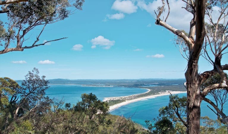
Views from Tomaree Head Summit: Take a short, invigorating walk 161 m up to Tomaree Head Summit; the jewel in the crown of all the lookouts in the area. Your reward is unparalleled ocean views from this photo-worthy vantage point.
Connection to Worimi Country: Learn about the Worimi People’s enduring connection to country when you visit Birubi Point Aboriginal Place with its cultural artwork and audio experience.
Whale watching, sea eagles and wildlife: Your feet might be on the earth but your gaze will often be out at sea, watching for dolphins, sea eagles, fur seals, and migrating humpback whales between May and November. Back on the ground, our wayfinding signs for Tomaree Coastal Walk feature a sea eagle totem to guide your way.
The convenience of coastal villages: It's not often you can explore a multi-day walk in a national park yet benefit from the conveniences of seaside villages along the way.
Forests: One of the special things about this walk is the diversity along the way. While you'll get your fill of secluded beaches and ocean rock platforms on the edge of the largest marine park in NSW, you'll also be exploring volcanic landscapes and peaks.
3 day option
Experience 27km of coastal hiking over 3 days along Tomaree Coastal Walk, near Port Stephens. Start on a high at Tomaree Head Summit, and stay overnight at a holiday park or accommodation of your choice in the area. Learn about Worimi culture at Birubi Point Aboriginal Place, and finish with a swim at the largest moving sand dune in the southern hemisphere. Learn more about the 3 day itinerary here.
Tips
- This is a Grade 4 walk, mainly because of the length of the track. Most of the terrain is flat and gentle with some short steep hills in places.
- The 1km climb up to Tomaree Head Summit is steep but short.
- In some sections you’ll be walking across sandy beaches and coastal rock platforms.
- This experience is not wheelchair accessible, however there are several locations along the way that are.
- This is a 2 day self guided walk so you'll need to carry a backpack with water, some food, and safety supplies. If you choose to camp at One Mile, you might also be carrying your tent.
- Drinking water is available along the way from amenities buildings at Fingal Bay, Barry Park, One Mile Beach, Boat Harbour, Fishermans Bay, and Birubi Point.
- You can buy lunch and snacks at Fingal Bay, One Mile Beach, and Birubi Point.
- There are no dinner options at One Mile so you might choose to get takeaway delivered from various restaurants in Anna Bay. Alternatively you could drive or catch a taxi or bus to Anna Bay, Nelson Bay or Shoal Bay for dinner.
Gallery
Got some great shots from this hike? Upload your photos here to inspire others and show off the beauty of the trail!
Click to view form >>
Submitting your photos doesn’t mean you lose ownership. You can be credited for your contributions, and you can request removal at any time.
Content use
Please don’t copy GPX files or content from this site to AllTrails or other platforms. Each trail has been personally mapped, documented, and refined to support Australia’s bushwalking and hiking community. While some details come from land managers, every listing reflects significant personal effort. This is a free, community-driven initiative—your respect helps keep it that way.
Walk map and GPX file
Max elevation: 123 m
Min elevation: 0 m
Total climbing: 762 m
Total descent: -762 m
Getting there
Getting to the trailhead: Tomaree National Park.
The nearest town to the start point is Shoal Bay which is about 3 hours drive from Sydney and about 1 hour drive from Newcastle.
You’ll be starting the walk at Tomaree Head Summit near Shoal Bay. Free all-day parking is available along Shoal Bay Road, and at Zenith Beach upper and lower car parks. Arrive early because this area is busy on weekends and in summer.
You could also catch a taxi or a bus from your location to the base of Tomaree Head Summit. Port Stephens Coaches run buses to Shoal Bay and Anna Bay. Route 130 stops at many locations along this walk including Shoal Bay, Nelson Bay, Fingal Bay, One Mile, Boat Harbour, Birubi Point and Anna Bay. Visit the Transport for NSW website for trip planning.
Closest towns to this walk: Anna Bay, Corlette, Fingal Bay, Medowie, Nelson Bay, Port Stephens, Salamander Bay, Shoal Bay
About the region
Tomaree National Park near Port Stephens is on Worimi Country. It's a great place for a weekend getaway. With so many coastal lookouts it's easy to go whale watching, hike the tracks, or explore the historical significance of Fort Tomaree.
Tomaree National Park provides a magnificent backdrop to the coastal villages of Nelson Bay, Shoal Bay, Fingal Bay, One Mile, Boat Harbour and Anna Bay. With 27km of connected hiking Tomaree Coastal Walk offers you a taste of everything in this surprisingly diverse park.
It’s the only place in NSW where you can see outcrops of the acid volcanic rock rhyodacite. The national park also borders the largest marine park in the state as well as the largest moving coastal sand dune in the southern hemisphere at nearby Worimi Conservation Lands. The Worimi connection to Country is strong and you can learn more about this at Birubi Point Aboriginal Place.
It’s an excellent spot for whale watching and offers a range of scenic walks, including the short Wreck Beach walk through coastal angophora forest and the longer Morna Point walk that comes alive with spring wildflowers. As you walk, look for sea eagles in the sky, koalas dozing high in the trees, and echidnas on the ground.
The park’s beaches are pretty places for a family barbecue and there are picnic facilities around Anna Bay, Fingal Bay, and Fishermans Bay. Enjoy a swim or snorkel at the beaches patrolled by lifeguards including One Mile Beach, Fingal Bay Beach, or Birubi Beach. Although there are some good places for fishing you’ll need to check the marine park zoning before setting out.
However you choose to spend your time in Tomaree National Park, make sure you hike Tomaree Head Summit. It’s steep but short and you’ll be rewarded with panoramic ocean views over Port Stephens, and Broughton, Cabbage Tree and Boondelbah Islands nature reserves. While you’re there, check out the historic gun emplacements, part of Fort Tomaree and built in 1941 as part of Australia’s World War II east coast defence system.
Similar walks nearby
Looking for more walks in or near Tomaree National Park? Try these trails with a similar difficulty grade.
Track grade
Grade 4 (Hard) - Challenging Walks for Experienced Walkers: Grade 4 on the AWTGS signifies challenging walking tracks. Bushwalking experience is recommended for these tracks, which may be long, rough, and very steep. Directional signage may be limited, requiring a good sense of navigation. These walks are suited for experienced walkers who are comfortable with steeper inclines, rougher terrain, and potentially longer distances.
Explore safe
Plan ahead and hike safely! Carry enough water, pack layers for changing conditions, and bring safety gear like a torch, PLB, and reliable communication device. Check official sources for trail updates, closures, and access requirements, and review local weather and bushfire advice. Most importantly, share your plans with someone before you go. Being prepared makes for a safer and more enjoyable hike! Stay Safe, Explore More, and Always #ExploreSafe.
Packing checklists
What you carry in your pack depends on factors like weather, terrain, and your adventure type. Not sure what to bring? My free planning, food, and packing checklists are a great starting point, covering day hikes, overnight trips, and multi-day adventures. Use them to customise your kit and always prioritise safety.
Let someone know
Before heading out, take a moment to fill out your trip intentions form. It’s a quick way to share your hike details with family or friends. If something goes wrong, they can notify emergency services, ensuring a faster response and peace of mind. Stay safe and enjoy your adventure
Suggest an edit
Spotted a change on this trail? Maybe there are new features, the route has shifted, or the trail is permanently closed. Whatever the update, I’d love your input. Your feedback helps fellow hikers stay informed and ensures that our trail info stays fresh and reliable.
Acknowledgement of Country
Trail Hiking Australia acknowledges the Traditional Owners of the lands on which we hike and pay respects to their Elders, past and present, and we acknowledge the First Nations people of other communities who may be here today.


