Hike at a Glance
Max elevation: 1043m
Min elevation: 71m
Total Ascent: 1080m
Important info
This is a strenuous hike suitable only for experienced and well-prepared bushwalkers. Ensure you carry adequate water, extra food, a first-aid kit, warm and wet-weather clothing, insect repellent, a torch, and reliable navigation tools such as a map, compass, GPS, and a personal locator beacon (PLB).
Hike overview
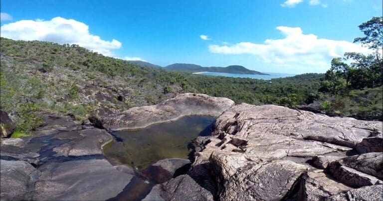
Mount Halifax, located in Paluma Range National Park, Queensland, offers a challenging yet rewarding hiking experience. Spanning 11 kilometres and graded as a level 5 hike, this trail demands physical fitness and takes most hikers between 5 to 8 hours to complete. At 1,063 metres, Mount Halifax is the tallest peak north of Townsville on the mainland, towering above the surrounding landscape until the Tully area. Its prominence is unmistakable, visible behind the pineapple farms along the Bruce Highway and even from Castle Hill in Townsville. Beyond its height, the mountain’s rugged charm draws adventurers seeking a test of endurance and a taste of its panoramic views.
The trek to the summit is no easy feat, with steep, uneven terrain that challenges both stamina and technical ability. The path is rough underfoot and includes sections of rock hopping, requiring hikers to navigate with care and maintain good foot placement. While the trail is generally marked with orange and yellow reflective markers and pink flagging tape, there are areas where the defined path disappears, leaving hikers reliant on the markers to stay on course. The creek sections, in particular, demand heightened attention, as the markers can be easily missed while traversing the rocks.
Setting out early, ideally around 6 to 7 am, is crucial for this hike. Reaching the summit typically takes between 4 and 6 hours, depending on your fitness level, and an early start ensures ample daylight for the return journey. It’s recommended to turn back by midday if you haven’t reached the summit to avoid descending in the dark. Before beginning, sign the logbook at the trailhead, where detailed mud maps are available. Be sure to return the map after your walk, as these resources are vital for others navigating the trail.
While the upper sections of the trail do offer mobile reception, it’s essential to come prepared for emergencies, as conditions can be unpredictable. Mount Halifax’s raw and untamed beauty, combined with the physical challenge it presents, makes it a memorable adventure for experienced hikers ready to tackle its steep climbs and rugged terrain.
With its isolation, rugged beauty, and the responsibility it asks of its visitors, Mount Halifax is a destination that rewards those who tread thoughtfully and come equipped to embrace its challenges.
Mount Halifax Remote Bush Camping
Mount Halifax offers a truly remote and challenging camping experience, reserved for experienced and self-sufficient bushwalkers. Access to camping areas is strictly hike-in only, and the absence of designated sites adds to the sense of solitude and adventure. To preserve the natural environment, campers are required to set up at least one kilometre away from any other group, with a maximum of six people permitted per group. This is a space for those who are prepared, self-reliant, and committed to respecting the wilderness.
Water can be collected from creeks along the way but must be treated before drinking to ensure safety. All rubbish, including food scraps, must be packed out, leaving no trace of your visit. Open fires are prohibited to minimise environmental impact and reduce fire risk, so a reliable fuel or gas stove is essential for cooking. The importance of preparation cannot be overstated. Essentials include adequate drinking water, extra food, a first-aid kit, and warm clothing, as well as wet-weather gear, rubbish bags, insect repellent, and a torch. Navigational tools such as a topographic map, compass, GPS, and safety devices such as a personal locator beacon (PLB) are vital in the rugged terrain.
Campers must also adhere to Leave No Trace principles to protect the fragile ecosystem. Human waste should be packed out wherever possible. If necessary, it can be buried at least 15 centimetres deep and 100 metres away from campsites, tracks, and water sources to prevent pollution and the spread of disease. These precautions ensure that the natural beauty of Mount Halifax remains unspoiled for future visitors while safeguarding the health of its waterways and wildlife.
Tips
- There are no facilities at the trailhead. Ensure you park outside the gate, well off the road, and avoid blocking access to the gate.
- This hike is physically demanding and should only be attempted by experienced bushwalkers who are well-prepared.
- Before setting out, always check:
- Park alerts for updates on access, closures, and track conditions.
- Weather forecasts from the Bureau of Meteorology to plan for any changes in conditions.
- Current bushfire warnings, incidents, and any fire bans or restrictions in the area.
- That your camping permit has been booked if staying overnight.
- Specific camping guidelines and requirements for Paluma Range National Park.
Gallery
Got some great shots from this hike? Upload your photos here to inspire others and show off the beauty of the trail!
Uploading your photos doesn’t mean you lose ownership. You can be credited for your contributions, and you can request removal at any time.
Content use
Please don’t copy GPX files or content from this site to AllTrails or other platforms. Each trail has been personally mapped, documented, and refined to support Australia’s bushwalking and hiking community. While some details come from land managers, every listing reflects significant personal effort. This is a free, community-driven initiative—your respect helps keep it that way.
Walk map and GPX file
Max elevation: 1043 m
Min elevation: 71 m
Total climbing: 1080 m
Total descent: -1081 m
Getting there
Getting to the trailhead: Paluma Range National Park.
To reach the Mount Halifax trailhead, head north from Townsville and turn left onto Pace Road just before crossing the Rollingstone bridge. Follow Pace Road until it ends at the sign-in point, where the track begins. This is the designated parking area, located along the roadside before the gate to Pace’s private property. Be aware that vehicles are not permitted to pass through the gate, as it is private land. Additionally, heavy machinery and wide loads regularly use this road, so it’s essential to park well off the roadside and ensure the gate remains unblocked.
Closest towns to this walk: Crystal Creek, Giru, Halifax, Herberton, Hervey Range, Herveys Range, Hidden Valley, Ingham, Little Crystal Creek, Mount Fox, Mount Spec, Mt. Spec, Paluma, Ravenswood
About the region
Just over 60 kilometres north of Townsville, Paluma Range National Park offers a rich variety of outdoor experiences. The park is split into two sections, each with its own charm and appeal for bushwalkers and nature lovers alike. In the north, the Jourama Falls section features a stunning waterfall framed by lush rainforest. This area also includes a mix of vine forest and open woodlands, providing an ideal setting for walks and wildlife spotting. The southern section, Mount Spec, rises nearly 1,000 metres above the Big Crystal Creek floodplain, offering sweeping views and access to diverse ecosystems, including tropical rainforest and eucalypt woodland.
The park holds cultural significance for the Traditional Owners, the Nywaigi Aboriginal people, who have deep connections to the land. They invite visitors to respect and enjoy this special place. Known as Munan Gumburu, meaning "misty mountain," the park is often blanketed in morning mists, adding an ethereal quality to the experience.
To access Jourama Falls, travel along an unsealed road off the Bruce Highway, which is suitable for most vehicles and caravans, though conditions can be challenging during the wet season. The Mount Spec section is easily accessible from both Townsville and Ingham, with two turn-offs from the Bruce Highway leading to the recreation areas.
Whether you're looking for serene rainforest walks, the beauty of cascading waterfalls, or a peaceful retreat for birdwatching, Paluma Range National Park offers a diverse range of experiences for all.
Main image: Tiaangobius20, CC BY-SA 4.0, via Wikimedia Commons
Similar walks nearby
Looking for more walks in or near Paluma Range National Park? Try these trails with a similar difficulty grade.
Track grade
Grade 5 (Difficult) - Walks for the Most Experienced: Grade 5 represents the most challenging walking tracks on the AWTGS. These are only recommended for very experienced and fit walkers with specialised skills, including navigation and emergency first aid. Tracks are likely to be very rough, very steep, and unmarked. Walks may be more than 20 kilometers. These challenging walks demand a high level of fitness and experience to navigate difficult terrain, significant elevation changes, and potentially unformed paths.
Explore safe
Plan ahead and hike safely! Carry enough water, pack layers for changing conditions, and bring safety gear like a torch, PLB, and reliable communication device. Check official sources for trail updates, closures, and access requirements, and review local weather and bushfire advice. Most importantly, share your plans with someone before you go. Being prepared makes for a safer and more enjoyable hike! Stay Safe, Explore More, and Always #ExploreSafe.
Packing checklists
What you carry in your pack depends on factors like weather, terrain, and your adventure type. Not sure what to bring? My free planning, food, and packing checklists are a great starting point, covering day hikes, overnight trips, and multi-day adventures. Use them to customise your kit and always prioritise safety.
Let someone know
Before heading out, take a moment to fill out your trip intentions form. It’s a quick way to share your hike details with family or friends. If something goes wrong, they can notify emergency services, ensuring a faster response and peace of mind. Stay safe and enjoy your adventure
Suggest an edit
Spotted a change on this trail? Maybe there are new features, the route has shifted, or the trail is permanently closed. Whatever the update, I’d love your input. Your feedback helps fellow hikers stay informed and ensures that our trail info stays fresh and reliable.
Acknowledgement of Country
Trail Hiking Australia acknowledges the Traditional Owners of the lands on which we hike and pay respects to their Elders, past and present, and we acknowledge the First Nations people of other communities who may be here today.


10 Reviews on “Mount Halifax Summit Hike (11km)”
Have you tackled Mount Halifax before? Feel free to leave a review.