Hike at a Glance
Max elevation: 258m
Min elevation: 195m
Total Ascent: 101m
Hike overview
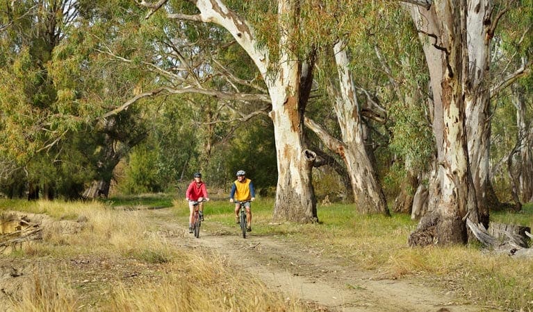
Enjoy a relaxing 1.5-hour adventure on the Jacks Creek walking track, a 2.5-kilometer loop trail within Cocoparra National Park. This moderate (grade 4) hike winds through a sheltered gorge and along scenic ridges, showcasing the park's diverse habitats.
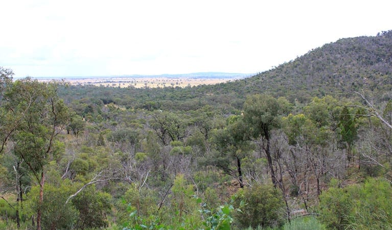
The beauty of Jacks Creek unfolds as you start your journey at the picnic area. Descend into a vast gorge, traversing sheltered gullies and exposed ridges. Three strategically placed lookouts offer stunning panoramas of the gorge and surrounding landscapes.
After rain, the gorge comes alive with the sounds of cascading water and croaking frogs. Watch for a variety of woodland birds soaring above. Keep an eye out for peregrine falcons perched on the cliffs or soaring through the gorge. Playful white-winged choughs might be nesting above the picnic tables, and shy swamp wallabies may be hiding in the rock caves, escaping the midday heat.
Gallery
Got some great shots from this hike? Upload your photos here to inspire others and show off the beauty of the trail!
Click to view form >>
Submitting your photos doesn’t mean you lose ownership. You can be credited for your contributions, and you can request removal at any time.
Content use
Please don’t copy GPX files or content from this site to AllTrails or other platforms. Each trail has been personally mapped, documented, and refined to support Australia’s bushwalking and hiking community. While some details come from land managers, every listing reflects significant personal effort. This is a free, community-driven initiative—your respect helps keep it that way.
Walk map and GPX file
Max elevation: 258 m
Min elevation: 195 m
Total climbing: 101 m
Total descent: -101 m
Getting there
Getting to the trailhead: Cocoparra National Park.
Nestled within the Jacks Creek precinct of Cocoparra National Park, the Jacks Creek walking track offers a delightful escape into nature.
For those coming from Griffith, follow Rankin Springs Road through Beelbangera village towards Yenda for about 16 kilometers. Take a left turn onto Myall Park Road, and then turn right onto Mount Bingar Road. Follow this road for 7 kilometers until you reach the intersection with the Whitton Stock Route. The entrance to the Jacks Creek picnic area, where the walking track begins and ends, is a further kilometer along this road.
Remember to check the weather conditions before setting out, as the road leading to Jacks Creek can become boggy after rainfall.
The Jacks Creek picnic area has a small, hard-packed ground carpark for visitors. As the area can get busy on weekends, parking might be limited. Be prepared to wait or consider visiting during a weekday for a more relaxed experience.
Closest towns to this walk: Cootamundra, Griffith, Gundagai, Hillston, Junee, Leeton, Narrandera, Temora, Wagga Wagga, Yenda
About the region
With its dramatic scenic views, Cocoparra National Park is a haven for outdoor enthusiasts, just a half hour drive from Griffith in the Riverina. Step inside the park and be greeted by the vastness of the outback sky, painted with the silhouette of the rugged Cocoparra Range. This dramatic landscape offers a vibrant escape, whether you're a keen bushwalker, an avid birdwatcher, or simply a nature lover.
The landscape comes alive throughout the seasons. Visit after rain to witness the waterfalls and creeks cascading through the valleys, like Jacks Creek with its impressive gorge. Spring brings a burst of color with blooming wildflowers – orchids, wattles, and tea trees paint the land in vivid hues. Keep an eye out for the majestic peregrine falcons nesting during this time, or watch the rainbow bee-eaters, a dazzling spectacle of color, building their homes in the ground.
For breathtaking panoramic views, take a walk along the range. The Jacks Creek and Mount Brogden walking tracks lead you up to the ridgeline, offering stunning views of the vast plains and unique geological formations. Explore the hidden gems like Falcon Falls, cascading down a sheer cliff, or Woolshed Falls, a picturesque spot for a picnic. Explore interesting rock formations on Store Creek walking track. For a truly immersive experience, consider a night of bush camping. Under a blanket of stars, Cocoparra National Park offers an incredibly peaceful escape.
Similar walks nearby
Looking for more walks in or near Cocoparra National Park? Try these trails with a similar difficulty grade.
Track grade
Grade 4 (Hard) - Challenging Walks for Experienced Walkers: Grade 4 on the AWTGS signifies challenging walking tracks. Bushwalking experience is recommended for these tracks, which may be long, rough, and very steep. Directional signage may be limited, requiring a good sense of navigation. These walks are suited for experienced walkers who are comfortable with steeper inclines, rougher terrain, and potentially longer distances.
Explore safe
Plan ahead and hike safely! Carry enough water, pack layers for changing conditions, and bring safety gear like a torch, PLB, and reliable communication device. Check official sources for trail updates, closures, and access requirements, and review local weather and bushfire advice. Most importantly, share your plans with someone before you go. Being prepared makes for a safer and more enjoyable hike! Stay Safe, Explore More, and Always #ExploreSafe.
Packing checklists
What you carry in your pack depends on factors like weather, terrain, and your adventure type. Not sure what to bring? My free planning, food, and packing checklists are a great starting point, covering day hikes, overnight trips, and multi-day adventures. Use them to customise your kit and always prioritise safety.
Let someone know
Before heading out, take a moment to fill out your trip intentions form. It’s a quick way to share your hike details with family or friends. If something goes wrong, they can notify emergency services, ensuring a faster response and peace of mind. Stay safe and enjoy your adventure
Suggest an edit
Spotted a change on this trail? Maybe there are new features, the route has shifted, or the trail is permanently closed. Whatever the update, I’d love your input. Your feedback helps fellow hikers stay informed and ensures that our trail info stays fresh and reliable.
Acknowledgement of Country
Trail Hiking Australia acknowledges the Traditional Owners of the lands on which we hike and pay respects to their Elders, past and present, and we acknowledge the First Nations people of other communities who may be here today.


