Trail Fast Facts
Conway Circuit is a 27.1km, grade 4 hike in Conway National Park, Queensland. This hike typically takes 2 days to complete.
Hike Overview
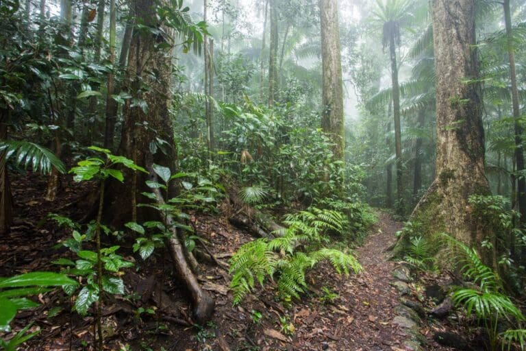
Part of the Whitsunday Trails, you can explore the Conway circuit on your mountain bike or on foot. Travel through majestic tropical rainforest, relax by seasonal creeks or absorb the views beyond coastal townships to the Whitsunday islands.
Forestry Road car park to Repulse Creek camp 8.3km
Begin the Conway circuit from the Forestry Road car park. Journey down this old logging trail for 800m to the beginning of the Kingfisher walk (not suitable for bicycles). Stop to enjoy this short return walk through the giant strangler figs and tulip oaks. Continue on the Conway circuit to the Wompoo way junction.
Wompoo way leads to a seasonal creek and you must return to the Conway circuit the way you came. Allow at least 1hr for this diversion. From the Wompoo way junction, continue on the Conway circuit passing Impulse Creek and notice the change in vegetation. Hardy, brown tulip oaks replace the moisture-loving Mackay tulip oaks, and tough, woody vines replace delicate climbers. Continue to Repulse Creek camp and set up to enjoy a night in the rainforest.
Repulse Creek camp to Bloodwood camp 11.5km
Begin your second day with a gentle walk through drier forest. You'll cross 2 creeks. The Conway circuit becomes steep and more difficult as you follow a ridge to the summit of Mount Hayward. Enjoy the cool breezes and rewarding view from the top. Continue along the ridge to Bloodwood camp where you can enjoy views beyond Jubilee Pocket to the Whitsunday Islands.
Bloodwood camp to Airlie Beach 8.5km
Follow the coastal ridge towards Airlie Beach through low vegetation tangled with vines. This forest survives on rocky soils and endures the seasonal hot sun and occasional tropical cyclones.
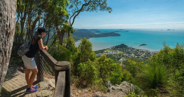
After a steep, challenging climb through low vine thicket the track descends through some taller forest to and intersection. Take the Honeyeater lookout turn-off for a great view, but by the time you return to the intersection it will add about 1.5hr to your journey. At the lookout, be rewarded with views beyond Cannonvale to the Dryander Range and the scattering of Whitsunday Islands.
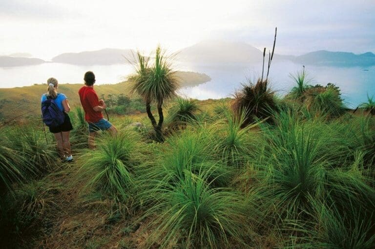
Continue on the Conway circuit and descend into Airlie Beach, taking time to enjoy your surroundings of grasstrees, cycads and gum trees. If the grasstrees are flowering, look for various honeyeater species coming in to feed.
All trails on the Conway circuit are shared-use, with the exception of the Kingfisher walk which is accessible to walkers only.
Track Grade
Grade 4 (Hard) - Challenging Walks for Experienced Walkers: Grade 4 on the AWTGS signifies challenging walking tracks. Bushwalking experience is recommended for these tracks, which may be long, rough, and very steep. Directional signage may be limited, requiring a good sense of navigation. These walks are suited for experienced walkers who are comfortable with steeper inclines, rougher terrain, and potentially longer distances.
Map and GPX file
Max elevation: 433 m
Min elevation: 59 m
Total climbing: 1022 m
Total descent: -1174 m
Trail Location (trailhead)
Sorry, no records were found. Please adjust your search criteria and try again.
Sorry, unable to load the Maps API.
Getting there
Take Shute Harbour Road to Brandy Creek Road and then Forestry Road car park at the start of the Conway National Park.
Photo gallery
If you have any photos from this hike and are happy to share them, please upload your .jpg files here.
Please note: Uploading photos does not transfer ownership of copyright away from you. If requested, you will be credited for any photos you provide and can ask they be deleted at any time.
About the region
Conway National Park spans approximately 75km of coastline, taking in the entire Cape Conway peninsula. The park includes the rainforest-clad Conway Range, which protects the largest area of lowland tropical rainforest in Queensland outside Tropical North Queensland. Hoop pines grow on coastal ridges and in damp gullies, emerging above the rainforest canopy. Rugged, steep, rocky cliffs provide a spectacular 35km-long backdrop to the Whitsunday Passage and islands.
Dry vine thicket, mangroves, open forests with a grasstree understorey, paperbark and pandanus woodlands, and patches of lowland rainforest with twisted vines grow in the park. It is home to 2 of Australia's mound-building birds, the Australian brush-turkey and the orange-footed scrubfowl.
Rising steeply behind busy coastal settlements, the Conway Range appears impenetrable. Through climate fluctuations over tens of thousands of years, the rainforest has persisted here, providing a continuous refuge for wildlife.
The park's vegetation is very similar to that on the Whitsunday islands because thousands of years ago the sea level rose, drowning coastal valleys and creating the islands. For thousands of years, the Ngaro and Gia people roamed these forests, harvesting riches of the land and the adjoining sea country. Today the adjacent waters are protected in the Great Barrier Reef Marine Park
Similar trails nearby
Explore Safe
While planning your hike, it’s important to check official government sources for updated information, temporary closures and trail access requirements. Before hitting the trail, check local weather and bushfire advice for planned burns and bushfire warnings and let someone know before you go. Plan ahead and hike safely.
Let someone know
Adventure with peace of mind: Fill out your trip intentions form. Before you hit the trail, fill out an online form to privately send important details about your hike to your family or friends. If you don’t return on time, they can easily alert emergency services, preventing worry and ensuring a swift response. Hike with peace of mind and enjoy your outdoor adventure to the fullest. Be smart, be safe: Register your plans here.
Gear to consider
What you carry in your pack will depend on the weather, terrain, time of year, type of adventure, and personal preferences. Having trouble deciding what gear’s right for you? My free planning, food and packing checklists provide an introduction to things your could consider (as well as the Ten Essentials) on your day, overnight and multi-day adventures. Customise your kit according to your personal needs, always considering safety first.
Suggest an edit
Trail changed? New features discovered? Has the route changed? Trail permanently closed? Help fellow hikers by suggesting edits! Click above to update route descriptions, GPX file, trail features (like boardwalks), or access conditions (like parking availability). Help me keep the trails info fresh!
Weather
Acknowledgement of Country
Trail Hiking Australia acknowledges the Traditional Owners of the lands on which we hike and pay respects to their Elders, past and present, and we acknowledge the First Nations people of other communities who may be here today.


