Hike at a Glance
Max elevation: 0m
Min elevation: 0m
Total Ascent: 0m
Hike overview
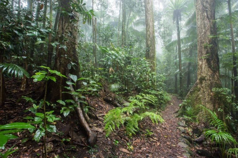
Mount Oldfield Walk is located within the Lindeman Islands National Park. Prolific birdlife, diverse plants and scenic walks feature strongly in this group of peaceful islands. The Ngaro Aboriginal people named Lindeman Island 'Yara-kimba', the place of snapper-bream fish. Lindeman Islands National Park protects 14 islands featuring a variety of vegetation types including rainforest in sheltered pockets, open forest in drier areas, grasslands and wetlands. Frequent burning by the Ngaro Aboriginal people maintained the grasslands in the area.
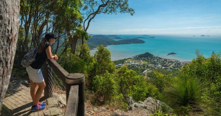
The 7.2 kilometre return Mount Oldfield Walk (Lindeman Island) involves a steady climb and features some of the most diverse vegetation on the island. You will be rewarded with spectacular views on reaching the peak. Remember water and your camera. Access the walk from the airport hut near the resort. Allow 3.5 hours to complete this walk of a moderate grade.
Gallery
Got some great shots from this hike? Upload your photos here to inspire others and show off the beauty of the trail!
Click to view form >>
Submitting your photos doesn’t mean you lose ownership. You can be credited for your contributions, and you can request removal at any time.
Content use
Please don’t copy GPX files or content from this site to AllTrails or other platforms. Each trail has been personally mapped, documented, and refined to support Australia’s bushwalking and hiking community. While some details come from land managers, every listing reflects significant personal effort. This is a free, community-driven initiative—your respect helps keep it that way.
Walk map and GPX file
It looks like I don’t have a GPX file for this trail yet. If you have one to share, please email it to me! I’ll verify it against official maps before adding it to help other hikers have a safer, easier experience. Thanks for contributing to a better hiking resource.
Getting there
Getting to the trailhead: Lindeman Islands National Park.
Apart from private yacht charter, a ferry to Lindeman Island takes about one hour from either Shute Harbour or Hamilton Island. Scenic seaplanes or helicopter rides can also be arranged.
Closest towns to this walk: Daydream Island, Hamilton Island, Lindeman Island, Long Island, South Molle Island
About the region
Lindeman Islands National Park is a national park covering the Lindeman Islands in Queensland, Australia, 885 km northwest of Brisbane.
Its natural beauty and breathtaking Whitsunday scenery make Lindeman Island one of the most spectacular tropical islands in Australia.
Complemented by temperate days and nights, Lindeman Island was one of the first Whitsunday islands to be developed. The resort on Lindeman Island is no longer operational, however, a new island owner is currently planning the build of a luxury resort with an estimated completion date of 2022. Aboriginal people refer to Lindeman Island as Yara-kimba, the place of snapper-bream fish.
Consisting of mostly National Park, Lindeman Island is a bushwalking paradise. More than 20 kilometres of bushwalking tracks allow visitors to stroll through the aptly named Butterfly Valley, or climb Mt Oldfield, which rewards the climb with stunning views across Hamilton and Whitsunday Island.
Lindeman Island has seven beautiful beaches, with Gap Beach being favoured for snorkelling, with colourful reefs and abundant marine life near the shore. Dolphins can often be spotted from the shore throughout the year and Humpback whales between July to November. Birdwatchers will delight in more than 90 bird species that inhabit or visit the island.
A camping site is located near the northwest point of the island at Boat Port. Camping fees apply and bookings are essential. This quiet campsite with sandy beaches is backed by rainforest and has a picnic table and toilet.
This is an incredible island to stop and enjoy while cruising through the Whitsundays.
Similar walks nearby
Looking for more walks in or near Lindeman Islands National Park? Try these trails with a similar difficulty grade.
Track grade
Grade 4 (Hard) - Challenging Walks for Experienced Walkers: Grade 4 on the AWTGS signifies challenging walking tracks. Bushwalking experience is recommended for these tracks, which may be long, rough, and very steep. Directional signage may be limited, requiring a good sense of navigation. These walks are suited for experienced walkers who are comfortable with steeper inclines, rougher terrain, and potentially longer distances.
Explore safe
Plan ahead and hike safely! Carry enough water, pack layers for changing conditions, and bring safety gear like a torch, PLB, and reliable communication device. Check official sources for trail updates, closures, and access requirements, and review local weather and bushfire advice. Most importantly, share your plans with someone before you go. Being prepared makes for a safer and more enjoyable hike! Stay Safe, Explore More, and Always #ExploreSafe.
Packing checklists
What you carry in your pack depends on factors like weather, terrain, and your adventure type. Not sure what to bring? My free planning, food, and packing checklists are a great starting point, covering day hikes, overnight trips, and multi-day adventures. Use them to customise your kit and always prioritise safety.
Let someone know
Before heading out, take a moment to fill out your trip intentions form. It’s a quick way to share your hike details with family or friends. If something goes wrong, they can notify emergency services, ensuring a faster response and peace of mind. Stay safe and enjoy your adventure
Suggest an edit
Spotted a change on this trail? Maybe there are new features, the route has shifted, or the trail is permanently closed. Whatever the update, I’d love your input. Your feedback helps fellow hikers stay informed and ensures that our trail info stays fresh and reliable.
Acknowledgement of Country
Trail Hiking Australia acknowledges the Traditional Owners of the lands on which we hike and pay respects to their Elders, past and present, and we acknowledge the First Nations people of other communities who may be here today.


