Hike at a Glance
Max elevation: 0m
Min elevation: 0m
Total Ascent: 0m
Hike overview
Turkey Flat trail is the ultimate twitchers' trail, taking you through the habitats of countless woodland and wetland birds.
The trail begins at Turkey Flat wetlands, close to Leeton. Start with a little birdwatching at the bird hide and then, when you're ready to get going, take the flat track over the floodwater regulator, which offers a great vantage point for seeing ducks flying overhead.
Keep your eyes peeled as you're hiking or mountain biking. You might glimpse threatened superb parrots, white-bellied sea eagles and sacred kingfishers, as well as other varieties too numerous to name. You'll probably spot the odd kangaroo, too, and be serenaded by frogs, particularly after rain.
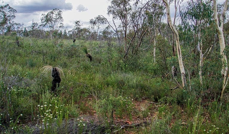
When you reach the junction, turn left or right - your choice - and follow the track as it meanders through part of the world's largest protected area of river red gum forest.
You'll end up at Middle Beach, which is a great spot to cool off with a swim or picnic. Alternatively, continue the birdwatching theme and watch pelicans skidding in to land on the water.
Tips
This trail can also be completed in the opposite direction by starting at Middle Beach and heading up to Turkey Flat Wetland
There is limited mobile reception in this park
The weather in this area can be extreme and unpredictable, so please ensure you're well-prepared for your visit.
Remember to take your binoculars if you want to go birdwatching
Visit NSW National Parks and Wildlife Service for more information on this trail.
The longitude and latitude of the start and end points are approximately only and should not be used for navigation purposes. Please contact me if you know the correct coordinates.
Gallery
Got some great shots from this hike? Upload your photos here to inspire others and show off the beauty of the trail!
Uploading your photos doesn’t mean you lose ownership. You can be credited for your contributions, and you can request removal at any time.
Content use
Please don’t copy GPX files or content from this site to AllTrails or other platforms. Each trail has been personally mapped, documented, and refined to support Australia’s bushwalking and hiking community. While some details come from land managers, every listing reflects significant personal effort. This is a free, community-driven initiative—your respect helps keep it that way.
Walk map and GPX file
It looks like I don’t have a GPX file for this trail yet. If you have one to share, please email it to me! I’ll verify it against official maps before adding it to help other hikers have a safer, easier experience. Thanks for contributing to a better hiking resource.
Getting there
Getting to the trailhead: Murrumbidgee Valley National Park.
Turkey Flat trail is in the MIA II precinct of Murrumbidgee Valley National Park, and begins at Turkey Flat Wetlands.To get there from Leeton:Drive east towards Narrandera on Irrigation WayHead through the township of Yanco and, just after crossing the train line, turn right onto Euroley Road.Continue down Euroley Road for 400m and turn right onto River RoadFollow River Road for 2.5km – the entrance to Turkey Flat Wetland and the picnic area is on the left. Road quality Check the weather before you set out as the road to Turkey Flat trail can become boggy when it rains. Parking Car and bus parking is available at Turkey Flat Wetlands carpark, a short walk from the trailhead.
Closest towns to this walk: Griffith, Hay, Leeton, Narrandera, Rankins Springs
About the region
Murrumbidgee Valley National Park, situated along the Murrumbidgee River and near Narrandera, Hay and Balranald, is a great place for fishing, camping, kayaking, cycling, hiking and birdwatching. With few facilities and infrastructure, Murrumbidgee Valley National Park allows you freedom to find your own camping spot as secluded or sociable as you like. If you're near Hay, check out the dog-friendly Wooloondool campground in Murrumbidgee Valley Regional Park. You can also book one of these lesser-known campgrounds and campsites.
Similar walks nearby
Looking for more walks in or near Murrumbidgee Valley National Park? Try these trails with a similar difficulty grade.
Track grade
Grade 4 (Hard) - Challenging Walks for Experienced Walkers: Grade 4 on the AWTGS signifies challenging walking tracks. Bushwalking experience is recommended for these tracks, which may be long, rough, and very steep. Directional signage may be limited, requiring a good sense of navigation. These walks are suited for experienced walkers who are comfortable with steeper inclines, rougher terrain, and potentially longer distances.
Explore safe
Plan ahead and hike safely! Carry enough water, pack layers for changing conditions, and bring safety gear like a torch, PLB, and reliable communication device. Check official sources for trail updates, closures, and access requirements, and review local weather and bushfire advice. Most importantly, share your plans with someone before you go. Being prepared makes for a safer and more enjoyable hike! Stay Safe, Explore More, and Always #ExploreSafe.
Packing checklists
What you carry in your pack depends on factors like weather, terrain, and your adventure type. Not sure what to bring? My free planning, food, and packing checklists are a great starting point, covering day hikes, overnight trips, and multi-day adventures. Use them to customise your kit and always prioritise safety.
Let someone know
Before heading out, take a moment to fill out your trip intentions form. It’s a quick way to share your hike details with family or friends. If something goes wrong, they can notify emergency services, ensuring a faster response and peace of mind. Stay safe and enjoy your adventure
Suggest an edit
Spotted a change on this trail? Maybe there are new features, the route has shifted, or the trail is permanently closed. Whatever the update, I’d love your input. Your feedback helps fellow hikers stay informed and ensures that our trail info stays fresh and reliable.
Acknowledgement of Country
Trail Hiking Australia acknowledges the Traditional Owners of the lands on which we hike and pay respects to their Elders, past and present, and we acknowledge the First Nations people of other communities who may be here today.


