Hike at a Glance
Max elevation: 1134m
Min elevation: 724m
Total Ascent: 423m
Important info
This park is in a remote location and weather can be unpredictable please ensure you're well-prepared.
Hike overview
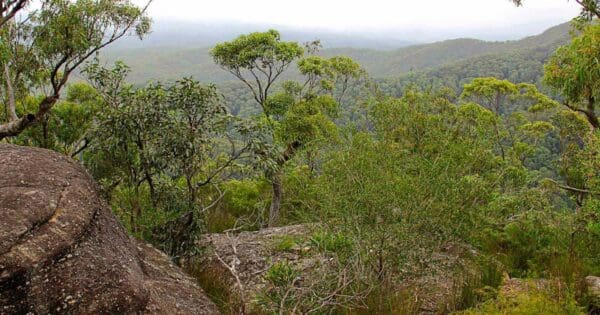
Mount Budawang trail is a challenging yet rewarding walk, cutting through several environments; from grassy woodland to montane forest, and finishing at the summit for scenic views. This is bushwalking at its best for those with a keen sense of adventure. Pull on your hiking boots and get ready to sweat, you should be fit and well-prepared with lots of water and a map as this day walk, to the summit of Mount Budawang, is more taxing than its modest distance of 4km suggests.
Threading through a diverse range of environments grassy woodland, wet gullies, montane forest and grassland at the top you're exposed to a terrific cross-section of what makes Budawang National Park wilderness. The rare Budawang wallaby grass, for example, is only found on the summits of Mount Budawang and Currockbilly Mountain.
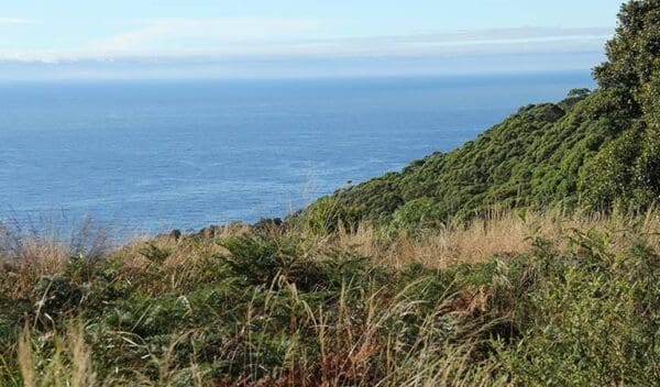
Bring binoculars for birdwatching, too crescent honeyeaters and olive whistlers are known to frequent higher areas of the park. The ascent is about 430m up a steep-sided mountain range, but the scenic views from Mount Budawang are tremendous, with 360-degree views of the surrounding area. To the north, along the Budawang Range, are the Castle and Pigeon House Mountain Didthul. To the east are Durras Mountain and the NSW coast. Down below is the forested Clyde River valley, and further afield west you can see all the way to Braidwood's Mount Gillamatong.
Track grade
Grade 4 (Hard) - Challenging Walks for Experienced Walkers: Grade 4 on the AWTGS signifies challenging walking tracks. Bushwalking experience is recommended for these tracks, which may be long, rough, and very steep. Directional signage may be limited, requiring a good sense of navigation. These walks are suited for experienced walkers who are comfortable with steeper inclines, rougher terrain, and potentially longer distances.
Walk map and GPX file
Max elevation: 1134 m
Min elevation: 724 m
Total climbing: 423 m
Total descent: -423 m
Content use
Please don’t copy GPX files or content from this site to AllTrails or other platforms. Each trail has been personally mapped, documented, and refined to support Australia’s bushwalking and hiking community. While some details come from land managers, every listing reflects significant personal effort. This is a free, community-driven initiative—your respect helps keep it that way.
Gallery
Got any photos from this hike? Your photos can help others plan. Share shots from along the trail so fellow hikers know what to expect.
Click to add your photos >>
Getting there
Getting to the trailhead: Budawang National Park.
Mount Budawang trail is at the southern precinct of Budawang National Park. To get there from Braidwood or Mongarlowe. From Charleys Forest Road or Little River Road, turn onto Northangera Road through Mongarlowe, then onto Budawang Road near the fire station. Travel a further 1.8km, then veer right at the intersection through a gate. Follow the signs for another 5km to the carpark. You’ll need to go through several farm gates make sure you leave them as you find them.
Check the weather before you set out as the road to Mount Budawang can become boggy when it rains. Parking is available at the start of Mount Budawang trail.
Need a rental car to get you to the hike? Find one here.
Find a place to stay
Wondering where to stay near this hike? Find accommodation close to the trailhead — hotels, cabins and campgrounds nearby. Click the button to view the interactive map.
Closest towns to this walk: Batemans Bay, Braidwood, Milton, Moruya, Nelligen
Let someone know
Heading out? Fill in a trip intentions form so someone knows your plans. If things go wrong, they can raise the alarm fast, giving you peace of mind on the trail.
About the region
Budawang National Park is declared a wilderness area, with hiking, river camping, swimming and scenic views for advanced, well-equipped travellers.
Budawang National Park is wilderness. Rugged and isolated, it's full of steep mountainsides and tall moist forests. There are glossy black-cockatoos in tall eucalypt forests, shallow rivers, and wallabies in patches of grassland.
The park derives its name from one of its dominant features, Mount Budawang whose name is a variation of the Aboriginal word Buddawong'. The prominence of its peak meant it was used to light signal fires and to observe the movement of people between the highlands and the coast.
Today, this park is perfect for adventurers and experienced trekkers who will love the walking through remote areas and river camping opportunities. If you're looking for a place to truly get away from the civilised world, Budawang offers a ready haven. Hiking in the park is suitable for fit and experienced bushwalkers equipped with sufficient water and survival gear. There are formal and informal walking tracks, meaning this is a perfect place to set off into the bush with a map and GPS.
Similar walks nearby
Looking for more walks in or near Budawang National Park? Try these trails with a similar difficulty grade.
Explore safe
Plan ahead and hike safely! Carry enough water, pack layers for changing conditions, and bring safety gear like a torch, PLB, and reliable communication device. Check official sources for trail updates, closures, and access requirements, and review local weather and bushfire advice. Most importantly, share your plans with someone before you go. Being prepared makes for a safer and more enjoyable hike! Stay Safe, Explore More, and Always #ExploreSafe.
Packing checklists
What you carry in your pack depends on factors like weather, terrain, and your adventure type. Not sure what to bring? My free planning, food, and packing checklists are a great starting point, covering day hikes, overnight trips, and multi-day adventures. Use them to customise your kit and always prioritise safety.
Suggest an edit
Notice something different about this trail? Whether it’s a new feature, a route change, or a closure, share your update so we can keep our info accurate and helpful for fellow hikers.
Click to suggest edits >>
Acknowledgement of Country
Trail Hiking Australia acknowledges the Traditional Owners of the lands on which we hike and pay respects to their Elders, past and present, and we acknowledge the First Nations people of other communities who may be here today.


